
Municipality of Donja Motičina
Accommodation in Municipality of Donja Motičina
Forests and hills define the Municipality of Donja Motičina; hiking and cycling routes lead to various destinations in the surrounding area. For planning your trip, the specific routes, the region’s plum-growing heritage and its cultural traditions offer several starting points.
 File:Donja motičina-Gazije-Šumeđe-Duzluk - panoramio.jpg
Photo: Robert Ruff via Wikimedia Commons, CC BY 3.0
File:Donja motičina-Gazije-Šumeđe-Duzluk - panoramio.jpg
Photo: Robert Ruff via Wikimedia Commons, CC BY 3.0
Quick facts about the Municipality of Donja Motičina
- Donja Motičina is 5 to 6 km from Našice.
- The area is surrounded by forests and hills; the hills are suitable for orchards and vineyards.
- Hiking trails include routes from Seona to Bedemgrad and from Donja Motičina toward Petrov vrh.
- Donja Motičina is traditionally a plum-growing area; the Motičanka variety is also known locally as raskaljanica.
What defines the landscape and local history?
The wooded, hilly surroundings give the destination a strong connection to nature. The hills are suitable for orchards and vineyards. The local plum-growing culture is also part of the region’s identity: Donja Motičina is traditionally considered a plum-growing area and is known for the Motičanka variety, called raskaljanica locally.
A notable cultural site is the Church of All Saints in Donja Motičina, which is designated a cultural monument. It was renovated and expanded in the 17th century and restored several times later. This also gives a cultural and historical context to a visit to the village. The cultural and historical event “Motičino moje drago selo” is held on the Municipality Day, which coincides with the Feast of the Most Sacred Heart of Jesus; a 31st folklore event of the same name was also held as part of the Municipality Day and the feast.
A particular tradition is part of the procession for the Feast of the Most Sacred Heart of Jesus: after the service, girls in white dresses scatter flower petals in front of the statue of the Most Sacred Heart of Jesus. Young women and men in traditional dress carry the statue.
How can you distinguish the hiking trails?
Several trails can be distinguished by their starting or finishing points. The Seona–Bedemgrad hiking trail starts in the village of Seona and leads to the ruins of the medieval fortified town of Bedemgrad. Another named route, “Stari Vodovod Seona–Križanje ispod Bedemgrada,” is listed as 5.2 km long, with an estimated walking time of 1 hour 40 minutes. The distance and time refer to this route.
The Našička geological trail starts at the end of Seona, near the source of the Našice water supply. There is a covered rest area with tables and benches there. The Staklana–Dobra Voda trail starts in the hamlet of Staklana in Gornja Motičina and leads to the Dobra voda spring. It mostly follows a forest road and passes the Jovac quarry. This can help you distinguish between a trail to a historic ruin, a geological route and a trail whose destination is a spring.
Another hiking trail leads from Donja Motičina past the Tivanovo mountain lodge toward Petrov vrh in the Krndija mountain range. The place and destination names help distinguish the various routes; they do not indicate that the trails are connected.
How do the cycling routes differ in their courses?
Motičina–Pijeskovi is described as a very easy ride along the slopes of the Krndija mountain range. It starts in Donja Motičina and goes via the Jovac quarry and the Pijeskovi area. The “very easy” rating applies to this route only, not automatically to the other routes.
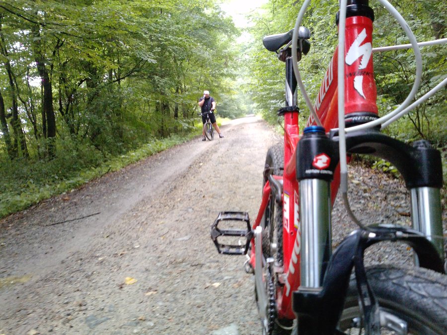
There is also an MTB route from Donja Motičina to Gazije, which runs along the slopes of the Krndija mountain range and mostly follows forest roads. Another cycling route starts in Donja Motičina, goes via Gazije and reaches Petrov vrh. These descriptions refer to different routes; compare them by their named destinations and the route details provided rather than treating them as a single ride.
Which places can help you plan your trip?
Donja Motičina is 5 to 6 km from Našice. Našice offers healthcare, education and cultural facilities. For choosing accommodation, the starting point of each route is a practical comparison point: trails start in Donja Motičina, in the village of Seona or in the hamlet of Staklana in Gornja Motičina. This lets you match your interests to the named places without treating different routes as the same one.
To compare other destinations in the municipality, you can also visit the Municipality of Našice, the Municipality of Donji Miholjac, the Municipality of Erdut, the Municipality of Bizovac, the Municipality of Šodolovci, the Municipality of Darda and the Municipality of Belišće.
FAQ
How long is the “Stari Vodovod Seona–Križanje ispod Bedemgrada” route?
It is listed as 5.2 km long, with an estimated walking time of 1 hour 40 minutes.
Which cycling route is described as very easy?
The Motičina–Pijeskovi cycling route is considered a very easy ride. It starts in Donja Motičina and goes via the Jovac quarry and the Pijeskovi area.
Where does the hiking trail from Seona lead?
The Seona–Bedemgrad hiking trail starts in the village of Seona and leads to the ruins of the medieval fortified town of Bedemgrad.
For the broader travel overview: Osijek-Baranja County.

