
Molat – Bays, Trails and History
Accommodation in Molat
Molat combines a long history of settlement with cycling and hiking trails, as well as bays that attract sailors. When planning your trip, the differences between the routes and the island’s historical background are just as interesting as its coastal scenery.
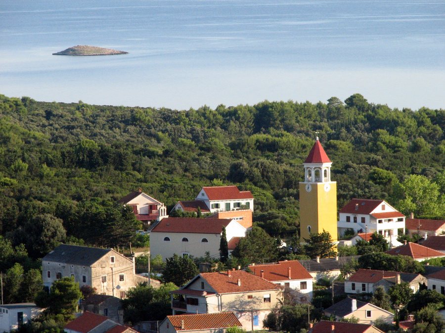
Molat at a glance
- Molat has been inhabited since the Paleolithic era.
- In the Middle Ages, one of Dalmatia’s oldest fishing villages developed here.
- The landscape is characterized by maquis shrubland and pine forests.
- The trails range from a route described as easy to a difficult trail.
What history can you discover on Molat?
The history of the island stretches far back: Molat has been inhabited since the Paleolithic era. In the Middle Ages, one of Dalmatia’s oldest fishing villages developed here. These two milestones give the island a historical context that stands in clear contrast to today’s opportunities for cycling, hiking and sailing.
The history of the Second World War is also part of this story. From 1942, an Italian concentration camp was located on Molat, where members of the Partisan forces were imprisoned. The camp’s former command building is a registered cultural asset of the Republic of Croatia. Those interested in the island’s history will find an important part of its past here.
Which trails suit your interests?
There are two different routes to choose from for a bike ride. The Bargamul Trail lies in the central part of Molat and starts in the small village of Brgulje. One of its sights is the Church of Saint Andrew the Apostle, which the route passes. The Vodomarka cycling trail is 12.3 kilometres long and leads through scenic landscapes to the secluded bays of Pržina, Vrulje and Vodomarka. The two cycling routes thus differ both in their course and in the destinations mentioned.
If you prefer to explore on foot, you can walk along forest trails. The Vranač Trail is considered easy and is suitable for runners and hikers of all ability levels; it passes the Church of the Nativity of the Blessed Virgin Mary. The Vapojni Trail is different: it is considered difficult and runs through pine forests and olive groves. There is also a bunker on Mount Straža along the trail. These differences can help you choose a route that suits your preferred way of being active.
What makes the bays and landscape distinctive?
Molat is covered in maquis shrubland and pine forests. Its many bays are popular destinations for boaters and sailors. Brgulje Bay in particular attracts many sailors and is especially busy during the summer months. It is known for its crystal-clear sea, and the beaches near Brgulje are among the best beach areas on Molat.
Brguljak, an uninhabited, forested island, lies in Brgulje Bay. The bays of Jaz and Lučina are near the village of Molat. Vodomarka Cave is also worth a visit and is named after the trail of the same name. These features of the island’s places and landscape offer different points of reference if you would like to plan your stay around walks, cycling routes or sailing.
Which connections are listed for getting there?
For the connection from Gaženica to Molat, the Jadrolinija ferry 433 via Rivanj, Sestrunj and Zverinac is listed, with a travel time of three hours. Another listed connection is the Jadrolinija catamaran 9403 from Zadar to Molat, Brgulje and Zapuntel, with a stated travel time of one hour and 50 minutes. The stated travel times and routes distinguish the two connections. Before travelling, check which connection is suitable for your travel date.
FAQ
How long is the Vodomarka cycling trail?
The trail is 12.3 kilometres long and leads to the bays of Pržina, Vrulje and Vodomarka.
Where are the bays of Jaz and Lučina?
Both bays are near the village of Molat.
Which trails are described as easy or difficult?
The Vranač Trail is considered easy and is suitable for runners and hikers of all ability levels. The Vapojni Trail is considered difficult.
To the main travel overview: Molat.

