
Discover Csomád: landscapes, culture and hotels
Accommodation in Csomád
Csomád combines a distinctive location between plain and hill country with a local Petőfi legend and a route to Mogyoród.
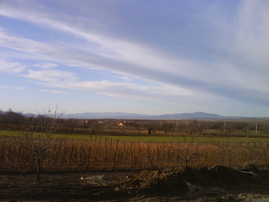 File:Csomadlatkep.jpg
Photo: Charpentier at Hungarian Wikipedia via Wikimedia Commons, Public domain
File:Csomadlatkep.jpg
Photo: Charpentier at Hungarian Wikipedia via Wikimedia Commons, Public domain
Csomád at a glance
Csomád lies on the eastern side of the Pesti Plain, at the northwestern edge of the Gödöllő Hills and at the foot of Oldal-hegy, Magas-hegy and Hátulsó-hegy. The settlement is 200 to 210 meters above sea level. According to a local legend, the young Sándor Petőfi wrote one of his poems beneath the olive tree beside the Petőfi memorial stone. In 1958, the Országos Műemlék Felügyelőség declared the Csomádi Evangélikus Templom a building of heritage character. The walking route to Mogyoród is listed as 9 kilometers, with 150 meters of elevation gain and a duration of 3.5 hours.
How can you place the landscape in context?
Several landscape features are useful for orientation: Csomád lies on the eastern side of the Pesti Plain, while also sitting at the northwestern edge of the Gödöllő Hills and at the foot of the three named hills. This describes its position between plain and hill country, rather than assigning Csomád to only one of these landscape regions. The elevation of 200 to 210 meters adds a specific point of reference to this picture.
If you mainly compare destinations by their landscapes, Csomád offers a clearly defined geographical setting. The combination of plain, hill country and the named elevations can help you form an impression of the settlement’s character. You can consider this landscape perspective alongside the cultural references and the listed walking route, without treating these different topics as one and the same.
What cultural connections are there?
The Petőfi memorial stone and the olive tree mentioned beside it are linked to a local legend: the young Sándor Petőfi is said to have written one of his poems there. The story should be understood as a legend, not as a confirmed historical claim. This distinction is useful when planning your trip: you can regard the connection as part of local tradition without equating the legend with a verified biographical event.
The Csomádi Evangélikus Templom is another cultural landmark. In 1958, the Országos Műemlék Felügyelőség declared it a building of heritage character. The dated designation and the local Petőfi story represent different kinds of local history: a historical heritage designation in one case, and a passed-down legend in the other. If you are interested in culture, these two subjects offer different ways to explore Csomád.
What does the walking route to Mogyoród mean for your plans?
The walking route to Mogyoród is listed as 9 kilometers, with 150 meters of elevation gain and a duration of 3.5 hours. This gives you both a distance and a time estimate to take into account when planning your day. These figures describe the route as an activity in its own right and provide more specific guidance than simply naming the destination.
If you include the route in your travel plans, you can use the stated duration as a time frame for the outing. The 150 meters of elevation gain offer another point of comparison alongside the 9-kilometer distance.
How can you approach your accommodation search?
First, consider which aspect of Csomád matters most to your travel plans: its location between plain and hill country, its cultural connections, or the listed walking route to Mogyoród. These priorities can guide your search for a hotel in Csomád. Then compare suitable offers based on what best fits your own travel plans.
Within the broader destination of Pest, the part of the highlighted Danube Bend tourism area that belongs to Pest County covers the entire Danube Bend, as well as the Visegrád Mountains and the Börzsöny Mountains. This regional perspective adds a wider landscape context within the destination of Pest to the specific details about Csomád.
Discover more destinations: Galgamácsa, Vácrátót, Erdőkertes, Őrbottyán.
FAQ
Where is Csomád?
Csomád lies on the eastern side of the Pesti Plain, at the northwestern edge of the Gödöllő Hills and at the foot of Oldal-hegy, Magas-hegy and Hátulsó-hegy. It is 200 to 210 meters above sea level.
Is the Petőfi story historically confirmed?
The story that the young Sándor Petőfi wrote one of his poems beneath the olive tree beside the Petőfi memorial stone is a local legend.
What information is available about the walking route to Mogyoród?
The route is listed as 9 kilometers, with 150 meters of elevation gain and a stated duration of 3.5 hours.
For the broader travel overview: Veresegyházi.

