
Kara Buura
Accommodation in Kara Buura
Kara Buura brings together the landscapes of Kara-Buura Nature Park with shrines and cultural sites in Sheker and Kok-Sai. When planning your trip, it helps to distinguish between these different highlights: nature, religious sites and the legacy of writer Chyngyz Aitmatov each shape a distinct facet of the destination.
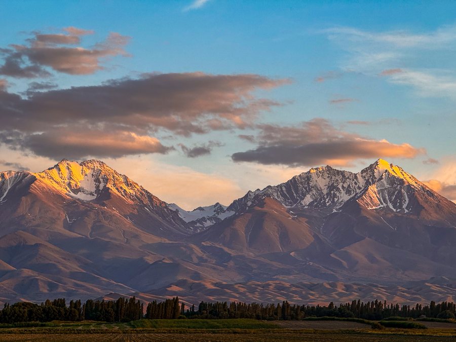
Kara Buura at a glance
- Kara-Buura Nature Park was established as a protected natural area in 2005.
- It covers about 61,544 hectares on the northern slopes of the Talas Ala-Too.
- At 4,484 meters, Manas Peak is the highest point in the park.
- Sheker is home to a house museum dedicated to Chyngyz Aitmatov and several sites linked to his culture.
What characterizes the landscape of Kara-Buura Nature Park?
The park features a mix of juniper and spruce forests, as well as subalpine and alpine meadows. These landscapes give the protected area a distinct mountain character. The park also protects rare plant species in Kyrgyzstan. Visitors interested in nature and plant life will find a different way to experience Kara Buura here than at the shrines and cultural sites in the surrounding area.
Covering about 61,544 hectares and located on the northern slopes of the Talas Ala-Too, the park has a substantial footprint. Within its boundaries, Manas Peak reaches 4,484 meters, making it the highest point. These details help put the park in context, but on their own do not tell you anything about specific trails, visitor access or the conditions of a particular tour.
What historical traces are part of the region?
Kara-Buura Nature Park also includes historical monuments. In addition, the nearby Kara-Buura Pass was part of historic routes connecting the Talas Ala-Too with areas to the northeast. Nature and history are therefore two distinct ways of looking at the area: the park is characterized by forests, meadows and the protection of rare plants, while the pass routes tell of former connections between regions.
A road also runs through the nearby area along the valley of the Kara-Buura River, from Talas over Kara-Buura Pass toward the Chatkal Valley.
Which shrines can be found in Kara Buura?
Several shrines differ in location and name. Azhydaar-Tash is a stone shrine in Kara-Buura District, 1–1.6 kilometers south of the center of Kok-Sai. Maymak-Ata is a spring shrine 2–3 kilometers north of the village of Sulumaymak.
The spring shrine Chargin-Ata is in a gorge in Sheker, 150 meters southwest of the Ak Uy shrine. Kok-Sai is also home to the Oljobay Kergen Tash shrine. Bubu-Baksy and the general public pray there. If you are interested in religious sites, you can use these details to distinguish their locations and themes when planning your trip.
What connects Sheker with Chyngyz Aitmatov?
Sheker is home to the house museum of writer Chyngyz Aitmatov. Stone sculptures of characters from his works stand on the museum grounds. The museum and sculptures give the place a literary focus, clearly distinct from the park's natural landscapes and the shrines.
Other places in Sheker are also connected with Aitmatov’s work. A field there was used to film “Early Cranes.” Ismail Cave is located in the center of a cemetery and is associated with Ismail, a character in Aitmatov’s story “Face to Face.” The historical and cultural complex “Chyngyz Aalamy” is currently under construction in Sheker. When considering these sites, it is helpful to distinguish between the existing house museum, the literary connections and the complex currently being built.
For a broader overview of the region, you can also visit the page about Talas.
FAQ
When was Kara-Buura Nature Park established?
Kara-Buura Nature Park was established as a protected natural area in 2005.
How high is the highest point in the park?
At 4,484 meters, Manas Peak is the highest point in the area of Kara-Buura Nature Park.
Where is the Chargin-Ata shrine?
Chargin-Ata is in a gorge in Sheker, 150 meters southwest of the Ak Uy shrine.
For the broader travel overview: Talas Region.

