
Šilalė District Municipality: Museums, landscapes and special experiences
Accommodation in Šilalė District Municipality
A visit to Šilalė District Municipality can be tailored to different interests: museums tell the story of Lithuanian history and culture, while the educational trail, lake and river bring the landscape into focus. Some experiences can be planned very specifically – for example, the 2 km-long educational trail along the Sietuvos kūlgrinda. Visits and tours at the Upynos Ethnographic Museum must be arranged in advance.
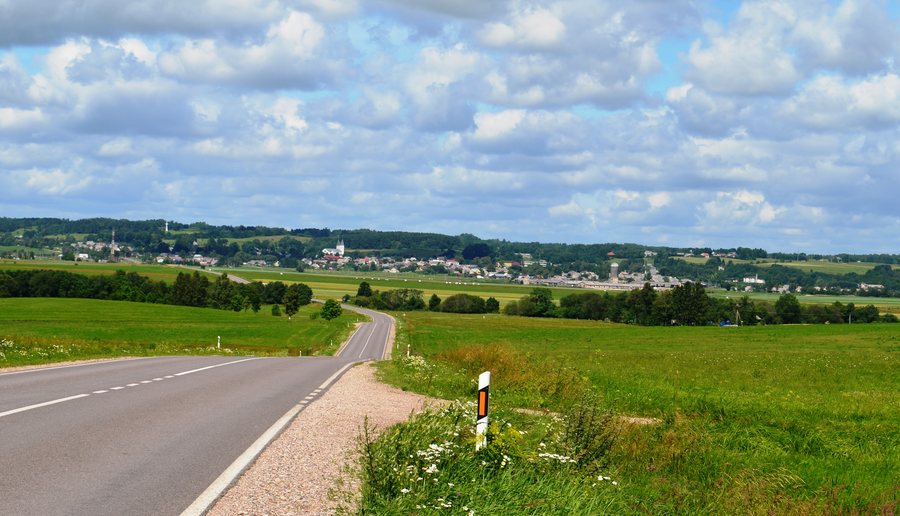 Žemaičių road near Kaltinėnai, Šilalė District
Photo: Šarūnas Šimkus via Wikimedia Commons, Public domain
Žemaičių road near Kaltinėnai, Šilalė District
Photo: Šarūnas Šimkus via Wikimedia Commons, Public domain
Quick facts about Šilalė District Municipality
The Jūra River flows through the municipality; Lake Paršežeris covers 193.4 hectares and is a lake of national significance. Cultural attractions include the Upynos Ethnographic Museum and the Dionizo Poškos Baubliai Museum. There is also a 2 km-long educational trail at the Sietuvos kūlgrinda. The attractions therefore range from landscapes and outdoor activities to collections and historic sites.
What experiences can you plan?
A 2 km-long educational trail runs along the Sietuvos kūlgrinda. The Sietuvos kūlgrinda is considered the only kūlgrinda in Lithuania that is accessible to visitors. If you would like to include this attraction in your trip, you can take the stated trail length into account when planning your day.
The Gėliūkis farmstead has a seven-wind flower maze, where self-discovery activities are held. This is a different kind of visit from exploring historical collections: here, the maze and its activities are the focus. The Aukštagirė ski slope is next to the Aukštagirė observation tower. So a ski slope and an observation tower are also named as specific places in the municipality.
What makes the museums different?
The Upynos Ethnographic Museum displays its collection in a former parish barn. Numerous metal crosses, pole crosses and small chapels are attached to its outer walls. The museum preserves around 3,500 ethnographic exhibits from Upyna and the surrounding areas. Please note that visits and tours must be arranged in advance.
The Dionizo Poškos Baubliai Museum was founded in 1812 and is considered Lithuania’s oldest museum. It is housed in the trunks of thousand-year-old oak trees. The two museums offer different points of interest: at Upyna, the focus is on ethnographic exhibits and the former parish barn; at the Baubliai Museum, it is on its founding history and its unusual setting in the oak trunks.
Another connection to cultural history leads to Lembas. It is the birthplace of Kazimieras Jaunius, a Catholic clergyman and scholar of the Lithuanian language. In 2024, a shelter was built at the Stasio Girėno Birthplace Museum for Vladas Kensgaila’s 1:2-scale model of the “Lituanica”.
What nature and culinary attractions are there?
The Jūra River flows through Šilalė District Municipality; at 193.4 hectares, Lake Paršežeris is another notable feature of the landscape. If you are interested in regional nature, you can consider these bodies of water as different aspects of the landscape.
A local taste experience is also on offer: Paulikų levandų idilė offers lavender tea to sample. Together with the flower maze at the Gėliūkis farmstead, this offers a different focus from a museum visit. You can tailor your trip to your interests in culture, landscape or the activities described here, without combining all the attractions into a set tour.
How can you plan a visit to the region?
In the wider region, the Šilalė Tourism Information Centre or selected professional guides create individually tailored sightseeing routes around the Šilalė region. This is an option for travellers who would rather not organize their sightseeing by theme themselves. For your own orientation, you can also visit the pages for Laukuva Eldership and Jomantai. Other destinations in the same broader area include Jurbarkas District Municipality and Tauragė District Municipality.
FAQ
How long is the educational trail at the Sietuvos kūlgrinda?
The educational trail along the Sietuvos kūlgrinda is 2 km long.
Do visits to the Upynos Ethnographic Museum need to be arranged in advance?
Yes. Visits and tours must be arranged in advance.
What is special about the Dionizo Poškos Baubliai Museum?
Founded in 1812, the museum is considered Lithuania’s oldest and is housed in the trunks of thousand-year-old oak trees.
For the broader travel overview: Tauragė County.

