
Marylin
Accommodation in Marylin
Marylin lies in the heart of the Puszcza Notecka and offers various ways to experience nature: a short educational trail at Lake Moczydło, as well as longer hiking, cycling and canoeing routes. Which one suits your trip depends mainly on whether you want to travel on foot, by bicycle or on the water.
Marylin at a glance
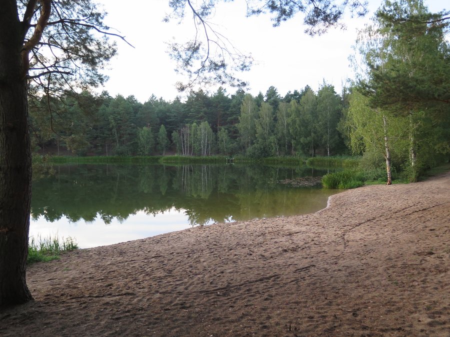
Marylin lies in an area protected under the Natura 2000 programme. The village is located in the heart of the Puszcza Notecka. Specific nature and leisure activities include the 600 m Maryliński Świat Ryb nature trail around Lake Moczydło and a recreation area by the lake. It has a volleyball court, a basketball court and play equipment.
There are three different options for longer routes: a 21.2 km blue hiking trail through the forests of the Puszcza Notecka, a 24 km cycling route and a 16 km canoe route on the Miała. Marylin also has 18th-century houses at house numbers 17 and 22.
Which routes suit your trip?
The blue hiking trail runs from Bucharzewo via Marylin to Miały and passes entirely through the forests of the Puszcza Notecka. It is 21.2 km long. If you are planning a hike as part of your trip, this total distance is a useful starting point for planning your day. The trail is a good reference for travellers who want to connect Marylin with other places along the route on foot; the distance alone does not indicate a specific walking time or difficulty level.
The cycling route is 24 km long and runs from Drawsko via Pęckowo, Marylin and Piłka, then via Pęckowo back to Drawsko. It differs from the blue hiking trail both in the activity and in the route. The places mentioned and the route length can help you assess it as a cycling option. Bear in mind the full distance when considering it for your own trip planning.
On the water, a 16 km canoe route follows the Miała from Marylin via Piłka and Kamiennik to Chełst. Hiking, cycling and canoeing are therefore three clearly distinct ways to explore the landscape around Marylin. Each distance refers to the route described: 21.2 km for the hiking trail, 24 km for the cycling route and 16 km for the canoe route.
What does Lake Moczydło offer?
At Lake Moczydło, the Maryliński Świat Ryb nature trail follows a 600 m circular route. Compared with the longer hiking, cycling and canoeing routes, it is considerably shorter. You can take this difference into account when choosing between a short nature trail and a trip with a stated total distance. The trail focuses on nature and runs around the lake.
The recreation area in Marylin is also located by Lake Moczydło. Its facilities include a volleyball court, a basketball court and play equipment. It therefore offers both sports facilities and play options.
Are there historic houses in Marylin, too?
The village’s streetscape includes 18th-century houses at house numbers 17 and 22. They add a historical point of interest to your trip, alongside the nature and leisure activities. Marylin can therefore be described not only in terms of the routes through the Puszcza Notecka, but also by its older buildings.
Which other destinations can you compare?
If you would like to consider other destinations for your trip alongside Marylin, you can also find Kocień Wielki, Czarnków, Kuźniczka, Kuźnica Żelichowska, Przesieki, Trzcianka, Krzyż Wielkopolski and Pestkownica.
FAQ
How long is the Maryliński Świat Ryb nature trail?
The nature trail around Lake Moczydło is 600 m long.
How long is the blue hiking trail via Marylin?
The trail from Bucharzewo via Marylin to Miały is 21.2 km long and passes entirely through the forests of the Puszcza Notecka.
What routes are available for cycling and canoeing?
The cycling route from Drawsko via Pęckowo, Marylin and Piłka, then back to Drawsko via Pęckowo, is 24 km long. The 16 km canoe route on the Miała runs from Marylin via Piłka and Kamiennik to Chełst.
To the main travel overview: Czarnikau.

