
Discover Niechorz
Accommodation in Niechorz
Niechorz combines a village settlement pattern with historic buildings from several periods and an observation tower overlooking the Krajna landscape. This lets you choose between cultural heritage and landscape themes when planning your trip.
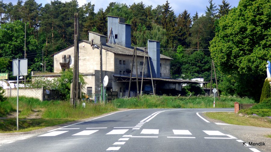 File:Niechorz - gmina Sępólno Krajeńskie - panoramio.jpg
Photo: Kazimierz Mendlik via Wikimedia Commons, CC BY-SA 3.0
Niechorz at a glance
- The motor-powered watermill dates from the mid-19th century and was converted in 1936.
- The Evangelical cemetery dates from the second half of the 19th century. Its gate also dates from the second half of the 19th century. The manor house dates from the early 20th century. The school building dates from the early 20th century.
- From the observation tower, you can view Krajna’s varied, uneven landscape panorama.
- The green-marked Szlak Męczeństwa Krajan is 28 km long and passes through Niechorz.
What historical traces can be found in Niechorz?
Two dates help place the watermill’s history in context: it dates from the mid-19th century and was converted in 1936. The later date therefore refers to a conversion, not the mill’s original construction date. The mill complex also includes a paved path dating from the second half of the 19th century.
The Evangelical cemetery and its gate are also dated to the second half of the 19th century. This date refers to two separate elements: the cemetery and its associated gate. The residential building at the Niechorz 4 estate also dates from the same half of the century. These details add specific buildings and features to the broader village settlement pattern.
The school building, by contrast, dates from the early 20th century. The dates thus span buildings and features from the second half of the 19th century through to buildings from the following century. If you are interested in the history of the place, you can distinguish between individual buildings, the cemetery and the mill complex, rather than attributing all the information to a single site.
How do the observation tower and the route differ?
The observation tower and the Szlak Męczeństwa Krajan offer different points of reference for planning a trip. The tower focuses on the Krajna landscape panorama, while the route information gives a specific length and a course through several places. You can therefore decide based on your interests whether the landscape view or a named route with a stated total length is more important to you.
The green-marked Szlak Męczeństwa Krajan runs from Jastrzębiec through Karolewo, Śmiłowo, Suchorączek, Wysoka Krajeńska and Niechorz to Sępólno Kraj. The length of 28 km applies to the route; Niechorz is explicitly part of the described course. The sequence of places helps you locate Niechorz along the route without assuming a connection to the observation tower.
The tower was reopened to visitors in December 2023 after being closed for almost a year. As this information refers to a point in the past, check current access before planning your visit. The view of Krajna’s varied and uneven landscape remains the specific landscape reference point for this place.
FAQ
When was the watermill in Niechorz converted?
The motor-powered watermill dates from the mid-19th century and was converted in 1936.
How long is the Szlak Męczeństwa Krajan?
The green-marked route is 28 km long and passes through Niechorz, among other places.
When was the observation tower reopened to visitors?
It reopened in December 2023 after being closed for almost a year. Check current access before planning your visit.
To the broader travel overview: Wiśniewa.

