
Cierpice: Forest Nature Trail and Architectural History
Accommodation in Cierpice
Things to explore in Cierpice include the “Podtoruńskie bory” forest nature trail, cycling and hiking routes, a parish church, and a group of brick railway station buildings. They span topics from forests and forestry to specific route features and architectural history. For trip planning, it is worth considering these different highlights separately.
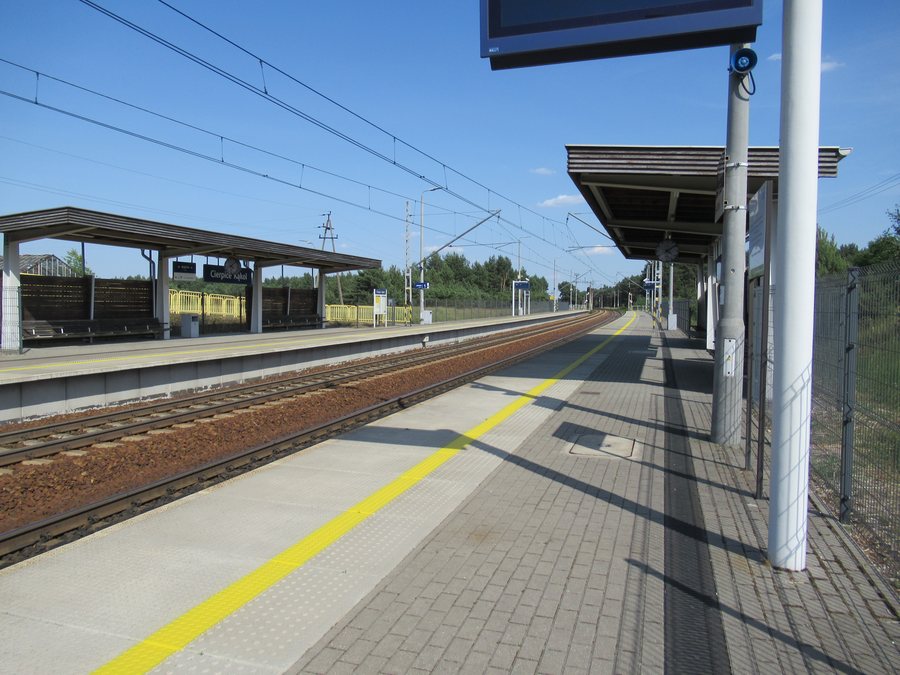
Cierpice at a glance
- The “Podtoruńskie bory” nature trail is an approximately 2.4 km circular route with seven information boards about the forest and forestry work.
- The Roman Catholic parish church is a brick building erected in 1938.
- A group of brick railway station buildings stands along the Toruń–Bydgoszcz railway line, which opened on 24 October 1861.
- The blue cycling route passes the railway station buildings and the station, then continues to the Kąkol settlement and into the Zielonka Valley.
- The black cycling route starts at Cierpice railway station.
- The blue hiking trail from Toruń ends in Cierpice, next to the cemetery and church.
What can you learn on the forest nature trail?
“Podtoruńskie bory” is an approximately 2.4 km circular route. Its length is explicitly given as approximate; the circular format is another practical detail for planning. Seven information boards cover the forest and the work of foresters. The nature trail thus combines a clearly defined, manageable loop with a focus on forests and forestry.
If the information boards are important to your visit, check their current condition in advance. When comparing this trail with the other routes in Cierpice, it helps to distinguish between the details provided: the nature trail is described by its length and circular format, while the cycling and hiking routes are described by their course, starting point, or destination.
How do the cycling and hiking routes differ?
The blue cycling route is described as passing through Cierpice: it goes past the railway station buildings and the station, then continues to the Kąkol settlement and into the Zielonka Valley. The black cycling route is described as starting at Cierpice railway station. These details therefore answer different planning questions: one describes the route and where it continues, while the other gives the starting point.
The blue hiking trail follows a different direction: it runs from Toruń to Cierpice and ends next to the cemetery and church. Its starting point and destination are given, but not its length. Keep this endpoint separate from the details about the cycling routes. For municipal routes, it is a good idea to check the current trail markings before planning.
What do the church and railway station buildings tell us?
The Roman Catholic parish church in Cierpice is a brick building dating from 1938. Another architectural feature is the group of brick railway station buildings along the Toruń–Bydgoszcz railway line. The two features draw attention to different aspects of local architectural history: one is a church with a specified construction year, the other a group of station buildings associated with a railway line.
The Toruń–Bydgoszcz railway line opened on 24 October 1861. This date refers to the opening of the line. The dates can therefore be understood correctly: 1938 is the year the church was built, while 1861 is the year the railway line opened. If you are interested in culture and history, you can consider these two topics separately instead of combining them into a single architectural history.
How should you approach Cierpice when looking for accommodation?
If you are looking for a hotel in Cierpice, you can first consider which aspect matters most for your stay: the forest and forestry theme of the nature trail, one of the routes described in different ways, or the architectural history. To choose a route, it is best to compare the specific features given—whether it is a circular route, its course, starting point, or destination. This lets you match your choice of location to your own travel interests without treating the different routes as the same.
Discover more destinations: Browina, Czarne Błoto, Toruń, Papowo Toruńskie, Zębowo, Czernikowo, Chełmża, Lubicz Dolny.
FAQ
How long is the “Podtoruńskie bory” nature trail?
The circular route is approximately 2.4 km long.
What topics do the information boards cover?
Seven information boards cover the forest and the work of foresters. If these stops are important to your visit, check their current condition in advance.
What information is available about the cycling and hiking routes?
The blue cycling route passes the railway station buildings and the station, then continues to Kąkol and into the Zielonka Valley. The black cycling route starts at the station. The blue hiking trail from Toruń ends in Cierpice next to the cemetery and church. Check the current trail markings before planning.
When did the Toruń–Bydgoszcz railway line open?
The railway line opened on 24 October 1861. The date refers to the opening of the line.
For the broader travel overview: Toruń County.

