
Wilga
Accommodation in Wilga
Wilga offers points of interest for those interested in cultural history, as well as hikers and cyclists. It also has fishponds and the Wodna Kraina family recreation park. Which of these aspects interests you most can help determine the focus of your stay.
Wilga at a glance
- The historic village is first mentioned in 1224.
- The parish Church of the Assumption of the Blessed Virgin Mary (Kościół Wniebowzięcia Najświętszej Maryi Panny) is a brick Neo-Gothic building dating from 1913–1918.
- Hiking trails include routes to the open-air battle museum; their stated lengths range from 8.8 to 21.5 km.
- The fishponds cover about 80 ha and are used for fishing.
- Wodna Kraina is a family recreation park in Wilga.
Which historic sites shape Wilga?
The parish Church of the Assumption of the Blessed Virgin Mary (Kościół Wniebowzięcia Najświętszej Maryi Panny) is on Warszawska Street. This brick Neo-Gothic building was constructed in 1913–1918. Its furnishings include stained-glass windows from the workshop of Roman Godlewski in Ciechanowiec. Those interested in church architecture will find here not only a distinctive architectural style but also a direct connection to a stained-glass workshop. Wilga’s parish cemetery was established in the early 19th century.
Several memorial sites highlight different aspects of history. An obelisk by the municipal office commemorates the restoration of independence in 1918. A monument on Warszawska Street is dedicated to those murdered by the Nazis. Wilga also has an obelisk commemorating the establishment of the holiday settlement on the Vistula by Count Stanisław Kostka Roztworowski and architects Andrzej Boni and Tadeusz Nowakowski. Another link to the area’s history is the monument commemorating the crossing of the Vistula in 1944.
Which hiking trails can you plan to take?
The blue “Czterech pancernych i psa” trail is 21.5 km long and ends in Wilga at the open-air battle museum of the 1st Polish Army and the monument commemorating the crossing of the Vistula in 1944. The trail description therefore combines a specific distance with two historic destinations. If you start by considering the distance when choosing a route, this figure is a clear starting point.
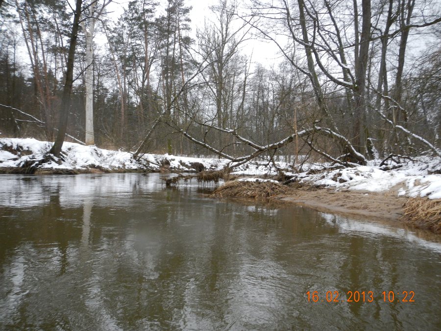
A local blue hiking trail runs 19.2 km from Wilga to the open-air battle museum. A green trail also leads there, running 8.8 km from Wilga via Trzcianka and Cyganówka. The routes differ in length, and the green trail also passes through the named villages. Another hiking trail runs 17 km from Garwolin through beautiful forests along the picturesque Wilga River to Wilga. This gives you a choice of routes with different stated lengths and descriptions when planning your trip.
What do the cycling routes and fishponds offer?
The blue “Pętla Wilska” cycling route is 38.1 km long and starts and ends in Wilga. Its stated length and circular route make it a distinct option for focusing your stay on cycling. Another cycling route passes through Łaskarzew, Aleksandrów, Grabina and Olszynki before reaching Wilga. If you choose a route based on its course, you can include these place names in your planning.
The fishponds are also a distinctive part of what the area offers: they cover about 80 ha and are used for fishing. They are also a habitat for more than ten rare bird species, including species listed in the Polish Red Data Book of Animals. Fishing and birdlife therefore offer two different points of interest for nature enthusiasts. Wodna Kraina adds another option as a family recreation park in Wilga.
To compare other local profiles, see Lipówki, Nowy Goniwilk, Zgórze, Kochów, Żelechów, Zwola Poduchowna, Pilawa and Dudki.
FAQ
How long is the blue “Czterech pancernych i psa” trail?
The trail is 21.5 km long and ends in Wilga at the open-air battle museum of the 1st Polish Army and the monument commemorating the crossing of the Vistula in 1944.
How long is the “Pętla Wilska” cycling route?
The blue cycling route is 38.1 km long and starts and ends in Wilga.
What characterizes the fishponds in Wilga?
They cover about 80 ha, are used for fishing and provide a habitat for more than ten rare bird species, including species listed in the Polish Red Data Book of Animals.
For the broader travel overview: Garwoliński.

.jpg)