
Gugny: Clearing, Marshland and Hiking Trail
Accommodation in Gugny
Gugny combines an open clearing with forest edges and the fens of the southern Biebrza Basin.
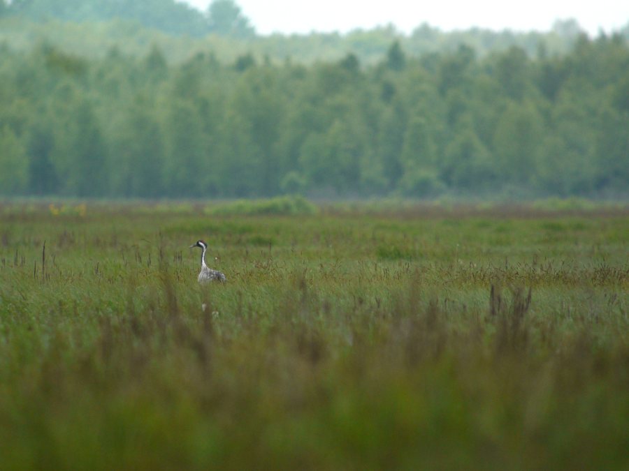 Common Crane, Gugny, Biebrzański Park Narodowy, Polska (4653391014)
Photo: Frank Vassen from Brussels, Belgium via Source, CC BY 2.0
Common Crane, Gugny, Biebrzański Park Narodowy, Polska (4653391014)
Photo: Frank Vassen from Brussels, Belgium via Source, CC BY 2.0
Key facts about Gugny
- The settlement of Gugny and its outlying station lie in a clearing between pine forest on dunes to the east and a narrow belt of swamp forest to the west.
- The swamp forest separates the clearing from the fens of the southern Biebrza Basin.
- About six kilometres of marshland lie between Gugny and the Biebrza River, which runs along the opposite edge of the valley.
- The red Gugny–Barwik hiking trail starts in Gugny, passes through peatland, is 9.5 kilometres long and has two observation towers along the route.
- Behind the settlement buildings, you can view peat meadows and wetlands from a nearby observation tower.
What kind of landscape defines Gugny?
The clearing gives Gugny a clearly defined landscape character: pine forest on dunes borders it to the east, while a narrow belt of swamp forest lies to the west. Beyond it stretch the fens of the southern Biebrza Basin. Forest, open settlement land and marshland have a specific spatial relationship here; the marshland begins beyond the western forest belt.
The Biebrza River is also a landmark in the surrounding area, but it does not run directly alongside the clearing: about six kilometres of marshland lie between Gugny and the river, which runs here along the opposite edge of the valley. This helps you distinguish between the area immediately around the settlement and the river, which lies farther away across the marshland.
What should you know about the Gugny–Barwik hiking trail?
The red hiking trail starts in Gugny and passes through peatland. The route is 9.5 kilometres long, with two observation towers along the way. This gives you concrete information about its length and route for planning, without implying a walking time.
Some sections of the trail are considered difficult. Check the current trail conditions before setting out. Length, surface and difficulty are different factors: your decision should take into account both the route through the peatland and the potentially difficult sections.
What nature and cultural sights will you encounter?
Behind the settlement buildings, you can view peat meadows and wetlands, including from a nearby observation tower.
The walls of buildings in Gugny also feature murals of herons, cranes and storks found in the area. The landscape and murals offer different points of interest: the wetlands shape the view of the surroundings, while the images on the house walls depict bird species found in the area.
How can you factor Gugny into your accommodation search?
If you are looking for a hotel in Gugny, consider whether you mainly want to explore the landscape around the settlement or also plan to hike the red trail. The clearing, wetlands and route described here offer different ways to shape your trip. You can match your choice of destination to your nature interests and check specific accommodation options against your own plans.
Discover more destinations: Laskowiec, Guzy, Mońki, Dolistowo Stare and Goniadz.
FAQ
How far apart are Gugny and the Biebrza River?
About six kilometres of marshland lie between Gugny and the Biebrza. The river runs along the opposite edge of the valley here.
How long is the Gugny–Barwik hiking trail?
The red hiking trail is 9.5 kilometres long and passes through peatland. Two observation towers stand along the route.
What can you see from the observation tower near the settlement?
Behind the settlement buildings, you can view peat meadows and wetlands from a nearby observation tower.
Go to the main travel overview: Moniecki.

.jpg)