
Miechucino
Accommodation in Miechucino
Miechucino combines a rare listed railway station ensemble with routes for cycling and hiking. For planning your trip, the railway remains, designated landscape areas, and described routes provide concrete points of reference to help you decide which aspects of the place are of particular interest to you.
Miechucino at a glance
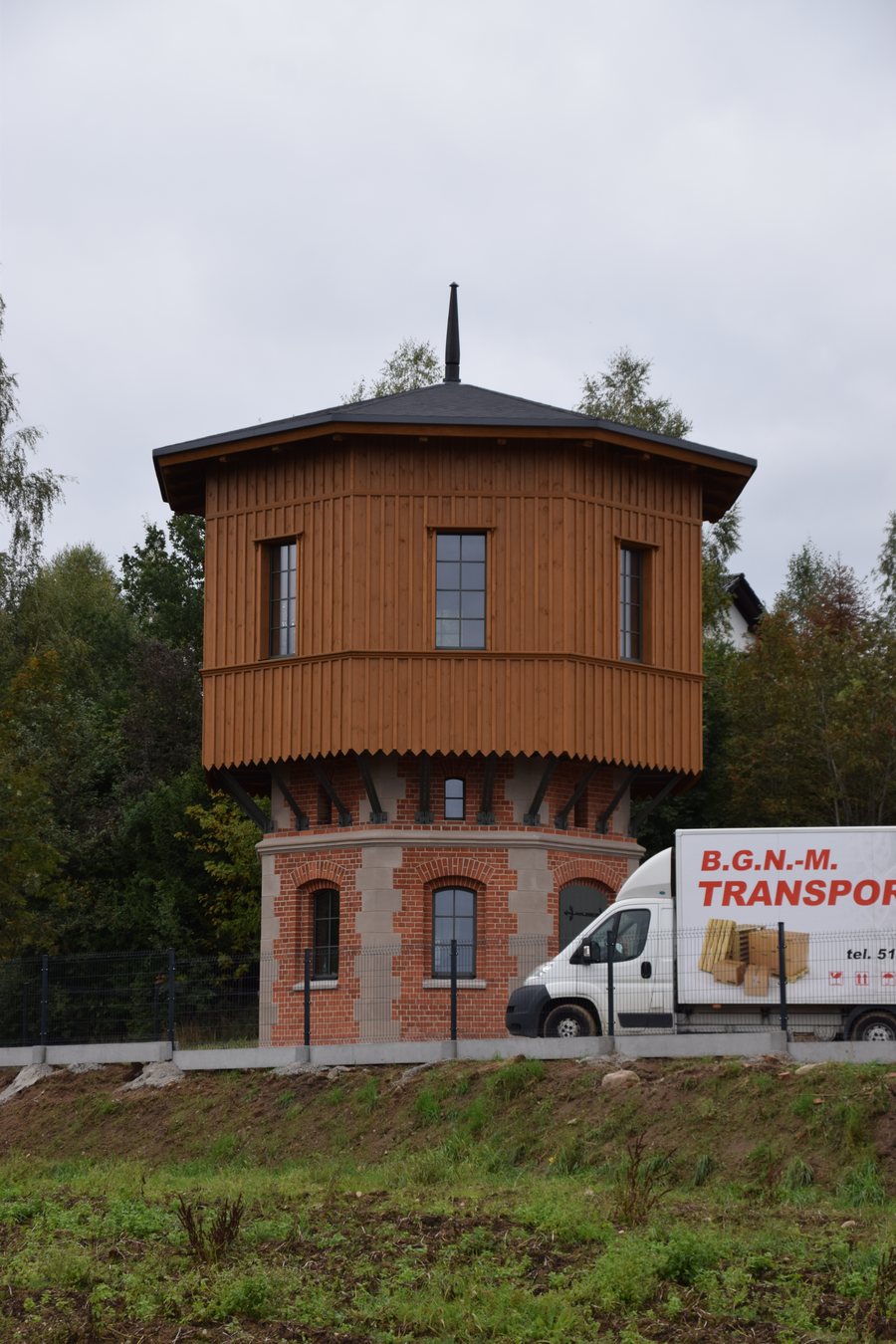
- The railway station ensemble comprises a station building and a water tower; its spatial layout has remained unchanged since the beginning of the 20th century.
- The station has been closed since 23 June 2000, following the closure of the Kartuzy–Lębork railway line.
- A recreational park area designated in the local development plan lies within the Kashubian Landscape Park and the “Dolina Łeby” Landscape-Nature Complex.
- A cycling route through Miechucino is 30.8 km long. The planned Miechucino–Borzestowo educational trail is intended to be approximately 3.8 km long.
What does the railway station ensemble tell us about Miechucino?
The station building and water tower together form a rare listed ensemble. Its spatial layout is also distinctive: it has remained unchanged since the beginning of the 20th century. This makes it possible to view the railway complex as a cohesive historic site, rather than just a single building.
The station has been closed since 23 June 2000. The Kartuzy–Lębork railway line had been closed beforehand. When planning your trip today, it is therefore worth distinguishing between the historic railway ensemble and former railway operations: the railway remains mentioned here shape the townscape as a heritage site, but the station is closed.
Which landscape areas shape the surroundings?
A recreational park area in Miechucino, designated in the local development plan, lies within the Kashubian Landscape Park (Kaszubski Park Krajobrazowy). It is also within the “Dolina Łeby” Landscape-Nature Complex. Both designations refer to the area identified as a recreational park area in the plan.
For orientation, it is worth distinguishing this designation from specific route alignments: protected or plan-designated areas describe the landscape setting, while the information on cycling and walking routes refers to particular routes and sections. This lets you consider the landscape and the individual tours described separately when planning your trip.
Which routes pass through Miechucino?
A 30.8 km cycling route runs from Kamienica Królewska via Jezioro Potęgowskie, Mirachowo, and Miechucino to Wygoda Łączyńska and Łączyno. Miechucino is therefore on the described route between Mirachowo and Wygoda Łączyńska. The total length refers to the entire route, not to an individual section.
The Szlak Wzgórz Szymbarskich hiking trail runs from Miechucino via Łączki. At kilometre 114.2, it follows a paved road. Further along, the trail passes through fields and meadows to Bór. These details describe different sections of the same hiking trail and help you distinguish the waypoints mentioned when choosing a destination for an outing.
What is planned for the educational trail to Borzestowo?
The Miechucino–Borzestowo educational trail includes a promenade by Jezioro Wielkie. The planned route is to run from Miechucino along the lake shore to the early medieval hillfort in Borzestowo (Garecznica). The planned educational trail is intended to be approximately 3.8 km long.
The accompanying infrastructure was planned to include boardwalks, benches, bicycle racks, and information and direction signs. The route concept thus links the lakeshore area with the historic destination in Borzestowo in the plans. If you are considering this tour, bear in mind that it is planned, and distinguish it from the described alignments of the cycling route and the Szlak Wzgórz Szymbarskich.
How can Miechucino be placed in the context of a regional trip?
The scenic Kashubian Route runs from Wieżyca via Szymbark, then through Gołubie, Stężyca, Zgorzałe, Łączyno, and Borzestowo to Miechucino and Kartuzy. As a described sequence of stops, it places the town among a number of other destinations. A Kartuzy–Miechucino bus route is also listed for Wygoda Łączyńska and Długi Kierz.
For a separate comparison of places, you can also view the pages for Kielpino K Kartuz, Grzybno, Tokary, Wiezyca, Somonino, Ostrzyce, Kamienica Krolewska, and Rąb.
FAQ
What is included in the Miechucino railway station ensemble?
The listed ensemble consists of a station building and a water tower. Its spatial layout has remained unchanged since the beginning of the 20th century.
When did the station close?
The station has been closed since 23 June 2000. The Kartuzy–Lębork railway line had been closed.
How long is the cycling route through Miechucino?
The route from Kamienica Królewska via Jezioro Potęgowskie and Mirachowo to Miechucino, and onward to Wygoda Łączyńska and Łączyno, is 30.8 km long.
Where is the planned educational trail supposed to lead?
It is planned to run from Miechucino along the shore of Jezioro Wielkie to the early medieval hillfort in Borzestowo (Garecznica); the planned length is approximately 3.8 km.
For the general travel overview: Karthaus.

