
Rowy: Harbor, Trails and Coastal Nature
Accommodation in Rowy
Rowy brings together the history of a fishing village with trails through forests, dunes and coastal landscapes. The town includes the fishing harbor at the mouth of the Łupawa, an exhibition on beach nature and several routes of varying lengths.
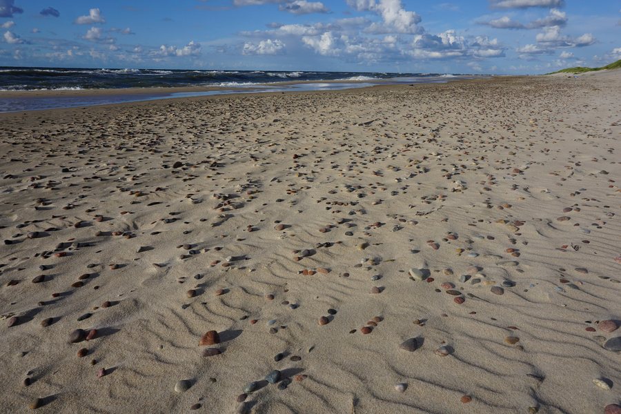
Rowy at a glance
Rowy was first mentioned as a fishing harbor in 1282 and has a long tradition as a fishing village. The harbor lies at the mouth of the Łupawa. Local highlights include a 19th-century Neo-Romanesque church, a branch of the Słowiński National Park Museum and routes through the landscape around Rowy.
What shapes the town and its history?
The Neo-Romanesque church in Rowy was built from 1844 to 1849 using dressed glacial granite stones. Its façade also features a “black stone,” which is associated with a weather legend: if it gets wet, a storm is said to be on the way.
Behind the coastal dune stands a lifeboat station that has been preserved to this day. The building bears a Maltese cross and is owned by the Maritime Office. Together with the fishing harbor, it reflects Rowy’s ties to the sea and fishing. These historic places serve different functions: the harbor is linked to the fishing tradition, while the lifeboat station is a preserved building behind the dune.
What nature experiences does the museum branch offer?
The branch of the Słowiński National Park Museum features the exhibition “Plaża – cztery pory roku” (“Beach – Four Seasons”). It explores changes in the coastal sandy area and the seasonal biological diversity of the beach, particularly the changing birdlife. The exhibition is therefore suited to visitors who want to learn more about coastal landscapes and their natural environment.
The museum branch is partially adapted for people with mobility impairments. If you want to assess its accessibility for your own needs, you can take this into account when planning your museum visit.
How do the routes around Rowy differ?
For a longer loop through the landscape, the 17-kilometer Rowy–Dołgie Małe–Rowy trail passes through the forest complexes of Słowiński National Park to Lake Dołgie Małe. It then runs through wooded dunes to the sea and back to Rowy, parallel to the coast.
The international R-10 “Nadmorski” coastal cycling route runs for 38 kilometers through the Ustka municipality and reaches Rowy at its eastern border with the Smołdzino municipality. The 20-kilometer route between Rowy and Przewłoka is also known as the “Szlak Zwiniętych Torów.” These three descriptions refer to different routes: a loop starting in Rowy, the section of the R-10 that runs through the Ustka municipality, and the route between Rowy and Przewłoka. When choosing, focus on which distance and route best suit your plans.
Where can you get information locally?
The tourist information office is at ul. Nadmorska 17 and is open in July and August. If you have questions about your stay during these months, you can plan a visit to this location.
If you’d like to explore other places in the same navigation area: Debnica Kaszubska, Dębina, Osowa, Pobłocie, Stojcino, Adlig Kublitz, Runowo and Gardna Wielka.
FAQ
When is the tourist information office in Rowy open?
It is at ul. Nadmorska 17 and is open in July and August.
What does the museum branch in Rowy display?
The exhibition “Plaża – cztery pory roku” (“Beach – Four Seasons”) explores changes in the coastal sandy area and seasonal diversity on the beach, especially the changing birdlife.
How long is the loop via Dołgie Małe?
The Rowy–Dołgie Małe–Rowy loop is 17 kilometers long. It passes through the forest complexes of Słowiński National Park, goes to the lake, crosses wooded dunes and returns parallel to the coast.
For the main travel overview: Słupsk.

