
Discover Maróz: Lake and Hiking Trails
Accommodation in Maróz
Maróz brings together two clear themes to help you plan your trip: Lake Maróz, with its highly indented shoreline, and two hiking trails that initially follow the same route before branching off in different directions. The landscape and the course of the trails provide concrete points of reference when considering the destination in light of your interests.
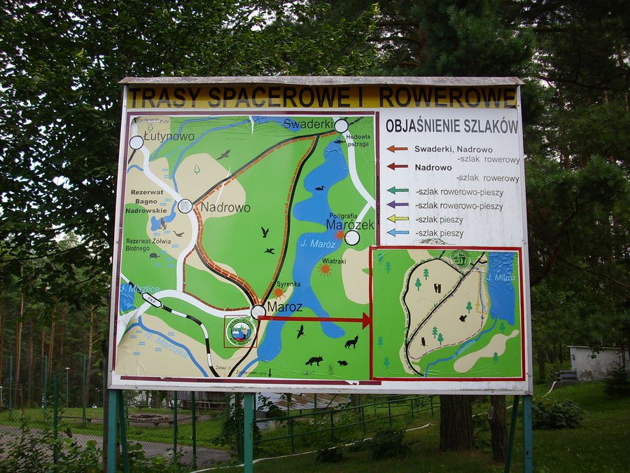
Maróz at a glance
Lake Maróz is a ribbon lake about 5.5 km long, up to 1,200 m wide, with a highly indented 18 km shoreline. Near Maróz, the lake has shallow shoreline areas, a sandy bottom and clear water; these features are associated with summer recreation. Water conditions may vary. The green hiking trail begins in the center, behind the entrance to OW Syrenka; the yellow trail starts in Maróz.
How can Lake Maróz be described?
The figures for length, maximum width and shoreline describe different aspects of the lake. At about 5.5 km long, the lake is longer than its maximum width of 1,200 m. Its 18 km shoreline is, by calculation, a little more than three times its approximate length. Together with its highly indented shape, this figure adds information about the contour of the shore to the lake's dimensions.
The lake can therefore be described by more than just its size: its shoreline is also a distinctive landscape feature. If you compare destinations by their landscapes, length and width provide one set of reference points, while the shoreline's shape provides another. Describing the lake as a ribbon lake adds further context.
What features define the lakeside surroundings?
Features of nearby Lake Maróz include shallow shoreline areas, a sandy bottom and clear water. These are associated with summer recreation. For orientation at the lake, you can consider not only its dimensions, but also its shore, bottom and water. Water conditions may vary, while the landscape features mentioned describe the character of the lake.
These details relate to a different aspect of the destination than the hiking trails: here, the focus is on the lake and its shore; there, on the routes through and from Maróz. This can help you decide whether to start planning your trip around the lakeside landscape or a specific route.
How do the hiking trails differ?
The green hiking trail begins in the center of Maróz, behind the entrance to OW Syrenka. The yellow hiking trail also starts in Maróz. At first, the two trails follow the same route from Maróz to Żelazno; after that, they head in opposite directions through the village. The yellow trail continues west to Witramowo.
So the starting point is not the only thing to compare: the trails initially share a section, then head in different directions. The green trail is described by its starting point in the center, behind the entrance to OW Syrenka; the yellow trail is noted as continuing west to Witramowo. If you plan to follow either route, check the current trail markings and local trail conditions in advance.
Discover more destinations: Ramsowo, Jaroty, Gmina Gietrzwałd, Waplewo, Lipowo Kurkowskie, Zgnilocha, Biedowo, Plutki.
FAQ
How long is Lake Maróz?
The lake is about 5.5 km long and up to 1,200 m wide. Its highly indented shoreline measures 18 km.
Where does the green hiking trail begin?
It begins in the center of Maróz, behind the entrance to OW Syrenka.
Where does the yellow hiking trail lead?
After the shared section to Żelazno, the trails head in different directions through the village. The yellow trail runs west to Witramowo.
Back to the main travel overview: Olsztyn.

