
Lunca: Nature, History and Village Customs
Accommodation in Lunca
Lunca in Bihor County is part of the ROSCI0042 Codru Moma Natura 2000 site. The Natura 2000 site comprises compact forest habitats that serve as an ecological corridor for wolves, bears and lynxes. Exploring Lunca by theme allows visitors to consider the landscape, history, churches and customs separately.
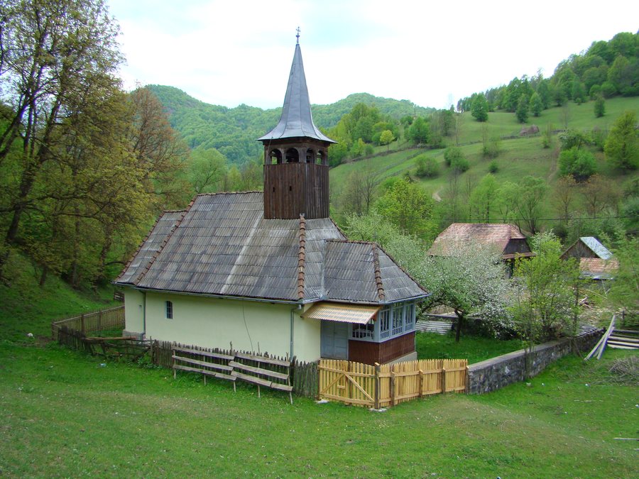 File:Biserica de lemn din Lunca Largă (10).jpg
Photo: Țetcu Mircea Rareș via Wikimedia Commons, CC BY-SA 4.0
File:Biserica de lemn din Lunca Largă (10).jpg
Photo: Țetcu Mircea Rareș via Wikimedia Commons, CC BY-SA 4.0
Nature
In terms of landscape, the municipality of Lunca consists of 25% plains, 40% hills and 35% mountains. Forests cover 50% of its area. The village of Lunca has riparian and steppe vegetation. In the floodplain of the Crișul Negru within the municipality, the terrain is flat and characterized by alluvial soils. The figures describe the municipality as a whole, while the vegetation and soils refer to individual landscape areas. For your own planning, these levels can be compared separately, for example according to terrain type, forest cover, and the difference between riparian and steppe vegetation.
History and Churches
The village of Lunca was first mentioned in a document in 1588. The cemetery in Seghiște contains the ruins of Orthodox churches from the Middle Ages, dated to the 15th to 17th centuries. One of these churches was destroyed by a storm in the summer of 1910. In Șuștiu, the masonry Church of Saints Michael and Gabriel was built in 1902 and consecrated on December 29 of the same year. The Orthodox Church of Saints Michael and Gabriel in Lunca is located at DJ764F 129, Lunca 417320, Romania. Those organizing the place names for their own daily itinerary can note Lunca, Șuștiu and Seghiște as separate reference points.
Customs and Regional Cuisine
In the past, the residents of Șuștiu, Briheni and Sîrbești in the municipality of Lunca were assigned work in smelting plants. The historic forge operated five days a week and produced 25 Măji of iron per week. In Lunca, Easter eggs are decorated in April and Toacă rhythms are maintained. The Festivalul Plăcintelor in Briheni has been held since 2017 and reached its eighth edition. Calendar dates and place names help distinguish the historical topics and recurring customs when planning personally.
When planning accommodation in Lunca, travel dates, room category and cancellation conditions can be compared separately on offer pages. This keeps the timeframe, type of accommodation and conditions recognizable as separate decision points.
Transport and Geographical Context
The Oradea–Vașcău railway line runs through Lunca parallel to the Crișul Negru. National road DN 76 Oradea–Deva runs along the roadside part of the village of Lunca. For geographical orientation, the railway line, river course and road alignment can be understood as different reference lines.
The geographical information can be read at different scales: the percentages refer to the municipality, vegetation and the floodplain to named landscape areas, and the church information to individual villages and cemeteries. For historical context, years, former work assignments, church construction history and recurring customs appear side by side. The transport data likewise describe separate lines rather than the same route: the railway, river and national road each mark their own geographical reference. This keeps the landscape, local history, culture and transport as distinguishable topics, even though they all contribute to understanding the same municipality.
For the overarching travel overview: Lunca.

.jpg)