
Colibița – Lakes, Mountains and Hiking Trails
Accommodation in Colibița
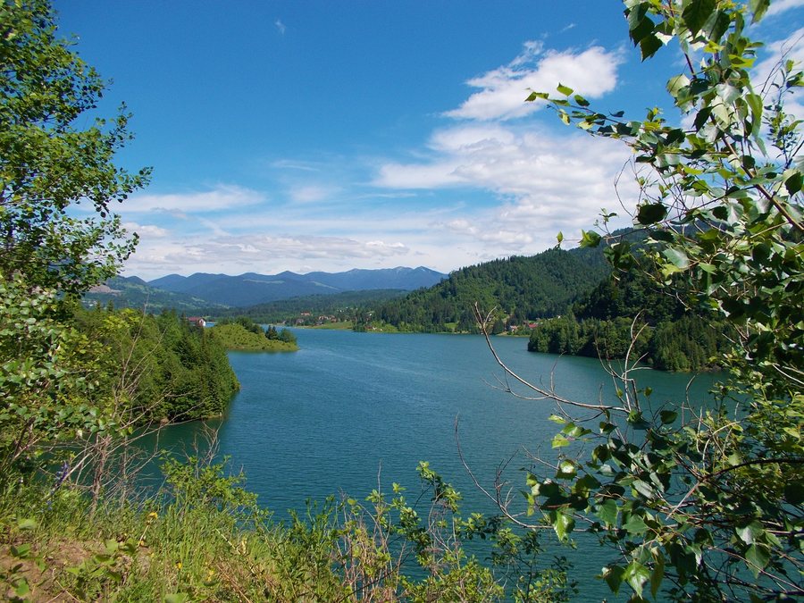
Colibița is one of the gateways to Călimani National Park. Lacul Colibiţa lies at an altitude of approximately 800 metres on the boundary between the Călimani Mountains and the Bârgăului Mountains. For day planning, hiking, water activities and the driving route can be considered as separate topics.
When comparing hotels in Colibița, check the travel dates, room category and cancellation conditions. Especially when travelling with several people, clearly stated information helps you compare different offers objectively side by side and avoid basing your planning solely on the accommodation price. The routes differ in their course: the section from Barajul Colibiţa initially follows a forest road, while the trails via Gura Izvoarelor lead to different destinations such as Gura Plaiului (Bistricior) and Ţuţurgău. The choice between hiking days and seasonal offerings at the lake also gives the planning a concrete framework without equating the individual options.
Landscape and Nature
In the Călimani Mountains, the Valea Repedea protected area is characterised by impressive erosion formations, groups of larch trees, and protected plant and animal species. At the summit of the route via Piatra lui Orban, there is a resting place and a viewpoint overlooking Lacul Colibiţa and the Bârgăului Mountains.
The Bistricioru trail leads through a spruce forest and offers views of the Bistricioru cirque, Lacul Colibiţa and Vf. Pietrosul Călimani at an altitude of 2,100 metres.
Hiking Trails
The Colibiţa–Tăul Zânelor hiking trail starts in the village of Colibiţa at an altitude of 800 metres and is considered the main way to reach Tăul Zânelor from the Lacul Colibiţa area. When comparing the hiking trails, you can use the starting point, intermediate stops and destination as your guide.
The municipality lists a hiking route from Colibiţa Sat via Gura Izvoarelor, Pârâul Colbu and Culmea Plaiului to Gura Plaiului (Bistricior). Another route leads from Colibiţa Sat via Gura Izvoarelor, Izvorul Lung, Poiana Terha, Viişorul, Străcior and Bistricior to Ţuţurgău.
The Barajul Colibiţa–Tăul Zânelor hiking trail begins by crossing the Colibiţa dam. For the first 7.5 kilometres, it follows a forest road, with Lacul Colibiţa continuously on the left; this section reaches an altitude of approximately 1,150 metres.
Water Activities
There are two signposted public access areas for pedestrians and bicycles at Lacul Colibiţa.
Ponton Colibiţa offers modern electric boat rentals on Lacul Colibiţa. Ponton Colibiţa also offers guided or independent boat trips on Lacul Colibiţa. For day planning, the water-based offerings can be compared by season, activity and type of boat trip.
Connections and Access
DJ172D connects Mureșenii Bârgăului on DN17 via Lacul Colibiţa and Colibiţa with Bistriţa Bârgăului. Access to Colibiţa from Mureșenii Bârgăului follows municipal and forest roads.
For the higher-level travel overview: Bistrita Bargaului.

