
Dejani between Natural Landscapes and Monastic Culture
Accommodation in Dejani
The village of Dejani is part of the ROSPA0098 Piemontul Făgăraș Natura 2000 site. The place can be viewed from three clearly distinct perspectives: natural landscapes, monastic culture, and hiking topics. These perspectives help you consider cultural destinations, the relationship with the landscape, and trails separately when planning your trip.
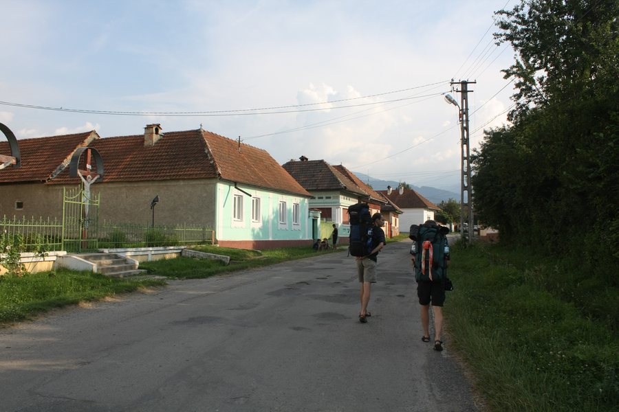 File:Dejani, Romania (1).jpg
Photo: Photo: This image is a work by Mercy . When reusing, please credit me as: Mercy from Wikimedia Commons . I would appreciate being notified if you use my work outside Wikimedia. Do not copy this image illegally by ignoring the terms of the license below, a
File:Dejani, Romania (1).jpg
Photo: Photo: This image is a work by Mercy . When reusing, please credit me as: Mercy from Wikimedia Commons . I would appreciate being notified if you use my work outside Wikimedia. Do not copy this image illegally by ignoring the terms of the license below, a
When booking a hotel in Dejani, travel dates, room category, and cancellation conditions are among the specific details of the offer.
Culture
The Mănăstirea Dejani Monastery is located in a clearing in the Făgăraș Mountains, on the Valea Radului. The existence of the Dejani monastic site in the 17th century is documented by inscriptions and entries in church registers from Țara Făgărașului. The monastery church includes a spacious wooden structure in the Moldavian style, which was consecrated on October 1, 2000, under the patronage of Acoperământul Maicii Domnului.
The chapel of Mănăstirea Dejani Monastery bears the patronage of Schimbarea la Față; its feast day is August 6. The patronal feast of Mănăstirea Dejani is celebrated every year on October 1.
The cultural information about Mănăstirea Dejani thus covers different historical and architectural levels: the monastic site documented as dating from the 17th century, the wooden structure consecrated in 2000, and the two patronages with their respective feast days. For planning your own day, these details can be considered separately from the road and hiking connections described below.
Trails
From Făgăraș, Dejani can be reached via Hurez, Săsciori, and Recea after a 15 km drive. The TR hiking trail connects Dejani via the Valea Dejani with the Curmătura Brătilei shelter on the main ridge. At Curmătura Brătilei, there is a Salvamont shelter with only four places and basic facilities.
At Curmătura Brătilei, trails from Dejani and the Iezer-Păpușa Mountains meet. The road journey, trail route, shelter capacity, and connection with other mountain trails represent different planning considerations. You can consider these details separately if you do not treat a stay focused on cultural destinations and a hiking day as the same activity.
The 15 km drive from Făgăraș describes access to the village, while the TR trail via the Valea Dejani indicates a connection toward the main ridge. The shelter with four places and basic facilities should be distinguished from these as a separate trail waypoint. Likewise, the trails coming from Dejani and the Iezer-Păpușa Mountains represent a connection in the mountains, not an additional road route.
Orientation
In the wider regional surroundings of Dejani, the route between Curmătura Brătilei and Curmătura Oticului is not recommended in conditions of limited visibility. This information refers to the wider regional surroundings and the specified section of the route, not to a general classification of all trails in Dejani.
On the Recea–Dejani–Valea Radului–Creasta Principală hiking trail, the old posts were replaced with new ones, and the existing markings were renewed and reinforced. In addition, a protective layer and reflective microspheres were applied.
For orientation purposes, three details must therefore be distinguished: the specifically mentioned section between Curmătura Brătilei and Curmătura Oticului in the wider regional surroundings, the connection of the TR trail via the Valea Dejani, and the renewed markings on the Recea–Dejani–Valea Radului–Creasta Principală trail. Each piece of information refers to a different part of the trail network.
For the broader travel overview: Recea.
