
Peștenița: Valley, River Landscape and Regional Destinations
Accommodation in Peștenița
Peștenița lies in a valley west of Peșteana. Around the village, landscape features in the surrounding area meet natural and cultural sites in the broader region.
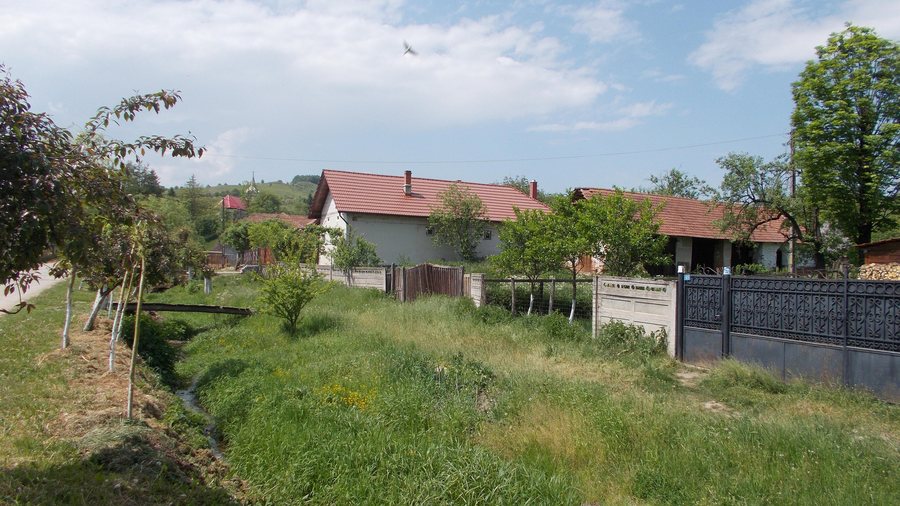
Landscape between Valley and River
The Bianu River (Peștenița) extends for 7 km within the Densuș Commune. Its course complements the valley setting with a distinct landscape area of its own. Peștenița is located in the valley west of Peșteana, while the Bianu is defined by its course within the commune. The seven kilometres describe the course of the waterway and not the distance between Peștenița and Peșteana. When assessing the regional extent, the length of the river can therefore serve as a separate measure alongside the valley location.
Peaks in the Surrounding Area
The peaks Ciclodan, Furcătura Clopotivei, Măgura Zimbrului and Lăpușului are located around Peștenița. Four individual elevations complement the landscape around the village. For nature enthusiasts, they form a separate area alongside the river and valley. Each of the four peaks represents its own landscape feature in the surroundings of Peștenița; this does not imply a shared route or a specific walking time. When planning nature activities in the region, the elevations can therefore be considered separately from the river course and the valley location.
Which Castle Is Located in the Regional Surroundings?
Hunyad Castle is a castle in the broader regional surroundings of Peștenița. The cultural site is therefore located within a larger regional context than the nearby peaks and the village’s valley setting. Alongside the Bianu, valley and elevations, the castle forms a distinct cultural reference. For a trip combining landscapes and history, it therefore belongs in the regional part of the overview, not in the immediate surroundings of the village.
FAQ
What was the former name of Peștenița?
The former name of Peștenița is “Pesteana Mică”. The historical name refers to the same place and is part of the village’s history.
What is Mlaștina de la Peșteana?
Mlaștina de la Peșteana is a national protected area in IUCN Category IV, meaning a botanical nature reserve, covering an area of 2 ha in the village of Peșteana in the Densuș Commune. The protected area belongs to the “Țara Hațegului” Dinosaur Geopark. It is located in the village of Peșteana and is also part of the regional context of the Densuș Commune, without being equated with the valley setting of Peștenița.
What was planned for the route to Tăul Fără Fund?
For the route from Peșteana to the Tăul Fără Fund protected area, markings, information boards about five points of interest and the design of the entrance were planned. The planned section and the protected-area surface are separate components: the 2 ha refer to Mlaștina de la Peșteana, while the markings, boards and entrance belong to the route project. The plan connects Peșteana with the protected area without claiming that it has been implemented.
For the overarching travel overview: Densuș Commune.

