
Medieșu Aurit – Archaeology, History and Landscape
Accommodation in Medieșu Aurit
In Medieșu Aurit, the Medieșu Aurit–Șuculeu archaeological reserve preserves six pottery kilns in situ.
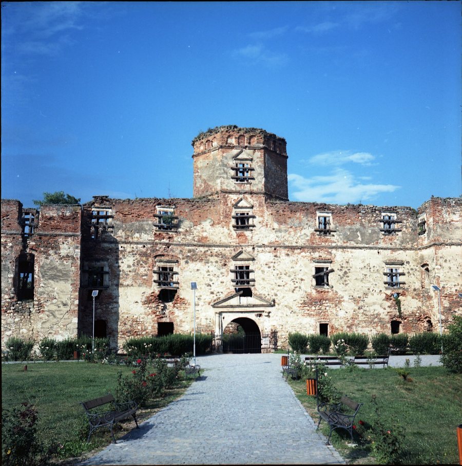 File:Ruinele castelulului Lónyai din Medieșu Aurit, județul Satu Mare.jpg
Photo: Teodor Ioan Diaconu via Wikimedia Commons, CC BY-SA 4.0
File:Ruinele castelulului Lónyai din Medieșu Aurit, județul Satu Mare.jpg
Photo: Teodor Ioan Diaconu via Wikimedia Commons, CC BY-SA 4.0
Culture and History
The Medieșu Aurit–Șuculeu archaeological site covers approximately 12–15 hectares. It is located on the southern terrace of the Racta stream. The buildings of the archaeological reserve were completely restored in 2014 as part of a European project. An archaeological exhibition was established in the archaeological reserve as part of a European project in 2014.
The reserve thus combines three levels of consideration: the pottery kilns preserved at their original site, the restored buildings and the exhibition from the 2014 project. The term in situ refers to the preservation of the pottery kilns at their original site. An educational excursion to discover the local cultural and historical heritage includes a visit to the Dacian ceramic kilns in Medieșu Aurit. For your own daily planning, you can list the archaeological area, built structures, exhibition and excursion destination separately.
The ruins of Lónyai Castle in Medieşu Aurit date back to a medieval castle from the period between 1620 and 1657. The Biserica Ortodoxă Medieşu Aurit, an Orthodox church, is located in the immediate vicinity of Medieşu Aurit. The Biserica Greco-Catolică Medieşu Aurit, a Greek Catholic church, is also located in the immediate vicinity. The Biserica Reformată Româneşti, a Reformed church, is also part of the immediate vicinity. The Biserica Ortodoxă Potău, an Orthodox church, is likewise located in the immediate vicinity of Medieşu Aurit.
The denominational designations Orthodox, Greek Catholic and Reformed indicate different ecclesiastical affiliations; they should be understood as distinct characteristics of the churches named. Archaeological, historical and sacred references can be noted as separate focal points when planning personally, without equating the individual sites.
When choosing a hotel for Medieșu Aurit, travel dates, room category and cancellation conditions can be considered separately. The location information points to different areas of focus: the archaeological reserve, castle ruins, churches, and mountains and peaks in the wider regional surroundings.
Geographical Location
Medieșu Aurit lies on the right bank of the Someș River. The village is located on county road DJ 192. The bank designation describes the location by the river, while the road designation identifies an independent transport-related reference point.
The spatial relationships mentioned distinguish between the place itself, the immediate vicinity and the wider regional surroundings. This gradation is useful when planning, because nearby churches should not be placed on the same level as mountains or peaks located within the region. A sacred reference point in the immediate vicinity and a landscape feature in the wider regional surroundings represent different types of spatial classification.
The wider regional surroundings of Medieşu Aurit include Dealul Plopii, a mountain, Cornetul Vămii, a peak, Cornetu, a peak, and Dealul Piatra Mică, a mountain.
For the general travel overview: Mediesu Aurit.

