
Kétvölgy: Trails, views and village culture
Accommodation in Kétvölgy
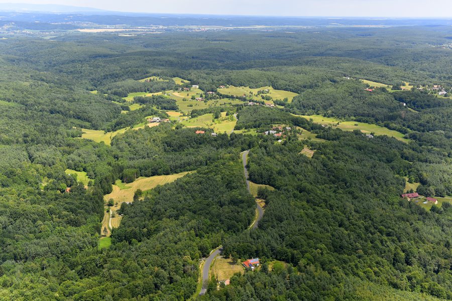
Kétvölgy combines Slovenian village culture with trails through the surrounding area and views of the Alps. The six-kilometre Réti orchideák tanösvény trail explores themes from nature and history; from the lookout tower on Katalin Hill, the view stretches over Kétvölgy to the Alps. Traditional architectural styles add concrete details of local history to this landscape perspective. When planning your trip, you can therefore assess the village based on your interest in nature trails, views and local architecture.
Quick facts about Kétvölgy
The Réti orchideák tanösvény is a six-kilometre circular trail through the immediate surroundings of Kétvölgy. It covers wildlife and plant life, tourist attractions, cultural history and folk architectural heritage. The Kétvölgyi körtúra passes the clear waters of the Szakonyfalvi stream and an area that is marshy in places. From the lookout tower on Katalin Hill, you can see Kétvölgy, with the Alps visible in the background.
What cultural traces shape Kétvölgy?
Kétvölgy is a village of the Slovenian national minority. The name of the lookout tower on Katalin Hill also refers to the local linguistic history: the municipality named it Bűricza. In the local Slovenian dialect, this name refers to the settlement’s former name, Permise. The name thus connects a present-day lookout point with an earlier settlement name, giving local cultural history a tangible point of reference.
The buildings, too, reveal different aspects of the village’s history. The bell tower with an apron roof in Kétvölgy-Ritkaháza was built around the 1880s. The folk architecture heritage house was restored at its original site. It is a log house with a thatched roof, a rammed-earth floor and a smoke kitchen. For the bell tower, the approximate construction date is the key detail; the heritage house offers visible architectural features in its roofing, construction, floor and kitchen design.
How do the trails and viewpoints differ?
The Réti orchideák tanösvény combines nature themes with cultural history and folk architectural heritage along its circular route. The Kétvölgyi körtúra passes other landscape features described in more detail: the clear waters of the Szakonyfalvi stream and an area that is marshy in places. Thematic interpretation and changing landscapes are therefore different aspects of the routes in Kétvölgy.
The Kétvölgyi körtúra can be difficult in wet weather. Bear this possibility in mind when planning your route. The lookout tower offers another perspective on the surroundings: from there, you can look out over Kétvölgy and the Alps in the background. The name Bűricza also connects this viewpoint with the local Slovenian linguistic history.
What else does the wider Eisenburg travel destination offer?
The Írottkő Nature Park lies in the northwestern part of Vas County, within the wider Eisenburg travel destination. The nature park encompasses the entire 4,303-hectare Kőszeg Landscape Protection Area. Another regional cultural landmark is the Vasi Skanzen: since opening in 1973, it has rescued and rebuilt 43 buildings from 27 settlements. The open-air museum also presents the agricultural way of life and folk architecture of Vas County from the past two centuries. These examples broaden the perspective on landscape and cultural history across the wider Eisenburg travel destination.
Discover more destinations: Alsószölnök, Apátistvánfalva, Felsőszölnök, Szentgotthárd, Rátót, Vasszentmihály.
FAQ
How long is the Réti orchideák tanösvény?
The circular trail is six kilometres long and leads through the immediate surroundings of Kétvölgy.
What does the name Bűricza mean?
The municipality gave this name to the lookout tower on Katalin Hill. In the local Slovenian dialect, it refers to the former name Permise.
What should you know about the Kétvölgyi körtúra?
The route passes the Szakonyfalvi stream and an area that is marshy in places. It can be difficult in wet weather.
Back to the wider travel overview: Szentgotthárdi.

