
Bukhar-Zhyrau District – Kurgans, Mausoleums and the Nura River
Accommodation in Bukhar-Zhyrau District
Historic burial sites meet a landscape shaped by the Nura River in Bukhar-Zhyrau District. The region offers points of interest for your travel planning, both for those interested in culture and for travelers drawn to river landscapes and rural places.
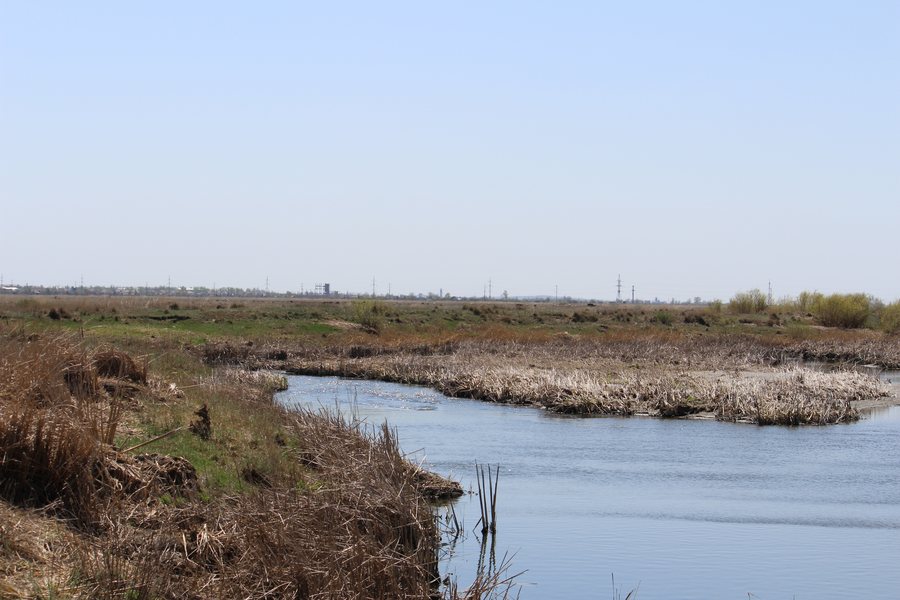 File:Bukhar-Zhyrau District, Kazakhstan - panoramio (2).jpg
Photo: Маргарита москалюк via Wikimedia Commons, CC BY 3.0
File:Bukhar-Zhyrau District, Kazakhstan - panoramio (2).jpg
Photo: Маргарита москалюк via Wikimedia Commons, CC BY 3.0
Accommodation in Bukhar-Zhyrau District: Quick Facts
- The Nura River flows through the district.
- Dams and reservoirs in the district cover a combined area of 16,232 ha.
- Three republican highways cross the district.
- Baiterek Resort is located in the village of Ushtobe.
- Historic sites include mausoleums, kurgans and stone enclosures.
Which historic sites can you discover?
The Bukhar-Zhyrau Mausoleum was built in 1993 and is 12 m high. It stands at the foot of Mount Dalba, about 25 km north of the village of Shalkar. As a sacred site, it is frequently visited by tourists and pilgrims.
The kurgans also display a variety of architectural forms. Botaqara Kurgan has an earthen mound 3 m high. Its preserved dimensions are 24.5 × 28.5 m. Koytas Kurgan stands on a rocky rise, 100 m from the Nura River. When it was excavated, a square stone mausoleum measuring 8 × 8.25 m was discovered; it is attributed to the Begazy-Dandybai culture.
How do the archaeological sites differ?
Ten stone structures were documented at the Temirkash burial ground in 2001; by 2008, eight remained. The site lies on a floodplain terrace on the left bank of the Nura.
The Kulsa burial ground comprises earthen kurgans, kurgans with stone enclosures, and stone enclosures. Up to 30 structures are documented there. The site lies on a slope, 4 km west of the settlement of Botakara and south of the Karaganda–Karkaraly road. Ten structures were documented at the burial ground; structures 1 and 2 are relatively well preserved. It is located in the Vodopad tract of a mountain-forest massif on the left bank of a seasonal stream.
The Belagash enclosures are also part of the region’s archaeological landscape. They consist of stone enclosures and stone settings and lie 2 km south of the village of Belagash. Visitors especially interested in stone structures can compare this site with the different types of kurgans and mausoleums.
What role do the Nura and the locations of the sites play?
The Nura flows through the district and provides a recurring geographic reference point for the places described. Botaqara Kurgan is located on a rise between the Nura’s left bank to the north and an old river channel to the south. It lies 2.5 km south of Senokosnoye and 3 km west of Petrovka. Koytas Kurgan stands on a rocky rise 100 m from the river.
The district’s water bodies include dams and reservoirs with a total area of 16,232 ha. They contain pike, crucian carp, perch, tench, burbot, carp and roach, as well as other species.
Where can you focus your accommodation search?
Baiterek Resort is a countryside holiday complex in the village of Ushtobe in Bukhar-Zhyrau District.
Three republican highways cross the district. This is a useful geographic reference point when getting your bearings in the region as a whole. It does not establish a specific route, travel time or connection to the individual sites. For further orientation within the page area, you can also include Temirtau.
FAQ
Where is the Bukhar-Zhyrau Mausoleum?
It stands at the foot of Mount Dalba, about 25 km north of the village of Shalkar in Bukhar-Zhyrau District.
How large is Botaqara Kurgan?
Its earthen mound is 3 m high; its preserved dimensions are 24.5 × 28.5 m.
Where is Baiterek Resort?
The countryside holiday complex is located in the village of Ushtobe in Bukhar-Zhyrau District.
For the broader travel overview: Karaganda.

.jpg)