
Kernavė: Archaeological Site, Museum and Trails
Accommodation in Kernavė
Kernavė combines an archaeological museum with trails through the archaeological site and a cycling route through the landscape. When planning your trip, you can choose between exhibitions, walking trails of different lengths and a longer cycling route.
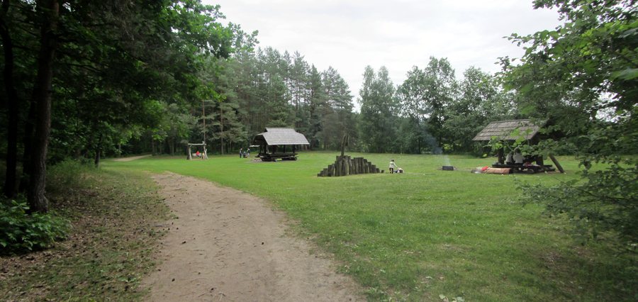 File:Kernavės sen., Lithuania - panoramio (48).jpg
Photo: VietovesLt via Wikimedia Commons, CC BY 3.0
File:Kernavės sen., Lithuania - panoramio (48).jpg
Photo: VietovesLt via Wikimedia Commons, CC BY 3.0
Kernavė at a glance
- The archaeological site comprises the town of Kernavė and a complex of archaeological sites, as well as historical and cultural monuments.
- The museum has three exhibition halls covering the site, prehistory and the 13th- and 14th-century Middle Ages.
- A walking route through the site is about 4 km long; the Kunigaikščių takas (Prince’s Trail) is a circular route of about 3 km.
- A scenic cycling route starts in the town of Kernavė and is about 9 km long.
What does the archaeological museum offer?
The three exhibition halls focus on different periods and themes: they cover the Kernavė archaeological site, prehistory and the 13th- and 14th-century Middle Ages. This lets you tailor your visit to your interest in the site itself or the periods represented.
During an educational tour, students can handle replicas as well as view the finds kept in the museum. The replicas span the period from the Early Stone Age to the Late Middle Ages. This makes the tour a special opportunity to engage with archaeological finds and their historical context.
Which trails lead through the archaeological site?
The walking route, about 4 km long, connects the lower and upper Neris terraces. It passes through archaeological areas, the fields of the Pajauta Valley, a ravine and an old-growth forest. The route also offers a wide view of the Pajauta Valley. Its length and changing landscapes give you concrete information to help plan your day.
A shorter circular option is the Kunigaikščių takas, also known as the Prince’s Trail, which is about 3 km long. It runs between the hillforts to the Neris. Both trails pass through the archaeological site, but differ in length and route: the longer trail connects the terraces and different landscape areas, while the circular route runs between the hillforts to the Neris.
What cycling options and nearby attractions are there?
The cycling route, about 9 km long, starts in the town of Kernavė and passes through local pine forests and valleys, and along river bends. It runs partly on forest trails and partly on paved roads. If you are planning a bike ride rather than a walk, this route offers a different way to experience the landscape around Kernavė.
The White Mountain Trail is also nearby. This easy 2.6 km walking trail has rest areas and leads to a viewing platform overlooking a bend in the Neris. It starts at the White Mountain Resort and can be reached by car from Kernavė via Pajautos Street.
If you would like to compare other destination pages, see Juodšiliai, Glitiškės, Bezdonys, Kaniūkai, Antatilčiai, Lentvaris, Madžiūnai and Žydkaimis.
FAQ
How long is the walking route through the archaeological site?
The walking route is about 4 km long. It connects the lower and upper Neris terraces and passes through the Pajauta Valley, a ravine and an old-growth forest, among other places.
What is the Kunigaikščių takas?
The Kunigaikščių takas, also known as the Prince’s Trail, is a circular route of about 3 km between the hillforts to the Neris.
What does the cycling route near Kernavė include?
The route, about 9 km long, starts in the town of Kernavė and passes through pine forests and valleys, and along river bends. It runs partly on forest trails and partly on paved roads.
What does the White Mountain Trail offer?
The easy 2.6 km walking trail has rest areas and a viewing platform overlooking a bend in the Neris. It can be reached by car from Kernavė via Pajautos Street.
For the main travel overview: Vilnius District.

.jpg)