
Švenčionėliai on the edge of the Žeimena Valley
Accommodation in Švenčionėliai
Švenčionėliai combines a location on the edge of the Žeimena Valley with a nature trail along the river and a history that began with railway construction. This gives you several concrete points to consider when planning your trip: the landscape and walking experience, the town’s history, and a railway station on the Vilnius–Turmantas line.
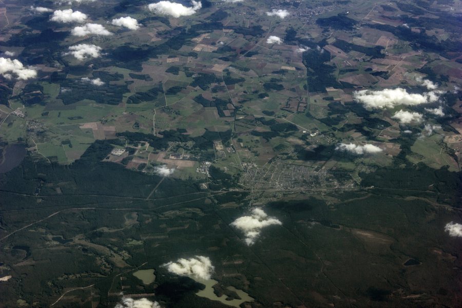 File:Aerial view to Švenčionėliai, Lithuania. August 28, 2019.jpg
Photo: Bestalex via Wikimedia Commons, CC0
File:Aerial view to Švenčionėliai, Lithuania. August 28, 2019.jpg
Photo: Bestalex via Wikimedia Commons, CC0
Quick facts about Švenčionėliai
- The town lies on the edge of the Žeimena Valley.
- The Žeimena nature trail runs along the river near Švenčionėliai.
- The trail is about 3 km long each way, is unmarked, and has information boards.
- A station on the Vilnius–Turmantas line is in operation in Švenčionėliai.
- Švenčionėliai was established in 1861, when the Saint Petersburg–Warsaw railway line was built and a railway station was constructed.
What makes the location on the Žeimena Valley distinctive?
Švenčionėliai lies on the edge of the Žeimena Valley; the Žeimena River runs along the western edge of the town. This gives the landscape a specific point of reference that you can find again on the nature trail: near Švenčionėliai, the path runs along the river. If you are interested in nature and landscapes when planning your trip, you can therefore consider the town through two related themes: the valley as its geographical setting and the river as the focus of a local walking experience.
The town’s history is also closely linked to a railway connection. Švenčionėliai was established in 1861 during construction of the Saint Petersburg–Warsaw line; a railway station was also built at that time. This historical development and the Vilnius–Turmantas line mentioned today refer to different periods. They help distinguish the role of the railway in the town’s origins from its current rail connections.
What can you expect on the Žeimena nature trail?
The trail runs along the Žeimena near Švenčionėliai and is about 3 km long each way. For your own planning, note that this distance is one way: if you walk back along the same route, you will cover the distance again. The distance alone does not determine how long the walk will take; plan according to your own pace and check local trail conditions before your visit.
The trail focuses on the nature of the flood meadows. Visitors can learn about their plants and animals and observe the Žeimena as it flows through the valley. The route therefore offers specific nature-related experiences, rather than just a stated distance. Information boards provide additional details. However, the trail is unmarked: bear this in mind when deciding whether this route description suits your plans.
The approximate distance, the lack of trail markers, and the information boards answer different questions: how far the route goes, how it is marked, and what you can encounter along the way.
What role does the railway play in planning your journey?
A station on the Vilnius–Turmantas line is in operation in Švenčionėliai. This is a specific point of reference if you would like to include rail travel in your plans. Check the timetable for the line before travelling so your plans are based on the services running on your travel date. The historical link to the Saint Petersburg–Warsaw line, by contrast, describes the period when the town was established and is not a timetable reference for travel today.
The railway can also be relevant if you want to understand the development of Švenčionėliai: the town was established in 1861 with the construction of the Saint Petersburg–Warsaw line and a railway station. For your stay, you can consider the town’s history and your present-day travel arrangements separately. Keep in mind the distinction between the historical railway construction and the Vilnius–Turmantas line mentioned today.
Where is there parking by the Žeimena?
There are parking spaces on both sides of the road at Platumų Bridge on Žeimenos Street. If you use this landmark to guide your drive, you can use the bridge and street as a specific location reference. Parking conditions may change; check whether a space is available when you arrive.
This parking information is a separate practical point of reference and should not be confused with the length of the nature trail. When planning, you can therefore consider separately whether to include the trail as a nature experience and whether to drive to the bridge mentioned. This keeps your decision focused on the stated locations and modes of transport.
How do you choose accommodation in Švenčionėliai?
When looking for accommodation in Švenčionėliai, you can first consider which of the topics mentioned matter to your trip: the Žeimena nature trail, the town’s history, or the railway connection. These priorities can help you tailor your search to the purpose of your trip.
If you would like to discover other destinations in addition to Švenčionėliai, you can also visit Labanoras and Kaltanėnai.
FAQ
How long is the Žeimena nature trail?
The trail is about 3 km long each way. If you walk back along the same route, remember to include the return distance in your plans.
Is the Žeimena nature trail marked?
No, the trail is unmarked. It has information boards.
What can you learn about on the trail?
The trail runs along the Žeimena. Visitors can learn about the plants and animals of the flood meadows and observe the river.
Which railway line serves the station in Švenčionėliai?
The station is in operation on the Vilnius–Turmantas line. Check the timetable for your travel date before setting off.
For the broader travel overview: Švenčionys District Municipality.

