
Discover Ostrzeszów
Accommodation in Ostrzeszów
Ostrzeszów combines church art with views from the Baszta Kazimierzowska and signposted trails ranging from 11 to 48 kilometres—practical points of reference for planning your cultural visits and tours.
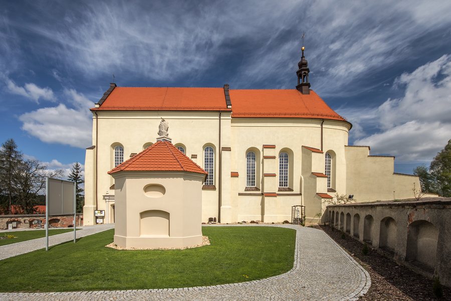 Ostrzeszów Bernardine monastery complex - Church of St Michael the Archangel
Photo: Sławomir Milejski via Source, CC BY 3.0
Ostrzeszów at a glance
The Władysław Golus Regional Museum is located at Rynek 19, in the town hall. Cultural highlights include the town’s churches and the Baszta Kazimierzowska as a viewpoint; there are also three signposted trails. National Road 11 runs through Ostrzeszów.
What church art can you identify?
The former Bernardine monastery complex consists of interconnected church and monastery buildings. Baroque polychrome wall paintings have been preserved inside the monastery church. Polychrome means multicoloured and here describes the colourful wall decoration. The parish church has frescoes donated by townspeople from the 14th to the 19th century, as well as Baroque altars. The main altar features a copy of Murillo’s “The Assumption of the Virgin.”
The churches therefore differ in specific elements of their decoration: the monastery complex has Baroque wall paintings, while the parish church has donated frescoes and altars. If you are interested in sacred art, these details offer a clear way to appreciate each building without confusing their motifs.
What distinguishes the museum and the Baszta Kazimierzowska?
The Władysław Golus Regional Museum is located at Rynek 19, in the town hall. The Baszta Kazimierzowska offers a different focus: it is the surviving tower of the former castle of Ostrzeszów and a viewpoint from which to take in the town panorama. In 1960, it was restored and adapted for museum and exhibition purposes.
The cultural highlights are clearly distinct for planning your visit: the museum is located in the town hall, while the Baszta offers both a historical story and a viewpoint. You can therefore organise your sightseeing by institution, building or town panorama.
How do the signposted trails differ?
The black connecting trail “W Dolinę Baryczy” runs from Ostrzeszów through Rojów to Szklarka Myślniewska and is 11 km long. According to its description, it is suitable for beginners. The red nature trail starts and ends at OSiR Ostrzeszów and is 21 km long. The green, level hiking trail WK–3670 z passes through Ostrzeszów and covers 48 km.
The distances give you an initial basis for comparing the scope of the trails. Their purpose also matters: “W Dolinę Baryczy” is designated as a connecting trail, both endpoints of the red nature trail are listed at OSiR, and the green route is described as a level hiking trail through Ostrzeszów. The three routes therefore differ not only in length, but also in their course and designation.
What guidance does National Road 11 offer?
National Road 11 runs through Ostrzeszów and connects the following places along the route described: Kołobrzeg, Piła, Poznań, Ostrów Wielkopolski, Ostrzeszów, Lubliniec and Bytom. This sequence of places helps you locate Ostrzeszów along a longer road connection.
Link your search to the activities you plan for your stay.
Discover more destinations: Syców, Kobyla Góra, Grabów Nad Prosną.
FAQ
Where is the Władysław Golus Regional Museum located?
The Regional Museum is located at Rynek 19, in Ostrzeszów Town Hall.
How long are the three trails described?
The black connecting trail is 11 km long, the red nature trail is 21 km, and the green WK–3670 z hiking trail is 48 km.
What is the Baszta Kazimierzowska?
It is the surviving tower of the former castle of Ostrzeszów and a viewpoint for the town panorama. In 1960, it was restored and adapted for museum and exhibition purposes.
Go to the main travel overview: Schildberg.

