
Oslonin
Accommodation in Oslonin
Oslonin is a summer holiday destination on the isthmus between Lake Wieleńskie and Lake Osłonińskie. The village features a municipal beach, water activities, routes for various activities and archaeological remains.
Quick facts about Oslonin
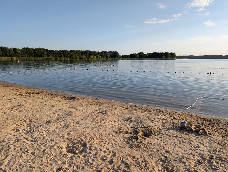
The municipal beach is on Lake Wieleńskie. The Przemęt municipal bathing area in Oslonin has separate areas for swimmers and non-swimmers. There is a rental facility near the bathing area offering pedal boats, kayaks and SUP boards. A 2 km cycling link connects Wieleń and Oslonin; a hiking trail across the isthmus and the “Szlak Konwalii” horse-riding trail also lead to the village or continue from there.
How does its location between the lakes shape the village?
Its location on an isthmus between two lakes gives Oslonin a distinct connection to the landscape. The two lakes are Lake Wieleńskie and Lake Osłonińskie.
Lake Wieleńskie is the specific point of reference for the beach: the municipal beach is located there. The Przemęt municipal bathing area in Oslonin is described as having separate areas for swimmers and non-swimmers. When comparing water activities, you can distinguish these bathing areas from other facilities with a different focus: watercraft can dock at the landing stage, a fishing pier is also part of the waterfront area, and the slipway is used to launch watercraft.
What water activities are available?
The “Konwalia” tourism complex in Oslonin has a waterfront area with a landing stage, fishing pier and slipway. There is a rental facility for watercraft and water sports equipment near the bathing area. The options include pedal boats, kayaks and SUP boards. These offer different ways to spend time on the water, with a choice ranging from a pedal boat to a kayak to a SUP board.
Which routes lead to and from Oslonin?
The cycling link from Wieleń to Oslonin is listed as 2 km long. A hiking trail crosses the isthmus between Lake Osłonińskie and Lake Wieleńskie to Oslonin; the village is reached at the 24.5 km mark along the route. These figures refer to different distances: 2 km is the cycling link between the two villages, while 24.5 km marks the point at which Oslonin is reached on the hiking trail.
There is also a named route for horse riders: the “Szlak Konwalii” horse-riding trail runs from Oslonin through the heart of Przemęt Landscape Park towards Perkowo and Nowa Wieś. The cycling link, hiking trail and horse-riding trail therefore describe different route connections. Depending on whether you want to focus on cycling, hiking or horse riding, different route details will be relevant for finding your way.
What archaeological remains are associated with Oslonin?
Oslonin is associated with several archaeological remains: two Stone Age campsites, two settlements of the Lusatian culture, an early medieval settlement and two Mesolithic settlements.
If you would like to compare other destinations, you can also visit Kaszczor and Wieleń.
FAQ
Between which lakes is Oslonin located?
Oslonin is located on the isthmus between Lake Wieleńskie and Lake Osłonińskie.
Where is the municipal beach?
The municipal beach in Oslonin is on Lake Wieleńskie.
How long is the cycling link from Wieleń to Oslonin?
The cycling link from Wieleń to Oslonin is 2 km long.
At what distance along the route is Oslonin reached on the hiking trail?
The hiking trail crosses the isthmus to Oslonin; the village is reached at the 24.5 km mark along the route.
For the broader travel overview: Solec Nowy.

