
Ponikiew: Hiking Trails, Romea Strata and a Natural Monument
Accommodation in Ponikiew
Ponikiew can be explored through its specific trails and a distinctive natural feature: a blue hiking trail leads from here to Groń Jana Pawła II, and a flysch rock is registered as a natural monument. When planning your trip, it is worth distinguishing these local highlights from the city, cultural and activity offerings in the wider destination of Wadowice.
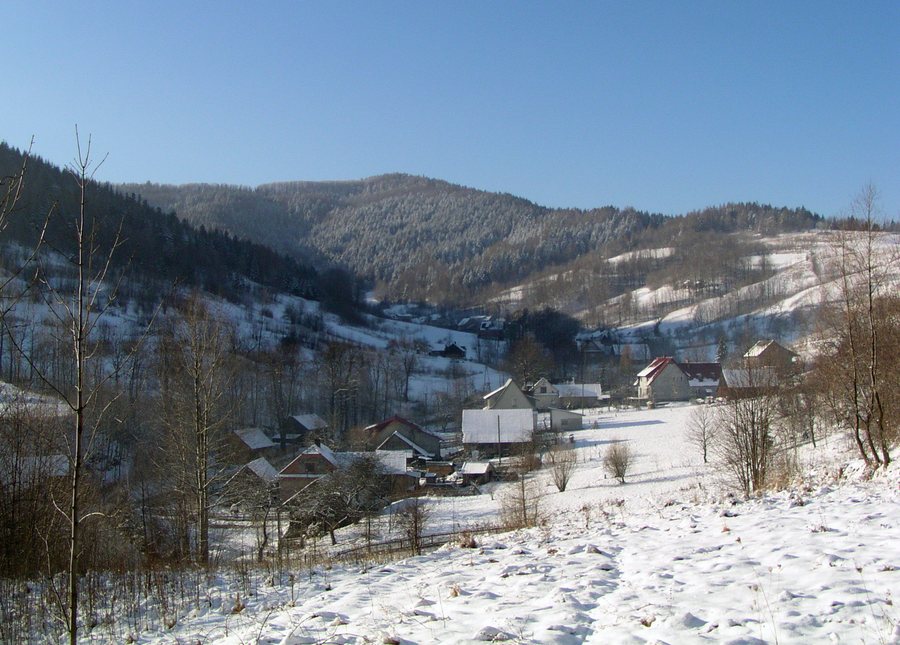
Ponikiew at a glance
- The blue hiking trail leads from Ponikiew to Groń Jana Pawła II; the stated walking time is 1 hour and 45 minutes.
- A 20-kilometre section of the Romea Strata runs through Jaroszowice, Wadowice, Chocznia, Zawadka and Ponikiew.
- Ponikiew is home to a flysch rock registered as a natural monument on the Żar range in the Little Beskids, at an elevation of 761 metres.
Which trails pass through Ponikiew?
The blue hiking trail has Ponikiew and Groń Jana Pawła II as its endpoints. The stated walking time is 1 hour and 45 minutes; the trail is named after Czesław Panczakiewicz. Check local trail conditions before setting out.
The Romea Strata is a pilgrimage route. Its 20-kilometre section in Wadowice Municipality passes through Jaroszowice, Wadowice, Chocznia, Zawadka and Ponikiew. One way to follow the route: from Wadowice, it goes along Karmelicka Street, past the Sanctuary of St Joseph and onward towards Zawadka and Ponikiew.
What makes the surrounding area distinctive in terms of nature and history?
The flysch rock registered as a natural monument is located in Ponikiew on the Żar range, which forms part of the Little Beskids. It is 761 metres high.
The history of the immediate area is also reflected in a small detail: a wayside shrine on a tree above the Ponikiewka stream was erected towards the end of the 19th century on the boundary between Gorzeń and Ponikiew.
What else does the wider destination of Wadowice offer?
Wadowice lies in the western part of the Wieliczka Foothills, in a basin between the foothills and the ranges of the Beskid Mały, and in the Skawa Valley. The centre of Wadowice lies between the Skawa and the Choczenka watercourse.
For a cultural and historical focus, Wadowice offers two city trails with different themes. The Karol Wojtyła Trail is about 4.5 kilometres long and leads to 14 sites associated with the childhood and youth of Saint John Paul II. Galicyjskie Wadowice is about 5 kilometres long and leads to 13 sites exploring the city’s history during the Partitions of Poland. Their approximate lengths and different themes help visitors choose between the two walks.
Wadowice’s museums also have their own focus: the Museum at the Family Home of Pope John Paul II features a permanent exhibition there and also welcomes visitors for individual visits. The Marcin Wadowita Municipal Museum presents historical collections from the Wadowice area as well as temporary exhibitions, many of which are connected with Karol Wojtyła. Visitors can sample Wadowice cream cake in the Market Square.
The wider destination also offers a range of activities for cycling and water sports. Wadowice Trails is a complex of mountain-bike singletracks in the wooded area of Jaroszowicka Góra, designed for beginners, families with children and advanced mountain bikers. A total of about 55 kilometres of tourist cycling routes run through Wadowice Municipality. The Wadowice–Grodzisko kayak route is 14 kilometres long, divided into three stages, and has an estimated paddling time of about 3.5 hours.
Wadowice bus station is on ul. Marsz. J. Piłsudskiego, opposite the railway station. The Zone of Discovery, Imagination and Activity (SOWA) in the historic railway station is accessible to people with reduced mobility. Wadowice also has a pump track with loops of varying difficulty for beginners and advanced riders; use is free. Check the current operating rules before visiting.
Discover more destinations: Bachowice, Jaroszowice, Gorzeń Górny, Nowe Dwory, Targanice, Jaszczurowa, Tomice and Andrychów.
FAQ
How long does it take to walk to Groń Jana Pawła II?
The stated walking time for the blue hiking trail from Ponikiew to Groń Jana Pawła II is 1 hour and 45 minutes.
How high is the flysch rock registered as a natural monument?
The flysch rock registered in Ponikiew is on the Żar range in the Little Beskids, at an elevation of 761 metres.
How do the two city trails in Wadowice differ?
The approximately 4.5-kilometre Karol Wojtyła Trail focuses on his childhood and youth and includes 14 sites. Galicyjskie Wadowice is about 5 kilometres long, has 13 sites and explores the city’s history during the Partitions of Poland.
For the wider travel overview: Wadowice.

