
Stronie Slaskie: Culture, Cycling and Hiking Routes
Accommodation in Stronie Slaskie
Stronie Slaskie combines historic buildings with cycling and hiking routes. When comparing hotels for a stay, the specific differences between local culture, route lengths and landscapes can help you decide what to focus on.
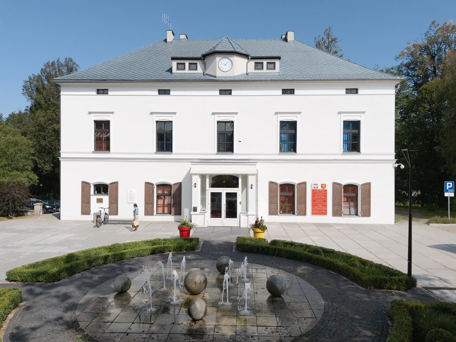
Stronie Slaskie at a glance
Highlights of a stay include the Parish Church of Our Lady Queen of Poland and Saint Maternus, the restored railway station with its cultural centre and tourist information office, and Stroński Park Aktywności. For outdoor activities, there are cycling routes and hiking trails with specified distances and times; Sowia Kopa and the Sowie Stopnie viewpoint offer additional perspectives on the landscape and geology.
Which buildings tell the story of the town?
The Parish Church of Our Lady Queen of Poland and Saint Maternus dates back to a wooden predecessor built in 1264. It was rebuilt in the Baroque style in 1732, and its tower dates from 1816. Beside the church stands a votive column with a twisted shaft, donated by Judge Wolff in 1672 and considered unique in the Kłodzko region.
Ulica Kościuszki is Stronie Slaskie’s main street. It preserves buildings from around 1900, including small apartment buildings, houses, hotels and restaurants. Another historic building is the restored railway station, built in 1897. Today it houses the municipal cultural centre, Centrum Edukacji, Turystyki i Kultury, which includes a tourist information office.
Muzeum Minerałów, a private collection of rocks and minerals with a shop selling jewellery made from semi-precious stones, is located at Kościuszki 40a. If you’re planning a visit, it’s best to check the current visitor arrangements in advance.
How do the cycling routes differ?
The shortest of the routes described is the “Do Lądka-Zdroju” cycling route. It runs from Stronie Slaskie via Strachocin and Stójków to Lądek-Zdrój, is 6.3 kilometres long and has a stated cycling time of 45 minutes. The “Pętla Janowej Góry” starts and ends in Stronie Slaskie. Its 15.60-kilometre route passes through Stronie Śląskie-Wieś, Janowa Góra, Kletno and Stara Morawa; the stated cycling time is two hours.
The western “Pętla Gór Bialskich” cycling route covers more ground. It also starts and ends in Stronie Slaskie, is 25.60 kilometres long and has a stated cycling time of four hours. Along the route are Młynowiec, Dział Pass at an elevation of 922 metres, Sucha Pass at 1,001 metres, Nowa Morawa, Bolesławów and Stara Morawa. The three routes can therefore be compared by distance and stated time, without treating their different itineraries as the same.
The nearest singletrack routes to Stronie Slaskie are “Pętla Ruda” and its extension, “Pętla Stronie Śląskie”. They are a separate addition to the municipal cycling routes described above.
Which trails lead into the landscape?
Municipal hiking trail No. 1, “Wokół Stronia Śląskiego”, is a 7.3-kilometre circular route through Stronie Slaskie, Sowia Kopa and Goszów. The stated walking time for the circuit is about two hours. This approximate duration differs from the cycling times given for the cycling routes, although Sowia Kopa features in both.
Sowia Kopa is a 672-metre-high peak in the Góry Złote. Rock formations and wooded beech-covered slopes characterise the area; residents of Stronie Slaskie enjoy walking there. Sowie Stopnie, a viewpoint on the slope above Goszów, is located at the upper part of a rock escarpment. The escarpment formed at a former gneiss quarry.
Another option for a walk is the “Albrecht Marien Weg”. It connects Stronie Slaskie with the village of Młynowiec and was created in the 19th century as a scenic route via Dział Pass to Stary Gierałtów. It is still used as a walking route today. Alongside circular trail No. 1, this offers different hiking options: a historic route and a trail to Sowia Kopa.
What facilities does Stroński Park Aktywności offer?
Stroński Park Aktywności in Stronie Slaskie includes an indoor swimming pool with five lanes and a length of 25 metres. The complex also has a large sports hall with seating for 300 people. The two facilities have clearly distinct focuses: the pool and lanes on the one hand, and indoor sports and spectator seating on the other. If you’d like to include either facility in your travel plans, check the current visitor arrangements before your visit.
Discover more destinations: Radochów, Gorzanów, Wójtowice, Bad Landeck, Nowa Ruda, Międzylesie, Ludwikowice Kłodzkie, Ołdrzychowice Kłodzkie.
FAQ
Which of the cycling routes described is the longest?
The western “Pętla Gór Bialskich” is the longest of the three cycling routes described, at 25.60 kilometres. Its stated cycling time is four hours.
How long is the “Wokół Stronia Śląskiego” hiking trail?
The circular route is 7.3 kilometres long. The walk takes about two hours and passes through Sowia Kopa and Goszów.
What is Sowie Stopnie?
Sowie Stopnie is a viewpoint on the slope of Sowia Kopa above Goszów. It is located at the upper part of a rock escarpment formed at a former gneiss quarry.
To the main travel overview: Kłodzki.

