
Jugowice – Landscape, History and Cycling Routes
Accommodation in Jugowice
Jugowice combines a valley setting between two mountain ranges with historic buildings and several cycling routes through the village.
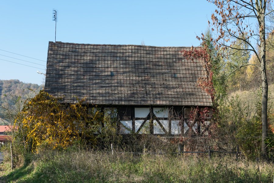 File:2018 Dom przy ul. Górnej 18 w Jugowicach 05.jpg
Photo: Jacek Halicki via Wikimedia Commons, CC BY 3.0
Jugowice at a glance
Jugowice is a large linear village stretching along the Bystrzyca Valley between the Owl Mountains and the Wałbrzych Mountains. The village lies at an elevation of 370–400 m above sea level. A small part lies in the Owl Mountains Landscape Park at the foot of Włodarz; a municipal plan for 2007–2015 identifies this limited overlap.
What traces tell the story of Jugowice’s past?
In 1786, Jugowice had a Protestant school, two watermills, a bleaching works and 25 weaving workshops. These four details place education alongside milling, bleaching and textile crafts, giving a sense of the range of village life at the time.
At the beginning of the 20th century, construction of the Świdnica–Jedlina railway line and the Walim electric railway contributed to the growth of tourism in Jugowice. The former railway station buildings form a station complex dating from the early 20th century. Transport and tourism history are therefore among the village’s important historical themes.
Which buildings stand out for their details?
The wooden cemetery bell tower dates from 1828 and was renovated in 1893. It has a post-and-beam structure and a tented roof; a masonry enclosure surrounds its lower section. On the cemetery side, there is an open niche with an altar.
The cemetery is also home to the Najświętszego Serca Pana Jezusa Mass chapel, built in 1975–76. Inside is a polychrome wooden statue of Saint Joseph in the Baroque-Classical style, transferred from the church in Walim. The manor house at 4 Główna Street dates from the second half of the 19th century. It is a two-storey masonry building on a high plinth. Its features include a gabled roof with stepped gables, a recessed cornice and segmental-arched windows with semicircular muntins.
How do the cycling routes through Jugowice differ?
Rowerowa 500 W2 is an easy, 14 km road cycling route. The village centre of Zagórze Śląskie is the recommended starting point. The route passes through Niedźwiedzica, Podlesie, Olszyniec and Jugowice before returning to Zagórze Śląskie. W3 is also recommended to start in the centre of Zagórze Śląskie and returns there; it is 20 km long and classified as a challenging road cycling route. It passes the ribbon-like footbridge over Jezioro Bystrzyckie and continues through Michałkowa, Glinno, Walim, Jawornik and Jugowice. The route lengths and difficulty ratings offer a concrete comparison between the two routes.
Route W9 in the Tras Active system is an easy, 14 km road and forest route. The route information gives the centre of Walim, on St. Żeromskiego Street, as the starting point. It runs from Jedlina Zdrój through Olszyniec, Jugowice, Walim and Górna Rzeczka; the next section follows Rowerowa 500, marked G9, to Głuszyca and the Osówka tourist complex. W2 and W9 are both listed as 14 km and easy, but differ in route type and recommended starting point. Check local information on current conditions before setting out.
What should you know about the playground?
The playground is next to the village community centre, in the former railway station building, and a safe distance from the tracks. The municipality announced its opening on 10 June 2024; listed amenities included slides, swings and other sports and recreational equipment. If you plan to visit, check its current operating status in advance.
Discover more destinations: Sokołowsko, Unisław Śląski, Zagórze Śląskie, Dziećmorowice, Boguszów-Gorce, Głuszyca, Mieroszów, Głuszyca Górna.
FAQ
Which part of Jugowice lies in the Owl Mountains Landscape Park?
A small part lies at the foot of Włodarz in the landscape park. A municipal plan for 2007–2015 identifies this limited overlap.
How do routes W2 and W9 differ?
Both are 14 km long and classified as easy. W2 is a road cycling route with a recommended starting point in Zagórze Śląskie; W9 combines road and forest sections and lists the centre of Walim as its starting point.
What are the distinguishing features of the cemetery bell tower?
The wooden tower dates from 1828 and was renovated in 1893. Its features include a post-and-beam structure, a tented roof and an open niche with an altar on the cemetery side.
For the broader travel overview: Wałbrzyski.

