
Górecko Stare on the Szum: Cycling Route, Village History and Hydropower
Accommodation in Górecko Stare
Górecko Stare lies on the Szum and at the boundary between Roztocze and the Sandomierz Basin. The village, dating from the 15th century, is thus clearly located within the region and closely connected to the river. Also relevant to your plans are a yellow-marked cycling route, several activities provided for in the park regulations, and a small hydropower plant dating from the 1950s. This gives you a way to understand the place through its landscape, history and opportunities in the national park.
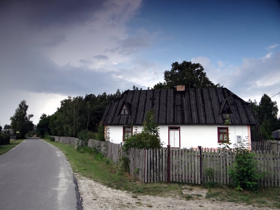 File:Górecko Stare - budynek dawnej szkoły (1).jpg
Photo: Zbigniew.czernik via Wikimedia Commons, CC BY 3.0
Key facts about Górecko Stare
- Górecko Stare is a village dating from the 15th century, on the boundary between Roztocze and the Sandomierz Basin.
- The village lies on the Szum, where a small hydropower plant dating from the 1950s also stands.
- The yellow-marked cycling route runs from Rybakówka via Florianka to Górecko Stare.
- The park regulations specify free admission to the park in Górecko Stare.
What shapes the village’s landscape and history?
The Szum is one of the place’s defining geographical features. The small hydropower plant stands on the river; it was built in the 1950s and is considered a tourist attraction. Its construction date and function as a hydropower plant give the river connection a technological and historical dimension.
Another landmark in the area around Górecko Stare is the large boulder known as the “Weeping Stone,” which sits on a hill. Water droplets emerge from its lower part throughout the year, even on hot days. The two features have different points of interest: the plant is notable for its construction date and hydropower function, while the stone is notable for its hilltop location and year-round water seepage.
How do the routes and activities differ?
The yellow-marked cycling route runs from Rybakówka via Florianka to Górecko Stare. For the Rybakówka–Florianka–Górecko Stare section, the park regulations provide for hiking, cycling and cross-country skiing. If you plan your visit around a particular activity, these are three permitted uses of the same section.
A length of 15 km is given for the cycling route from the national park’s Educational and Museum Complex via Florianka to Górecko Stare. When comparing the routes, pay attention to their respective starting points: Rybakówka is named for the yellow-marked route, while the 15 km figure refers to the Educational and Museum Complex. This lets you match each distance to the route described.
What visitor information is available?
The park regulations specify free admission to the park in Górecko Stare. The Roztocze National Park Tourist Information Point in Florianka is listed at Górecko Stare 105, 23-460 Józefów. This provides a specific admission detail and address to help you find your way.
How can you factor Górecko Stare into your accommodation search?
If you are considering Górecko Stare as a destination for your stay, first think about which theme will guide your plans: cycling, the Szum and its hydropower plant, or the village’s history. This helps you decide on a destination first, and then on a particular place to stay.
FAQ
Which activities do the park regulations provide for on the Rybakówka–Florianka–Górecko Stare section?
They provide for hiking, cycling and cross-country skiing.
Which cycling route is listed as 15 km long?
The length applies to the route from the Educational and Museum Complex via Florianka to Górecko Stare.
What is the “Weeping Stone”?
A large boulder on a hill in the area around Górecko Stare, from whose lower part water droplets emerge throughout the year.
For the broader travel overview: Borowina.

