
Bochotnica: Discover the castle ruins and geology
Accommodation in Bochotnica
Bochotnica combines a protected underground quarry with medieval castle remains and a rare geological outcrop. This raises a practical question as you plan your trip: are you most interested in the castle, natural history or a cycling route through the village?
Bochotnica at a glance
- The disused Ścianka Pożaryskich underground quarry is protected as a site documenting inanimate nature; this designation dates back to 1992.
- A geological outcrop reveals the boundary between the Maastrichtian and Paleocene, which is rare in Central Europe.
- The castle ruins preserve the remains of a medieval stone castle associated with the Firlej family.
- A blue hiking trail leads from Góry Street in Bochotnica to the castle ruins; a green cycling route passes through the village.
What geological features are there?
First, it is worth noting the protected status of the disused Ścianka Pożaryskich underground quarry as a site documenting inanimate nature. This designation dates back to 1992. The Ścianka Pożaryskich quarry also reveals a geological outcrop rare in Central Europe, showing the boundary between the Maastrichtian and Paleocene. The former Ściana Krystyny i Władysława Pożaryskich quarry offers a geological profile.
To understand the site, it helps to distinguish between its protected status and its geological feature: the former refers to the protected site documenting inanimate nature, while the latter is the feature visible in the outcrop. At the Pożaryskich Wall, this is the boundary between two named geological stages. This describes the geological feature specifically, rather than referring to a rocky landscape in general.
What should you know about the castle ruins?
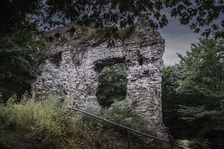
The castle ruins in Bochotnica preserve the remains of a medieval stone castle associated with the Firlej family. Their focus differs from the village’s geological features: here, the castle remains and their historical connection take centre stage. Visitors wishing to compare cultural history with natural features will find both represented in different ways in Bochotnica.
A description dated 7 December 2015 portrays the ruins as difficult to access: the slopes were covered with trees, shrubs and dense undergrowth; the walls were crumbling and unsecured. Check the site’s condition before visiting. This keeps the description of its condition in its historical context, rather than treating it as current access information.
What do the hiking and cycling routes offer?
The blue hiking trail leads from Góry Street in Bochotnica to the castle ruins. The described green cycling route passes through Bochotnica; from there, cyclists can see the Pożaryskich Wall and its underground quarry. The routes offer different perspectives: the hiking trail leads to the ruins, while the cycling route passes through the village and offers a view of the wall. Check the current route before setting out on a cycling trip.
How can you use this information when looking for accommodation?
When looking for hotels in Bochotnica, you can use your interests as a first filter: the castle remains, geological profile and cycling route each represent a different focus for choosing where to stay. First, consider which topic matters most to your travel plans.
Discover more destinations: Parchatka, Strzyżowice, Kurów, Nałęczów, Karmanowice, Puławy, Sadurki, Rablów.
FAQ
What geological feature does the Ścianka Pożaryskich quarry reveal?
The outcrop reveals the boundary between the Maastrichtian and Paleocene, which is rare in Central Europe.
How is access to the castle ruins described?
A description dated 7 December 2015 calls the ruins difficult to access and mentions overgrown slopes and crumbling, unsecured walls. Check the site’s condition before visiting.
What can cyclists see from the green route?
The route passes through Bochotnica. From there, cyclists can see the Pożaryskich Wall and its underground quarry.
For the broader travel overview: Puławski.

