
Discover Załuski
Accommodation in Załuski
In Załuski, a former manor park with a manor house and the starting point of the blue-marked Cycle Route II appeal to two different travel interests. Information about the park and the route helps you consider cultural interest and cycling plans separately when choosing a destination.
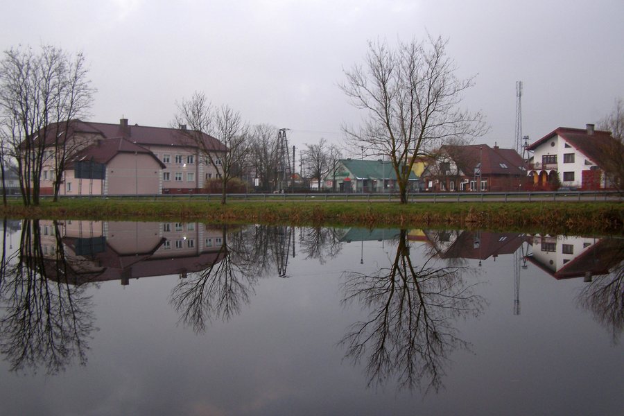 File:Panorama wsi Załuski, gmina Załuski.jpg
Photo: Michał Czerwiński via Wikimedia Commons, CC BY-SA 4.0
Załuski at a glance
- The former manor park in Załuski covers 1.20 ha; a manor house is located in the park.
- The blue-marked Cycle Route II starts in Załuski and passes through 14 localities. It is about 30 km long; the estimated cycling time is around two hours.
- The cycle routes in Załuski municipality run along public roads, including paved and gravel roads. Signposts and information boards with maps and descriptions help with navigation.
What makes the former manor park distinctive?
The park and manor house provide a specific point of reference for cultural and historical interest. The term “former manor park” identifies the site’s historical character; the area of 1.20 ha refers to the park. The manor house is located within the park, so both details belong together. If you also choose destinations based on cultural themes, you will find a clearly defined focus here that you can consider alongside your cycling plans.
The park area and cycling route describe different scales: the area in hectares characterizes the manor park, while the distance in kilometres and estimated cycling time relate to the cycle route. This makes it easier to base your decision about whether to focus more on cultural and historical interest or cycling during your trip on the specific information about Załuski.
What should you plan for Cycle Route II?
The starting point, route and length help you gauge the scale of Cycle Route II: it starts in Załuski, passes through 14 localities and is approximately 30 km long. The estimated cycling time is around two hours. The distance describes the route; the time is a guideline and varies depending on the person and conditions. Therefore, use this estimate as a guide when planning your time, not as a fixed duration. Route details may change.
The blue marking and the name “Cycle Route II” identify the route clearly. Municipality-wide information about the cycle routes adds details about navigation to these specific route features: at the starting points, boards provide maps and descriptions of interesting places, natural features and monuments. If you plan to follow the signage on site, check that it is up to date.
How should you understand the cycle routes in the municipality?
The municipality-wide information describes cycle routes on public roads, both paved and gravel. It applies to the cycle routes throughout Załuski municipality. For Cycle Route II, by contrast, the specific route details are that it starts in Załuski, passes through 14 localities, and has an approximate length and estimated cycling time. This distinction is useful when you want to separate general information about navigating the municipality from details about a specific route while planning.
The boards at the starting points provide maps and descriptions of interesting places, natural features and monuments. Thus, the municipality-wide navigation information includes not only signposts but also pointers to possible points of interest along the routes. Information about these boards applies to the municipality; it should not be taken to mean that every section of Cycle Route II has these facilities.
Which focus suits your travel plans?
If your main interest is assessing a cycling trip, the length and estimated cycling time for Cycle Route II provide a specific basis for planning your time. The former manor park with its manor house offers a different focus and appeals to travellers who also take cultural connections to a place into account when choosing a destination. Each can be considered as a separate focus: route details help with planning a trip, while the information about the park and manor house describes the historical point of reference in Załuski.
Discover more destinations: Drożdżyn, Sobieski, Sochocin, Dłużniewo, Siedlin, Popielzyn-Zawady, Joniec, Wycinki.
FAQ
How long is the blue-marked Cycle Route II?
It is approximately 30 km long and passes through 14 localities. The estimated cycling time is around two hours; it varies depending on the person and conditions.
What is known about the roads used by the cycle routes in the municipality?
The municipality-wide information refers to public roads, including paved and gravel roads. The cycle routes are marked with signposts; information boards with maps and descriptions are located at the starting points.
What is located in the former manor park?
The former manor park in Załuski covers 1.20 ha. A manor house is located within the park.
For the broader travel overview: Płoński.

