
Woźnawieś for hiking and cycling trips
Accommodation in Woźnawieś
Hiking trails, designated cycling routes, and picnic spots are among the features described as points of interest for a stay in Woźnawieś. To plan your visit, you can first decide whether you would like to follow a hiking route, a cycling route, or a spot by the river.
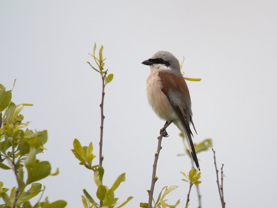 Red-backed Shrike, Woźnawieś, Poland
Photo: Frank Vassen from Brussels, Belgium via Wikimedia Commons, CC BY 2.0
Woźnawieś at a glance
- The red Rajgród–Grzędy hiking trail is 41.6 km long, is classified as easy, and is wet in places.
- A section of the green R-11 EuroVelo between Wizna and Śluza Sosnowo passes through Woźnawieś and is 106.4 km long.
- The village has a wooden picnic shelter with a large wooden table and two benches.
Which hiking trails pass through or start from Woźnawieś?
The red Rajgród–Grzędy hiking trail passes through Woźnawieś and continues to Biebrza National Park and the strictly protected “Czerwone Bagno” area. Its stated length of 41.6 km and its easy classification can help you get a first sense of the route. Also note the description that the trail is wet in places: this feature is part of its route profile, just like its difficulty rating.
A red hiking trail connects Woźnawieś with the Grzędy forest district. This provides a specific link between the village and this destination, in addition to the longer route description. The name Grzędy appears in both descriptions; for navigation, however, what matters is the specific route connection given in each case: the Rajgród–Grzędy trail passes through the village and continues to the national park and protected area, while the other description refers to the connection from the village to the forest district.
Which cycling routes are designated in Woźnawieś?
The green R-11 EuroVelo section between Wizna and Śluza Sosnowo is 106.4 km long and passes through Woźnawieś. This places the village within a longer, named route section. It differs from the description of the yellow Tama–Kuligi–Orzechówka–Tajenko cycling trail, whose designated sections are identified more specifically by their locations.
On the yellow trail, the section from Tama to the outskirts of Woźnawieś is designated for cycling tourism. Another designated stretch lies between Orzechówka and the “Tajenko” trail junction. These two location references describe where the designation applies; they should not be confused with the length of the EuroVelo section. When comparing the routes, therefore, note whether a description refers to a longer section between two places or to specific designated stretches.
What picnic facilities are available?
Woźnawieś has a wooden picnic shelter with a large wooden table and two benches. The specific details about the table and seating give you a clear picture of what is mentioned at this spot. Another description places a picnic shelter by the Jegrznia River and calls it a family picnic area. The river setting and the description as a family picnic area help distinguish this spot from the shelter with the explicitly mentioned furniture, without assuming any other facilities.
Woźnawieś therefore offers different kinds of information to help you find your way: route descriptions give the route, length, or designated stretches, while the picnic descriptions identify a spot in the village or one by the Jegrznia. Depending on what matters for your trip, you can consider these details separately or combine your interests. For hiking- or cycling-focused plans, the relevant route connections are useful; for a break, the two descriptions provide information about the picnic spots.
Discover more destinations: Kownatki, Konopki, Rajgród, Grajewo, Tama.
FAQ
How long is the red Rajgród–Grzędy hiking trail?
The trail is 41.6 km long, is described as easy, and is wet in places. It passes through Woźnawieś and continues to Biebrza National Park and the strictly protected “Czerwone Bagno” area.
Which cycling routes are connected to Woźnawieś?
The 106.4 km section of the green R-11 EuroVelo between Wizna and Śluza Sosnowo passes through the village. On the yellow cycling trail, the sections from Tama to the outskirts of the village and between Orzechówka and the “Tajenko” trail junction are designated for cycling tourism.
What is known about the picnic spots?
A wooden picnic shelter in the village has a large wooden table and two benches. A shelter by the Jegrznia is described as a family picnic area.
For the broader travel overview: Grajewski.

