
Płociczno-Osiedle: Cycling Routes and History
Accommodation in Płociczno-Osiedle
Two cycling route sections with different surfaces, a constructed footpath, and a First World War cemetery provide concrete starting points for planning a trip to Płociczno-Osiedle. Here, you can compare route lengths and surfaces while also learning about the area's historical connections.
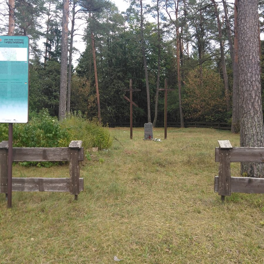 File:Cmentarz wojenny Płociczno-Osiedle w 2024 r.jpg
Photo: Śryż via Wikimedia Commons, CC BY-SA 4.0
Key Facts about Płociczno-Osiedle
- Along county road DP 1149B, there is a 523 m cycling route with a gravel and crushed-stone surface.
- A 1.1 km cycling route with concrete paving runs along a residential street; one section is separated by a grass verge.
- An approximately 820 m long and 2 m wide footpath with concrete paving and drainage was built along municipal road 102030B. The municipality accepted the completed path on October 1, 2024.
- The village has a First World War cemetery dating from 1915 to 1918.
How do the cycling routes differ?
The two cycling route sections can be distinguished mainly by their length, surface, and location. The section along county road DP 1149B is 523 m long and has a gravel and crushed-stone surface. The second runs along a residential street and is 1.1 km long; it is paved with concrete blocks. One section of this cycling route is also separated by a grass verge.
The section on the residential street is a little more than twice as long as the one along the county road. The surfaces also differ: gravel and crushed stone on one route, concrete paving on the other. This gives you a concrete comparison of two sections that differ in length, surface type, and road setting when planning your trip.
What information is available about the footpath?
The footpath runs along municipal road 102030B and is distinct from the two cycling route sections. It was built with concrete paving and drainage, is approximately 820 m long, and is 2 m wide. The municipality accepted the completed path on October 1, 2024.
At around 820 m, its length falls between those of the two cycling route sections: longer than 523 m and shorter than 1.1 km. This means the three routes can be compared not only by their measurements, but also by their respective types. When planning, you can consider these differences separately: two cycling route sections with their own surface characteristics, and a footpath with stated dimensions and drainage.
What is the cemetery's historical significance?
The cemetery in Płociczno-Osiedle is dated to 1915–1918, the years of the First World War. This adds a clear cultural and historical connection alongside the information about the routes. Unlike the routes, the focus here is not on length or surface, but on the site's historical period.
If you compare destinations by historical themes as well, you can consider this dating as a separate aspect. It complements the concrete information about cycling and walking routes, adding a different perspective to the practical overview of Płociczno-Osiedle.
Discover more destinations: Smolniki, Szypliszki, Gawrych-Ruda, Bród Stary, Przerośl, Przełomka, Krzywe and Stary Folwark.
FAQ
How do the two cycling route sections differ?
The section along county road DP 1149B is 523 m long and has a gravel and crushed-stone surface. The section on a residential street is 1.1 km long, is paved with concrete blocks, and has a section separated by a grass verge.
What are the footpath's dimensions and features?
The footpath along municipal road 102030B is approximately 820 m long and 2 m wide. It was built with concrete paving and drainage; the municipality accepted it on October 1, 2024.
What years is the cemetery dated to?
The First World War cemetery is dated to the years 1915 to 1918.
For the broader travel overview: Suwalski.

