
Discover Łączyno
Accommodation in Łączyno
Łączyno combines a distinctive village layout with walking and cycling routes.
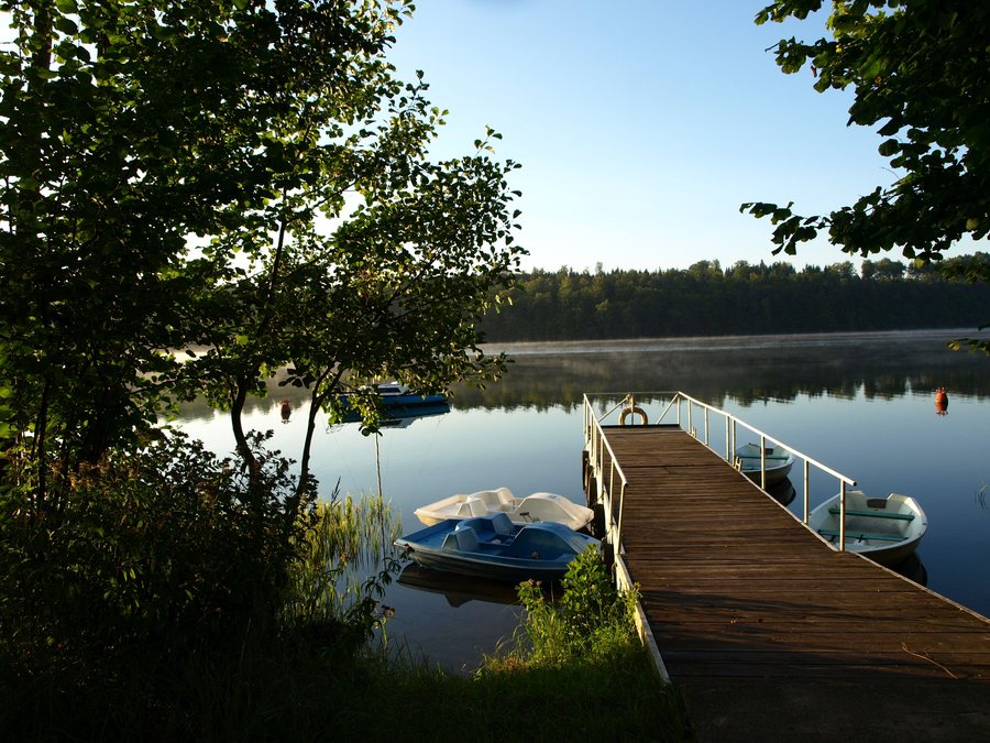 File:Jezioro Raduńskie Dolne. Łączyno Przystań wodna UG.jpg
Photo: Gingko~plwiki via Wikimedia Commons, CC BY-SA 3.0 pl
File:Jezioro Raduńskie Dolne. Łączyno Przystań wodna UG.jpg
Photo: Gingko~plwiki via Wikimedia Commons, CC BY-SA 3.0 pl
Łączyno at a glance
The entire village lies within Kaszubski Park Krajobrazowy. Łączyno is a roadside village with buildings on both sides; a manor complex is separated from the village by a valley. The black Wzgórza Szymbarskie hiking trail passes through the village. A cycling route also connects here with the main cycling route.
Which routes can you plan to take in Łączyno?
For a hike, the black Wzgórza Szymbarskie hiking trail passes through Łączyno. You can take this route into account as a specific point of reference when planning your trip. The Kamienica Królewska–Jezioro Potęgowskie–Mirachowo–Miechucino–Wygoda Łączyńska–Łączyno cycling route is 30.8 kilometres long. It runs entirely within Kaszubski Park Krajobrazowy and connects with the main cycling route in Łączyno.
For walking or cycling, there are two distinct ways to plan a route: the hiking trail is described by its course through Łączyno, while the cycling route has a stated length, sequence of places, and connection to the main cycling route. These details can help you decide how the village fits into your own travel plans. Plan your time around the stages that suit you rather than inferring a duration from the route’s length.
What shapes the village’s layout?
Łączyno is laid out as a roadside village, with buildings on both sides of the road. The manor complex is set apart from the village, beyond a valley. This spatial layout gives the village a distinctive character, beyond what a description of its hiking and cycling routes alone can convey. If you are interested in settlement patterns, you can consider both aspects when exploring the destination, without equating the manor complex with the village centre.
How does the landscape park setting affect your plans?
The entire village of Łączyno lies within Kaszubski Park Krajobrazowy, and the cycling route described also runs entirely within the landscape park. The park setting therefore applies both to the village and to this cycling route. This provides helpful context for planning your trip to the destination and along the route. Together with the hiking trail and the village’s described layout, it offers different points of interest, depending on whether you are interested in routes or in the village’s structure.
How do you choose Łączyno as a place to stay?
Start by deciding what your trip will focus on: do you want to include a hiking trail that passes through the village or the 30.8-kilometre cycling route in your plans? Or are you mainly interested in exploring the distinctive village layout? These questions relate to different documented features of Łączyno and can help narrow your search for hotels at the destination without assuming a particular location or set of amenities.
If you would like to include other destinations in your search, discover Kamienica Szlachecka too.
Discover more destinations: Kaliska, Golubie, Lapalice, Sianowska Huta, Kamienica Krolewska, Chmielno, Ręboszewo.
FAQ
Which hiking trail passes through Łączyno?
The black Wzgórza Szymbarskie hiking trail passes through Łączyno.
How long is the cycling route through Łączyno?
The cycling route from Kamienica Królewska through Jezioro Potęgowskie, Mirachowo, Miechucino, and Wygoda Łączyńska to Łączyno is 30.8 kilometres long. In Łączyno, it connects with the main cycling route.
What is Łączyno’s layout like?
Łączyno is a roadside village with buildings on both sides. A manor complex is separated from the village by a valley.
For the broader travel overview: Karthaus.

