
Zamostne: Landscape, Cultural Heritage and Kayaking
Accommodation in Zamostne
Zamostne combines open countryside with historic village features and a kayaking route on the Reda. When planning your trip, it is worth distinguishing between the different highlights: the landscape can be seen from Wejherowska Street and along the lime tree avenue; the buildings tell of past and present uses; the paddling route runs from Zamostne to Reda. This way, you can decide which of these themes will be the main draw for your stay.
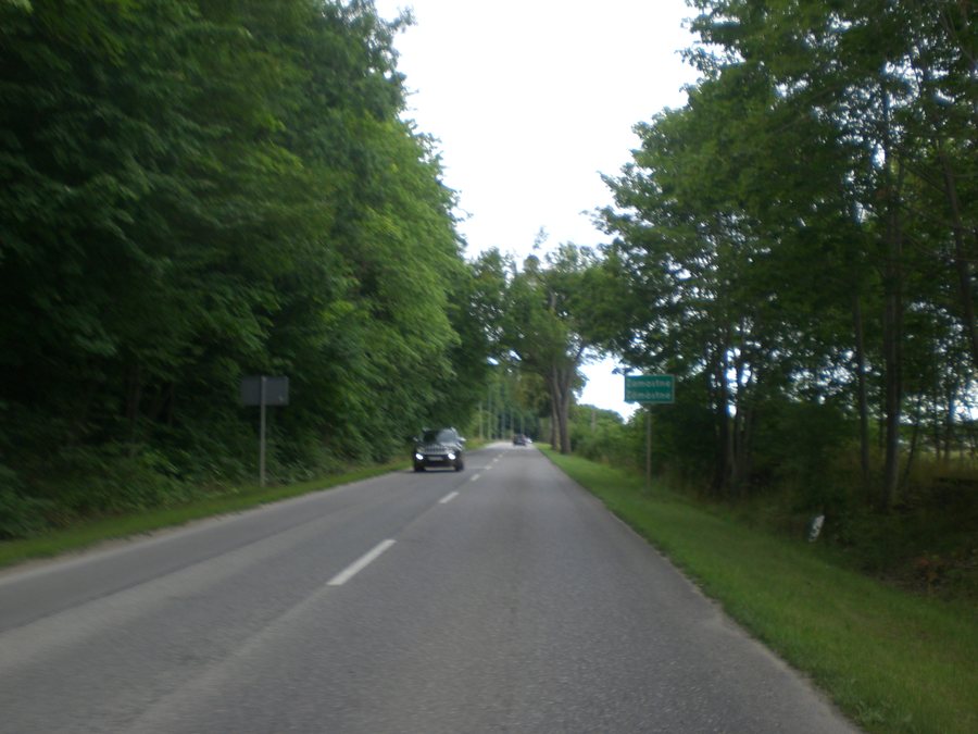
Zamostne at a glance
- From Wejherowska Street, the view takes in the open countryside and the village of Kniewo.
- A lime tree avenue runs between Zamostne and Kniewo.
- The village’s features include a manor house forming part of a manor farm complex and two archaeological hillforts, each with its own landform.
- The kayaking section from Zamostne to Reda is 22 kilometres long and is rated as moderately difficult and strenuous overall.
What historical traces shape Zamostne?
The village’s historic features include buildings with different uses. An Evangelical cemetery is located on Wejherowska Street. A manor house, which forms part of a manor farm complex, is also situated there. A dairy and a chimney are on the same street, on plot 128. These two details refer to different features of the same property; they should not be combined into a claim about the dairy’s current use.
Former businesses are also part of the village’s character. A butcher’s shop once operated at 34 Wejherowska Street; the building is now a house. A post office once stood on plot 129 on the street, and that building is also now a house. The distinction between former and current uses gives the two houses their own place in time. Together with the manor house, the cemetery and the dairy, they create a varied picture of the village’s historic features, without implying that all the buildings belong to the same use or period.
Two archaeological hillforts are also part of Zamostne. Their individual landforms provide a different point of reference from the buildings on Wejherowska Street: here, the focus is on the shape of the land, while there it is on the different types of buildings and their uses. Those interested in local history will find several kinds of features here, which can be considered separately and also viewed as different aspects of the same place.
What is the landscape around Zamostne like?
From Wejherowska Street, the view takes in the open countryside and the village of Kniewo. The lime tree avenue between Zamostne and Kniewo is a different landscape feature: rather than a view from a specific stretch of road, it is an avenue connecting the two places.
The two features offer different perspectives for understanding the landscape: the open view brings Kniewo into sight, while the lime tree avenue runs between the villages as a linear landscape feature. Along with the archaeological hillforts, Zamostne thus offers both a connection to the surrounding landscape and individual, clearly defined local features. If you are including nature and cultural experiences in your travel plans, these distinctions can help you prioritise your interests.
What should you know about the kayaking route?
The kayaking section from Zamostne to Reda is 22 kilometres long. The route as a whole is rated as moderately difficult and strenuous. At the same time, paddling from the starting point in Zamostne is described as easy and enjoyable. These details refer to different aspects of the trip: an easy and enjoyable start does not change the overall assessment of the 22 kilometres.
The riverbed is also not uniform throughout: it is narrower in some places and wider in others. Weirs, bridges and footbridges mean that you will need to carry your kayak. River conditions can vary, so check them before setting off. Both the route length and its overall rating, as well as the sections where you need to carry your kayak, are important when planning your trip. When assessing the effort involved in the whole route, do not rely solely on the pleasant conditions at the starting point.
What cultural themes does the wider destination of Neustadt offer?
Within the wider destination of Neustadt, Wejherowo offers a distinct cultural focus. The Muzeum Piśmiennictwa i Muzyki Kaszubsko-Pomorskiej was founded in 1968 and is a centre of Kashubian culture, particularly its language, as well as a treasure trove of regional artefacts. The Książnica prof. Gerarda Labudy presents a permanent exhibition on the history of the Kashubians. Models of the city and Kalwaria Wejherowska are on display in the historic town hall.
The history of Kalwaria Wejherowska offers its own connection to the past: it was the fourth Calvary complex to be established during the Polish–Lithuanian Commonwealth. After Bishop Mikołaj Albert Gniewosz of Aleksandrów approved its construction on 9 June 1649, work began on its chapels. Another attraction in Wejherowo is the Szlak Nut Kaszubskich. Fifteen pedestals bearing fragments of a traditional counting rhyme form a route through different parts of the city, passing its most important sights. These themes complement Zamostne’s local features with perspectives on the Kashubian language, regional culture and urban history.
Discover more destinations: Gościcino, Kłosówko, Barłomino, Gniewino, Dobrzewino, Donimierz, Lubiatowo, Strzebielino Morskie.
FAQ
How long is the kayaking section from Zamostne to Reda?
The section is 22 kilometres long. It is rated as moderately difficult and strenuous overall; obstacles such as weirs, bridges and footbridges mean that you will need to carry your kayak.
What landscape features connect Zamostne and Kniewo?
From Wejherowska Street in Zamostne, you can see the open countryside and Kniewo. A lime tree avenue runs between the two villages.
What former uses are known on Wejherowska Street?
A butcher’s shop once operated at 34 Wejherowska Street; the building is now a house. A post office once stood on plot 129; that building is also now a house.
For the wider travel overview: Neustadt.

