
Discover Kopaniarze: Nature, Trails and Village History
Accommodation in Kopaniarze
Kopaniarze is located in Welski Landscape Park. A marked blue circular trail passes through the village; several farmsteads dating from the interwar period have also been preserved. When planning your trip, you can therefore consider the landscape, the trail route and the rural architectural heritage as distinct aspects of the destination.
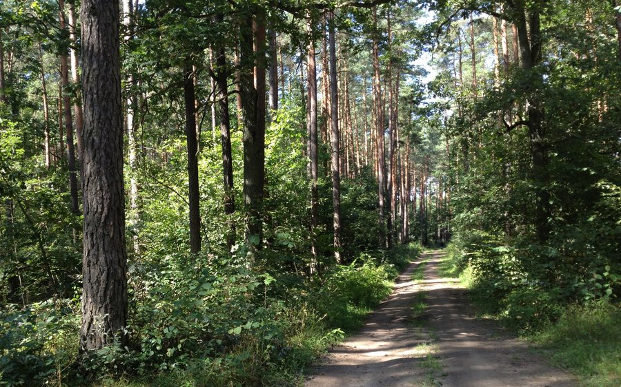 Bike trail between Grabacz and Kopaniarze - panoramio (1)
Photo: PinkFloydian via Wikimedia Commons, CC BY-SA 3.0
Kopaniarze at a glance
- The Szlak Błękitny is a 25.5-kilometre blue-marked circular trail that passes through Kopaniarze.
- The village is located in Welski Landscape Park.
- The Torfowisko Kopaniarze peatland covers about 100 hectares.
- Several farmsteads dating from the interwar period have been preserved in the village.
What kind of landscape defines the surrounding area?
Its location in Welski Landscape Park provides the broader landscape context. Numerous peat bogs are also noted near Kopaniarze. The Torfowisko Kopaniarze peatland covers about 100 hectares and contains the best-preserved fen complex in the park. The park setting thus describes the village’s natural surroundings, while the information about the peat bogs identifies specific landscape features in greater detail.
A Scots pine with a distinctive collar-shaped form, protected as a natural monument, stands at a crossroads near the road to Kopaniarze. It is located in the vicinity of the village. Together with the peat bogs, this individual natural landmark adds to the picture of a region whose landscape can be described not only by reference to the park, but also through specific natural features.
Which route descriptions can help you find your way?
The marked blue Szlak Błękitny is a 25.5-kilometre circular trail that passes through Kopaniarze. Its length and circular layout offer two distinct points of reference: the distance covered and the shape of the route. At the Marian shrine in Kopaniarze, a municipal cycling route turns right at a crossroads onto an unpaved road. It leads southwest towards Jezioro Tarczyńskie and Wery. Check the signs and trail conditions on site before following this route instruction.
Another crossroads near Kopaniarze is described as having a road that runs straight towards the village. When finding your way, pay attention to the reference point in each description: the sign at the Marian shrine starts within the village, while the other crossroads is nearby. This helps distinguish a direction within Kopaniarze from a road leading to the village, without treating them as the same stretch of route.
What do the preserved farmsteads tell us?
Several farmsteads dating from the interwar period have been preserved in Kopaniarze. The term refers to the period between the First and Second World Wars, placing these farm complexes in a specific historical era. This gives the village description an architectural dimension in addition to its natural and route-related aspects: while the circular trail presents Kopaniarze as part of a route, the farmsteads point to the village’s historic character. These are different perspectives on the same place to weigh according to your interests, not interchangeable attractions.
Discover more destinations: Uzdowo, Murawki, Lidzbark, Grądy, Działdowo, Naguszewo, Rybno, Nowa Wies.
FAQ
How long is the Szlak Błękitny?
The blue-marked circular trail is 25.5 kilometres long and passes through Kopaniarze.
What makes the Torfowisko Kopaniarze special?
The peatland covers about 100 hectares and contains the best-preserved fen complex in Welski Landscape Park.
What does the cycling route instruction at the Marian shrine say?
At the shrine, the municipal cycling route turns right at a crossroads onto an unpaved road heading southwest towards Jezioro Tarczyńskie and Wery. You should check the signs and trail conditions on site.
For the broader travel overview: Soldau.

