
Kruklanki: Nature Trail, Way of St. James and Historic Sites
Accommodation in Kruklanki
Kruklanki offers several ways to shape a stay: a nature and educational trail, sections of a Way of St. James, and the Sapina as part of a kayaking route. There are also historic sites in the village and its surroundings. Which of these themes defines your stay depends on whether you would rather explore a circular route, follow a long-distance hiking trail, or get to know the area from the water.
Kruklanki at a glance
- The nature and educational walking trail is an approximately 7 km, two-stage circular route. It starts and ends in the center of Kruklanki.
- Twelve stops provide information about the local fauna, flora, history and culture.
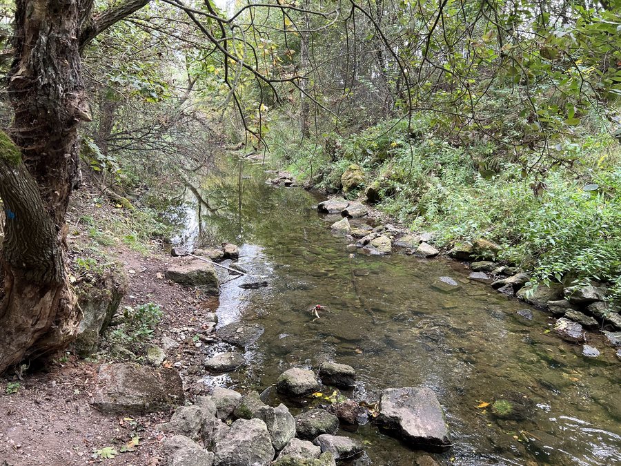
- The Sapina is part of an approximately 26 km kayaking route between Lake Kruklin to the south and Lake Święcajty to the north.
- Historic sites include the Church of the Assumption of Mary and the ruins of a railway bridge over the Sapina.
What does the walking trail in Kruklanki offer?
The nature and educational walking trail combines a circular route with twelve themed stops. Since it starts and ends in the center, you can treat the trail as a destination in its own right without having to plan a destination outside Kruklanki. Its approximate length of 7 km and division into two stages give you concrete points to consider when planning your day; they do not, however, indicate walking time or terrain.
The information boards cover fauna and flora, as well as the history and culture of the area. The trail therefore offers several thematic perspectives rather than focusing on just one topic. A viewpoint overlooking Lake Patelnia is also part of the route. If you want to combine nature themes with a view of the lake on a walk, you can enjoy both along this circular trail.
Which routes pass through Kruklanki?
Kruklanki is also part of a Way of St. James. The route runs between Lakes Gołdopiwo and Brożówka and reaches Kruklanki after 1.5 km. From here, it continues via Kożuchy Wielkie to Giżycko. The Olecko–Kruklanki–Giżycko section is also part of a Way of St. James. These place names help you understand the route without specifying a particular stage length for the entire route.
The walking trail and the Way of St. James offer different ways to explore the area on foot: one is an approximately 7 km loop that starts and ends in the center; the other is part of a route connecting Kruklanki with other places. If you are looking for a circular route, you can follow the walking trail. If you are planning a longer hike, you can use the sections and place names mentioned here to plan your own route.
What can you discover in Kruklanki and the surrounding area?
A notable historic site in the surrounding area is the ruin of a five-span reinforced-concrete railway bridge over the Sapina. Built in 1908, it is considered the best-known site in the Kruklanki area. It lies a few hundred meters south of Lake Patelnia.
The Church of the Assumption of Mary is also in the village. It was built in 1574 and is now a parish church. Buildings belonging to the former railway station have also been preserved. Together, these sites reflect different aspects of Kruklanki’s history; they can be considered a cultural complement to the walking and water routes, although this does not mean they form a single route.
What visitor information is available on site?
Kruklanki has a tourist information office and rental outlets for tourist equipment. These are two different points of contact when planning a stay: one is a tourist information office, while the rental outlets offer equipment for tourist use.
If you would like to compare other destinations, you can also find information about Wydminy, Jeziorowskie, Wilkasy, Brożówka, Prażmowo, Fuleda, Giżycko and Jagodne Wielkie.
FAQ
How long is the walking trail in Kruklanki?
The nature and educational circular trail is approximately 7 km long, has two stages, and starts and ends in the center.
What can you learn along the walking trail?
At twelve stops, information boards cover the local fauna, flora, history and culture. The trail also leads to a viewpoint overlooking Lake Patelnia.
Which historic sites are there in Kruklanki?
In the village are the Church of the Assumption of Mary, built in 1574 and now used as a parish church, and preserved buildings from the former railway station. Nearby are the ruins of the railway bridge over the Sapina, built in 1908.
How long is the kayaking route on the Sapina?
The Sapina is part of an approximately 26 km kayaking route between Lake Kruklin to the south and Lake Święcajty to the north.
For the broader travel overview: Giżycko.

