
Kuligi: Local history and kayaking route on the nearby Wel
Accommodation in Kuligi
Kuligi brings together a settlement history that also includes Trzcin, the nearby Wel, and a kayaking route. The former Baptist prayer house is considered a unique monument; an Evangelical cemetery in Kuligi dates from the early 20th century. For trip planning, this means historical traces of settlement and religious life alongside a kayaking connection in the surrounding area. When comparing hotels, you can first decide which focus matters more for your own itinerary.
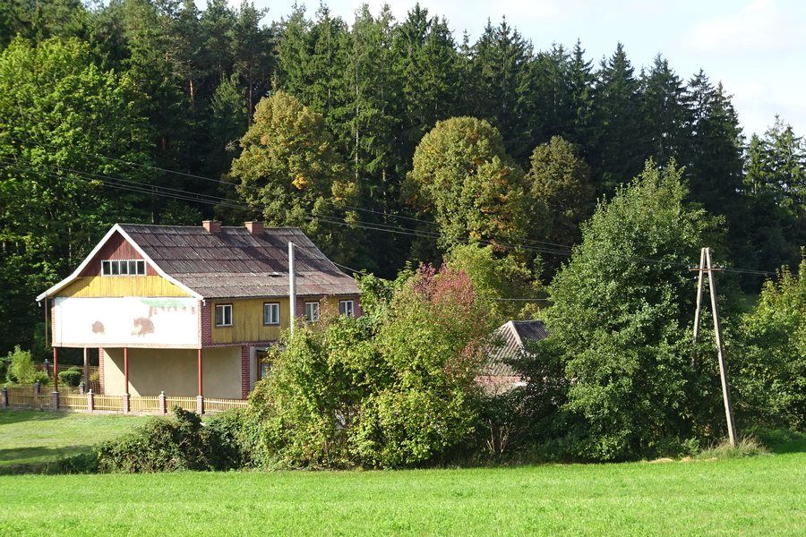
Kuligi at a glance
- The former Baptist prayer house is considered a unique monument.
- An Evangelical cemetery in Kuligi dates from the early 20th century.
- The dispersed settlement pattern of Kuligi and Trzcin developed in connection with the settlement of people from the interior of Germany.
- The Wel flows near Kuligi. At kilometre 11.6, the kayaking route passes under the new road bridge on Voivodeship Road 538.
- At high water, a section of the kayaking route is considered dangerous when the water level in Lidzbark is above 100 cm and the level in Kuligi is above 120 cm.
What story do Kuligi’s historic traces tell?
The dispersed settlement pattern of Kuligi and Trzcin developed in connection with the settlement of people from the interior of Germany. Prussian authorities divided land among these settlers and sold it to them. Disused Evangelical cemeteries are considered remnants of these communities. Land distribution, settlement, and the spatial form of the villages are thus part of a shared historical context. Anyone interested in local history can also understand Kuligi in relation to Trzcin, rather than considering individual traces in isolation.
The former Baptist prayer house is considered a unique monument. An Evangelical cemetery in Kuligi dates from the early 20th century. The two traces highlight different aspects: the prayer house is notable for its particular significance as a monument, while the cemetery is notable for its date. Together, they offer different clues to the history of the place, though they cannot be interpreted in the same way.
What does the kayaking route on the Wel offer?
The Wel flows near Kuligi. At kilometre 11.6, the kayaking route passes under the new road bridge on Voivodeship Road 538. This kilometre marker provides a specific reference point along the route. For planning, the route marker and water levels answer different questions: the bridge marks a point on the route, while the water levels indicate a condition to consider when assessing hazards.
At high water, a section of the kayaking route is considered dangerous when the water level in Lidzbark is above 100 cm and the level in Kuligi is above 120 cm. The warning applies at these water levels. If you are considering a trip, check current river conditions beforehand.
How do the travel interests differ?
The local history connects Kuligi with Trzcin and the traces of settlement history found there; the kayaking route offers a different way to explore the area via the nearby Wel. Next, check the location of each accommodation option in relation to your own itinerary. This keeps your choice focused on your plans, without treating local history and a kayaking route as the same kind of travel experience.
Discover more destinations: Ostaszewo, Nowe Miasto Lubawskie, Grodziczno, Kurzętnik
FAQ
What is the historical connection between Kuligi and Trzcin?
The dispersed settlement pattern of both places developed in connection with settlers from the interior of Germany. Prussian authorities divided land among them and sold it to them; disused Evangelical cemeteries are considered remnants of their communities.
What historic traces can be found in Kuligi?
The former Baptist prayer house is considered a unique monument. Kuligi also has an Evangelical cemetery dating from the early 20th century.
Which water levels are relevant at high water?
A section of the kayaking route is considered dangerous when the water level in Lidzbark is above 100 cm and the level in Kuligi is above 120 cm. Check current river conditions before setting out.
For the broader travel overview: Nowomiejski.

