
Kaplityny – Cycling Routes, Hiking Trails and Angel Square
Accommodation in Kaplityny
Kaplityny brings together several cycling and hiking routes with a distinctive theme: the village is home to an Angel Square and an Angel Playground. For planning your trip, the routes of varying lengths provide concrete points of comparison for cycling, hiking and the village’s theme.
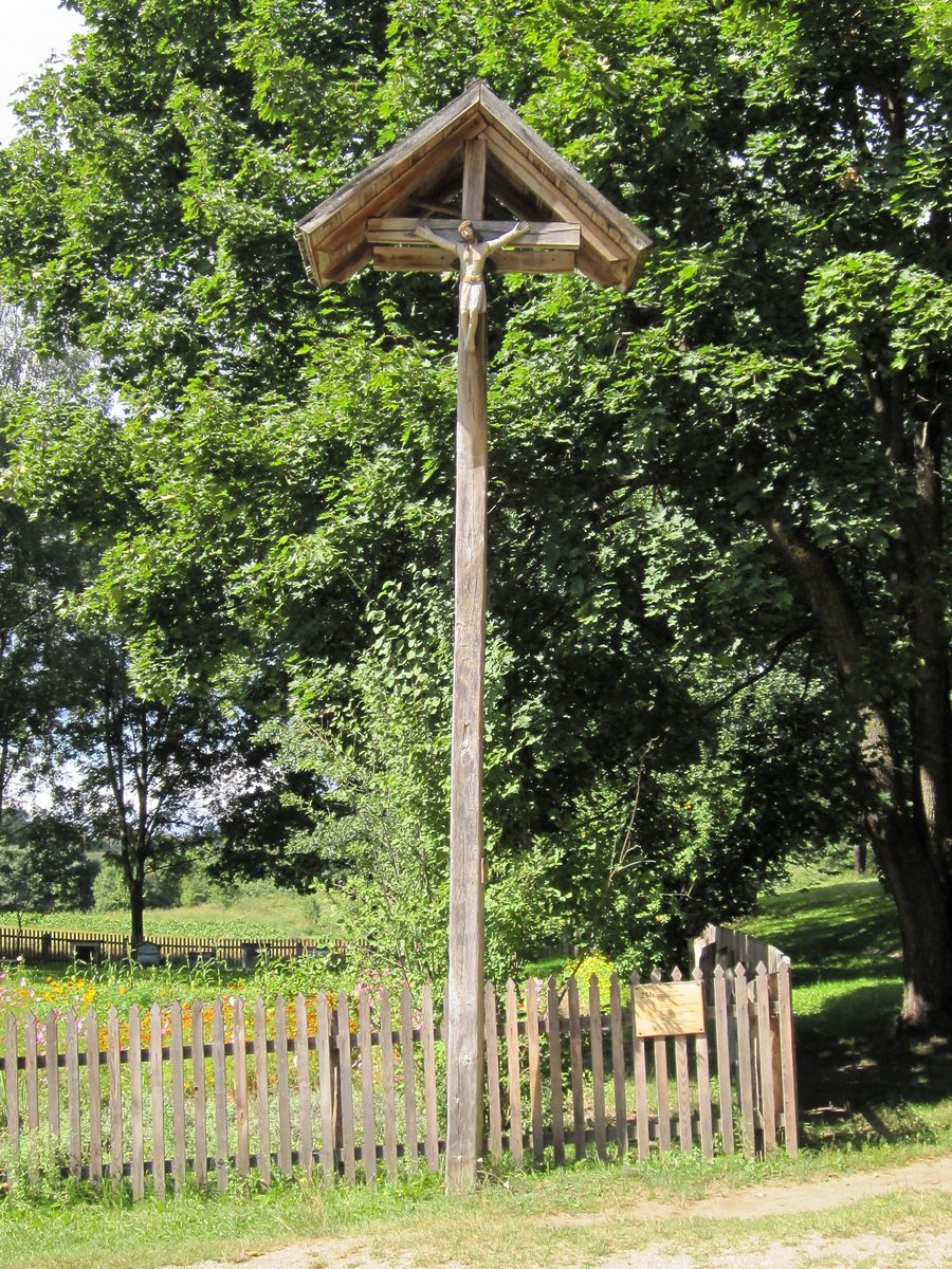 File:MBL Olsztynek - 25b. Dzwonniczka słupowa z Kaplityn.jpg
Photo: GringoPL via Wikimedia Commons, CC BY-SA 3.0
File:MBL Olsztynek - 25b. Dzwonniczka słupowa z Kaplityn.jpg
Photo: GringoPL via Wikimedia Commons, CC BY-SA 3.0
Kaplityny at a glance
- The red cycling route is 23.4 km long and passes through Kaplityny.
- A 27 km green cycling route also passes through the village.
- The blue hiking trail is 5.7 km long, and the black one is 10.0 km.
- Kaplityny is a themed village with an Angel Square and an Angel Playground.
Which cycling routes pass through Kaplityny?
The red cycling route follows a 23.4 km circuit from Barczewo via Rejczuchy, Sapuny, Bogdany, Kaplityny, Łęgajny, Biedowo and Dąbrówka Mała, returning to Barczewo. More than half of the route is on asphalt. Basic skills for riding off paved roads are needed for the remaining sections. This is an important distinction to consider when choosing the route for your cycling trip.
The green cycling route also passes through Kaplityny. Its 27 km circuit runs from Barczewo via Mokiny, Bogdany, Kaplityny, Łęgajny and Barczewko, returning to Barczewo. The two cycling routes therefore differ in both length and course. Their stated distances can help you choose a planned ride based on the route length.
What can you expect on the hiking trails?
The blue hiking trail covers 5.7 km from Wójtowo Osiedle Leśne via Kaplityny and back to the starting point. Along the way, it crosses the Kanał Elżbiety; the route then reaches a signal-controlled road crossing in Kaplityny. These waypoints make the route more concrete than a distance alone and help you assess it when planning your day.
The black hiking trail is longer, at 10.0 km. It runs from Wójtowo via Kaplityny and Sapunki to Bogdany, then back to Wójtowo. For a short stretch, it meets the blue trail; together, the two cross a bridge over the Kanał Elżbiety. If you are choosing between hikes by distance, you have a shorter and a longer marked route to choose from. The shared section by the canal is also a concrete landmark along the way.
How do the landscape and village theme shape a visit?
The red cycling route through Kaplityny passes through Warmia’s hilly landscape, with lakes, streams, canals and wetlands. These landscape features give the route a character beyond simply connecting place names. If you are particularly interested in a cycling trip, details about the surface and scenery, as well as the route length, may help you make your choice.
Kaplityny is also a themed village. Its theme includes a village Angel Square and an Angel Playground. The Wioska Sosnowych Aniołów, created by Krystyna Szter, includes the Anielski Plac zabaw dla dzieci. The Polish names refer to the specific village theme and playground; together with the routes, they offer different points of interest for a visit. If you would like to view another place page alongside Kaplityny, you can also find Kromerowo here.
FAQ
How long are the cycling routes through Kaplityny?
The red cycling route is 23.4 km long, and the green cycling route is 27 km long. Both pass through Kaplityny, but follow different routes.
Which hiking trails pass through Kaplityny?
The blue hiking trail is 5.7 km long and runs from Wójtowo Osiedle Leśne via Kaplityny and back. The black hiking trail covers 10.0 km and runs from Wójtowo via Kaplityny, Sapunki and Bogdany, then back to Wójtowo.
What should I know about the red cycling route?
More than half of the route is on asphalt. Basic skills for riding off paved roads are needed for the remaining sections.
What is included in Kaplityny’s theme?
It includes a village Angel Square and an Angel Playground. The Wioska Sosnowych Aniołów includes the Anielski Plac zabaw dla dzieci.
For the broader travel overview: Biedowo.

