
Discover Cerkiewnik
Accommodation in Cerkiewnik
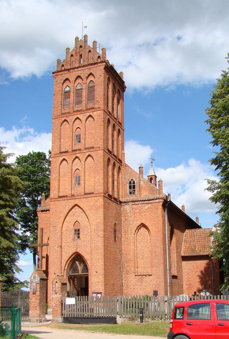
Cerkiewnik offers two starting points for planning your trip: the neo-Gothic Church of St. Catherine and St. Anne, with its links to the medieval architecture of Warmia, and cycling and hiking routes. Depending on the route, the village is either the starting point and destination or part of a longer itinerary.
Cerkiewnik at a glance
- The church is an east-facing hall church built of red brick, with a rectangular floor plan.
- The two cycling routes described are 17 and 20 km long.
- Hiking routes through Cerkiewnik: a 42 km route to Smolajny and the 87 km Kopernikus Hiking Trail to Mingajny.
What makes the church architecturally interesting?
The church stands on a rise in the center of Cerkiewnik. Red brick, a rectangular floor plan, and its hall-church design give a clear picture of the building. A hall church is a church with a single main space; “east-facing” describes its orientation toward the east. Stylistically, the church is neo-Gothic and draws on forms from the medieval architecture of Warmia. This combination of neo-Gothic design and regional architectural references offers a tangible point of interest for travelers interested in architectural styles.
How do the cycling routes differ?
The cycling routes differ in both length and starting and ending points. The 17 km loop begins and ends in Cerkiewnik, passing through Barkweda, Bukwałd, and Różynka. The 20 km route starts in Dobre Miasto, runs via Głotowo, Swobodna, Lake Limajno, and the Chmury Forest District to Cerkiewnik, then returns to Dobre Miasto via Swobodna and Knopin.
The shorter route is a loop from Cerkiewnik, while the longer one includes the village on a round trip from Dobre Miasto. When planning, you can consider which of these starting and return points better fits the rest of your itinerary.
Which hiking routes pass through Cerkiewnik?
The 42 km hiking route runs from Olsztyn via Brąswałd, the bridge over the artificial channel of the Łyna, Barkweda, and Bukwałd to Cerkiewnik. From there, it continues via Głotowo and Dobre Miasto to Smolajny.
The 87 km Kopernikus Hiking Trail also runs from Olsztyn via Cerkiewnik, then through Dobre Miasto, Smolajny, and Lidzbark Warmiński to Mingajny. Both routes include Cerkiewnik, but differ in length and endpoint: one ends in Smolajny, while the Kopernikus Hiking Trail ends in Mingajny.
Discover more destinations: Łomy, Purda, Mierki, Rybaki, Lipowo Kurkowskie, Kręsk, Ramsowo and Allenstein.
FAQ
Which cycling route starts and ends in Cerkiewnik?
The 17 km route runs from Cerkiewnik via Barkweda, Bukwałd, and Różynka, then back to the village.
Which hiking routes pass through Cerkiewnik?
The 42 km route runs from Olsztyn to Smolajny; the 87 km Kopernikus Hiking Trail runs from Olsztyn to Mingajny. Both pass through Cerkiewnik.
What is the Church of St. Catherine and St. Anne like?
It is a neo-Gothic, east-facing hall church built of red brick, with a rectangular floor plan, drawing on forms from the medieval architecture of Warmia.
For the broader travel overview: Allenstein.

