
Wygryny between Two Lakes
Accommodation in Wygryny
Wygryny lies between the eastern arm of Lake Bełdany and the narrow, elongated Lake Wygryny. When choosing where to stay, you can also consider a kayak route to Ruciane-Nida, the Szlak bociani, and the village’s history.
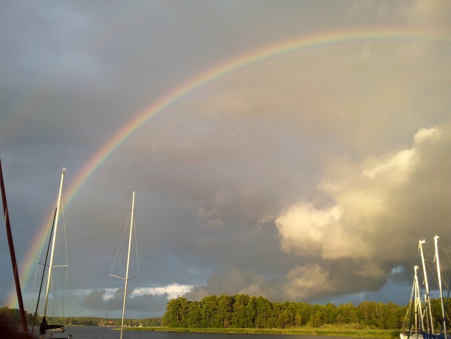 File:Gmina Ruciane-Nida, Poland - panoramio (5).jpg
Photo: Mariusz Cholewski (S… via Wikimedia Commons, CC BY 3.0
Wygryny at a glance
- Location: Masurian Plain, in the southeast of the Warmian-Masurian Voivodeship.
- Lakes: between the eastern arm of Lake Bełdany and Lake Wygryny (Wygryńskie).
- Ruciane-Nida: 4.5 km south of Wygryny.
- Routes: a 7 km kayak route to Ruciane-Nida and the Szlak bociani hiking and cycling trail.
- History: Wygryny is an old village whose history dates back to the 18th century.
Where is Wygryny in relation to the lakes and Ruciane-Nida?
Wygryny is located on the Masurian Plain in the southeast of the Warmian-Masurian Voivodeship. The village lies between the eastern arm of Lake Bełdany and the narrow, elongated Lake Wygryny, also called Wygryńskie, providing two specific geographic reference points. Together with its location in the region, these details make it clear where Wygryny is situated within Masuria.
Ruciane-Nida lies 4.5 km south of Wygryny. This location information and the 7 km kayak route to Ruciane-Nida describe different things: one shows the distance between the two places, while the other refers to the course of a route on the water. Keep this distinction in mind when using the information to plan your trip.
Which routes start in Wygryny?
The Szlak bociani starts in Wygryny and runs via Śwignajno Wielkie and Śwignajno Małe to Ukta. The hiking and cycling route passes through the “Jeziora Mazurskie” UNESCO Biosphere Reserve. The starting point, intermediate places, and destination provide a clear sequence for following the route; its passage through the biosphere reserve is another feature to note.
Another option is the kayak route from Wygryny to Ruciane-Nida, which covers 7 km. The two routes can therefore be distinguished by how you travel and where they go: the Szlak bociani is designated for hiking and cycling and ends in Ukta, while the kayak route goes to Ruciane-Nida. Check local operating conditions before making concrete plans for your kayak trip.
What is Wygryny’s historical and regional context?
Wygryny is an old village whose history dates back to the 18th century. This historical context adds a sense of the place’s past to the geographic information and named routes.
The harbor is also highlighted in the regional context: the local development strategy for 2023–2027 counts the harbor in Wygryny among the area’s largest harbors. The village’s history and its harbor are thus distinct aspects alongside its location between the lakes and its routes.
What should you consider when looking for accommodation?
When comparing accommodation in the area, check whether Wygryny or Ruciane-Nida is listed as the location. Wygryny lies 4.5 km north of Ruciane-Nida. For a specific listing, check the address and compare it with the place you want to use as a base for your planned trips.
Discover more destinations: Biala Piska, Ublik, Jaśkowo, Niedzwiedzi Rog, Klusy, Kaliszki, Wejsuny, Imionek.
FAQ
How long is the kayak route from Wygryny?
The route to Ruciane-Nida covers 7 km. Check local operating conditions before making concrete plans.
Which places are on the Szlak bociani?
The hiking and cycling route starts in Wygryny, runs via Śwignajno Wielkie and Śwignajno Małe, and ends in Ukta. It passes through the “Jeziora Mazurskie” UNESCO Biosphere Reserve.
How far back does Wygryny’s history go?
Wygryny is an old village; its history dates back to the 18th century.
For the broader travel overview: Piski.

