
Discover Drawno
Accommodation in Drawno
Drawno offers several distinct points of interest to help you plan your trip: artesian wells, the town lake Adamowo, hiking trails and canoe routes. Historic sites and buildings also shape the character of this destination. You can choose which themes to focus on by exploring the different routes and attractions.
Quick facts about Drawno
- The artesian wells are one of Drawno’s attractions; they date from the 17th and 19th centuries.
- Drawno’s town lake is also called Adamowo.
- The yellow P10 hiking trail forms an 8.2 km loop around the lake.
- The canoe route from Drawno to the “Barnimie” bivouac site is 8.7 km long and rated difficult.
What can you discover in Drawno?
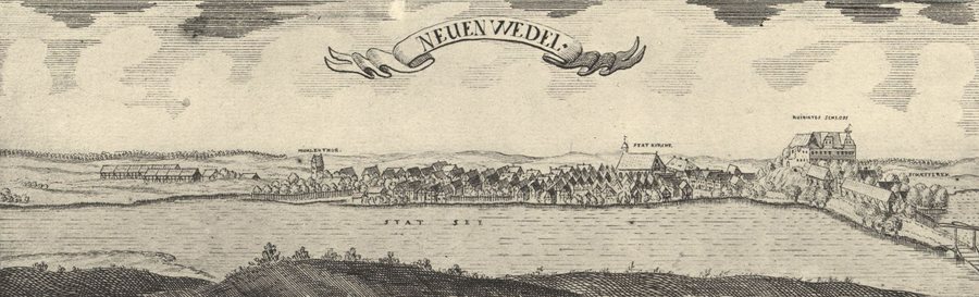
The artesian wells give a trip to Drawno a special historical dimension: they date back to the 17th and 19th centuries. You can connect this theme with other traces of the town’s history. Around the 10th century, the original inhabitants built a fortified settlement on Zamkowy Hill. The ruins of Wedel Castle are also among Drawno’s historic remains.
The buildings of the former “Etruria” terracotta factory also tell a story of another chapter in the town’s past. Located on Choszczeńska Street, they are remnants of the former factory, where garden gnomes were mass-produced. Drawno’s historic buildings also include the Church of Our Lady of Perpetual Help. These sites represent different facets of the town: a fortified settlement, a castle, a former industrial plant and a church. If you are interested in history, you will find several clearly distinct themes in the townscape.
Which hiking trails can you choose?
For a walk by the water, consider the yellow P10 hiking trail: it forms an 8.2 km loop around the town lake, also known as Adamowo. The distance makes it easy to compare this circular route with a different type of trail. Check local trail conditions before setting out.
Another route description starts at the hiking trail junction by Drawno’s market square. From there, the trail follows ul. Pomorska towards Święciechów, together with the yellow P10 hiking trail. These two descriptions offer different points of reference for planning: the loop focuses on the lake and circular route, while the other route highlights the starting point at the market square and the direction towards Święciechów. This lets you consider in advance whether you would prefer a loop around Adamowo or a described route, without treating the two as the same trail.
What should you know before taking a canoe trip from Drawno?
The canoe section from Drawno to the “Barnimie” bivouac site is 8.7 km long and rated difficult. Take this rating into account when deciding whether to tackle the route; river conditions can vary. So check current conditions locally before setting out. The Drawieński National Park landing stage and the PTTK water station near the road bridge over the channel between Lakes Grażyna and Dubie are designated as convenient launch points for a canoe trip from Drawno.
Drawno also has places where you can rent water sports equipment. Since availability can change, check locally for the latest information before making plans. This keeps two different steps distinct: choosing one of the listed launch points and checking whether rental equipment is available for your trip. The distance and difficulty information refers to the section ending at Barnimie.
Discover more destinations: Łasko, Gostyczyn, Bonin, Skrzaty, Kiełpino, Choszczno, Dominikowo and Bierzwnik.
FAQ
How long is the hiking loop around the town lake?
The yellow P10 hiking trail forms an 8.2 km loop around the town lake, Adamowo.
What is the canoe route to Barnimie rated?
The 8.7 km canoe section from Drawno to the “Barnimie” bivouac site is rated difficult.
Which launch points are mentioned for a canoe trip from Drawno?
The Drawieński National Park landing stage and the PTTK water station near the road bridge between Lakes Grażyna and Dubie are considered convenient launch points.
For the main travel overview: Choszczeński.

