
Iara – Roman traces, monuments and landscape in the surrounding area
Accommodation in Iara
Culture and History
Iara combines Roman traces, a prehistoric settlement and historic buildings with named landscape features in the surrounding area. This provides a range of periods and specific destinations for a culturally focused exploration, without the individual remains having the same historical origin.
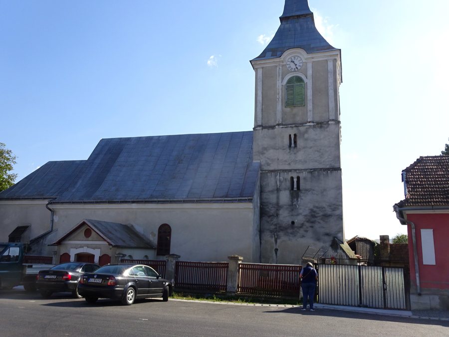 File:Biserica unitariană din Iara (1).jpg
Photo: Țetcu Mircea Rareș via Wikimedia Commons, CC BY-SA 4.0
File:Biserica unitariană din Iara (1).jpg
Photo: Țetcu Mircea Rareș via Wikimedia Commons, CC BY-SA 4.0
The Roman secondary road and the Roman settlement belong to the same period, but differ in their location: the road passes through Iara, while the settlement was discovered on the road to Băişoara. The Roman secondary road near Iara passes through the village in a northeast-southwest direction. The Roman settlement Aşezarea romană de la Iara - Groapa lui Papa was also discovered on the road to Băişoara. The prehistoric settlement of Iara belongs to the older history and is listed in Romania's List of Historical Monuments under code CJ-I-s-B-07077. The Roman transport connection and the two settlement remains thus represent different historical references. The orientation of the secondary road and the location of the Roman settlement on the road to Băişoara complement the two settlement remains with two specific locations.
The buildings in Iara include the Conacul Teleki and the Biserica Unitariană din Iara. The two buildings are associated with different dates: Conacul Teleki dates from the 19th century, while the church was rebuilt in the 18th century. Conacul Teleki is a locally significant architectural monument from the 19th century. The Unitarian church is also a locally significant architectural monument and was rebuilt in the 18th century.
Churches in the Surrounding Area
The churches in the vicinity of Iara include Biserica Pădureni, Biserica Filea de Sus, Biserica Şutu and Biserica Săcel. These four places of worship are not located in the village itself but are assigned to the area surrounding Iara. The four churches in the surrounding area are therefore spatially separate from the two architectural monuments within Iara. For culturally oriented excursions, they complement the two architectural monuments in Iara with additional religious buildings.
Landscape
Vârful Ţâcluiul is a peak in the vicinity of Iara. Dealul Ierii is located nearby and is a hill. The two landforms therefore represent different types of the nearby landscape.
The Muntele Agrişului and Dealul Melinilor are located in the wider regional surroundings. Both are mountains in the wider regional surroundings of Iara. The named landscape features differ both in their designation as a peak, hill or mountain and in the respective stated spatial reference.
Cycling Route
For cycling, the route Iara–Lungeşti–Iara is named. The route begins in Iara near the Unitarian church, thereby linking a specific starting point with a circular route.
For the broader travel overview: Iara.

.jpg)