
Merdare
Accommodation in Merdare
Merdare has Neolithic settlement remains near the village cemetery; peak listings and municipal plans for nature and transport also offer insight into the area. For an initial overview, archaeological traces, listed elevations, and planned developments can be considered separately.
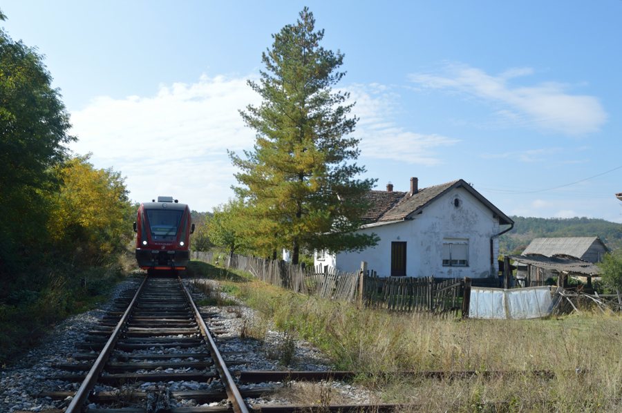 File:28.09.13 Merdare 711.013 (10101075614).jpg
Photo: Phil Richards from London, UK via Wikimedia Commons, CC-BY-SA-2.0
Merdare at a glance
- Remains of a Neolithic settlement are located near the village cemetery.
- Banjski Vis is listed at 736 metres in the M. Kosanica–Merdare area.
- Nizamska Kula is listed at 773 metres in the Merdare–Mirovac area.
- The listed transport links are Municipal Road II Order 13 and the Niš–Priština main railway line.
- Future tourism development plans include transit and fishing-related offerings connected with transport and nature.
What archaeological traces are there?
The remains belong to a Neolithic settlement and are located near Merdare’s village cemetery. They are recorded as an archaeological site. The cemetery provides a specific geographical reference point for locating the settlement remains. This gives Merdare a clearly identifiable archaeological connection, alongside the information about its landscape and transport.
Which peaks are listed?
Banjski Vis is listed at 736 metres in the M. Kosanica–Merdare area; Nizamska Kula is listed at 773 metres in the Merdare–Mirovac area. According to these elevation figures, Nizamska Kula is 37 metres higher than Banjski Vis. The area names help distinguish the two peaks: Banjski Vis is associated with M. Kosanica–Merdare, and Nizamska Kula with Merdare–Mirovac. This lets you compare the stated elevations directly without confusing the different place names.
What tourism development is planned?
The spatial plan for the Municipality of Kuršumlija envisages tourism and recreation offerings in Merdare connected with transport and nature as part of future development. These include transit and fishing tourism. The future-oriented context matters: the plan describes a direction for development. For travellers interested in nature and transport, it offers an indication of which areas are considered together in the municipality’s plans.
How is Merdare positioned in terms of transport?
The municipal spatial plan lists Municipal Road II Order 13 as part of the transport infrastructure designated for Merdare. The Niš–Priština main railway line is also listed as a transport link for Merdare. The plan therefore identifies both road and rail infrastructure. Before travelling, check road conditions and currently available transport services.
What landscape is planned for?
The spatial plan provides for no construction in the western and eastern parts of the Merdare area. It lists fields, meadows, orchards, pastures, and forests as land uses. Fields and orchards are therefore listed alongside meadows, pastures, and forest; the planned absence of construction applies to the specified parts of the area. This describes a plan, not a guarantee that current conditions will remain unchanged.
Discover more destinations: Lukovska Banja, Prokuplje, Kuršumlija, Blace, Kursumlijska Banja, Lukovo, Barbatovac, Prolom Banja.
FAQ
Where are the Neolithic settlement remains located?
They are located near Merdare’s village cemetery and are recorded as an archaeological site.
Which peaks are listed for the areas around Merdare?
Banjski Vis is listed at 736 metres in the M. Kosanica–Merdare area, and Nizamska Kula at 773 metres in the Merdare–Mirovac area.
What tourism priorities are included in the plan?
Future development plans include transit and fishing tourism offerings connected with transport and nature.
For the broader travel overview: Okrug Toplica.

