
Simeonovgrad: Fortresses, Churches and Maritsa Landscapes
Accommodation in Simeonovgrad
Simeonovgrad combines the Maritsa river landscape with archaeological sites, churches and a layered history. When planning your trip, it is worth distinguishing the locations and landscape details by their specific points of reference.
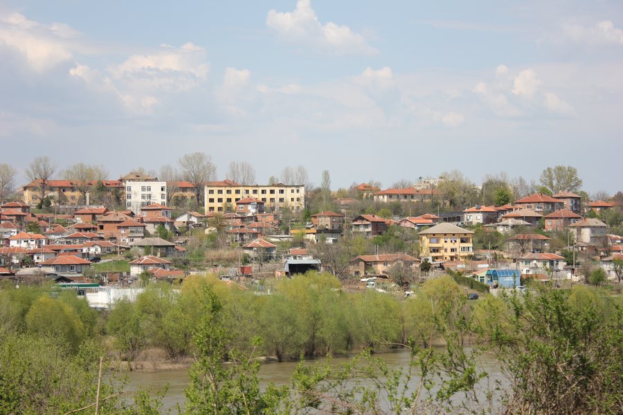
Simeonovgrad at a glance
- The Maritsa crosses Simeonovgrad Municipality; the Sazliya is its most significant left-bank tributary.
- Constancia existed from the 4th century until the beginning of the 13th century.
- St Nicholas Church is in the centre of Simeonovgrad and is designated a site of national significance for its architectural and artistic value.
- Two railway lines pass through the municipality; the main railway station is Simeonovgrad Station.
What do the fortress sites tell us about history?
The Constancia fortress stood on Asara Hill near Simeonovgrad, on the right bank of the Maritsa. It existed from the 4th century until the beginning of the 13th century. In the 12th century, it developed into a significant urban centre with military-administrative, ecclesiastical and economic functions. Its dating and varied functions offer several clues to understanding the history of the site.
The medieval city fortress Hisara is also near Simeonovgrad and is designated an archaeological monument of national significance. The Roman road that runs through Kalugerovo and Troyan, as well as Tenevo and Ovcharovo, is also an archaeological monument of national significance. The place names help distinguish these different historical points of reference.
Which churches and sacred sites can you distinguish?
St Nicholas Church is located in the centre of Simeonovgrad. It is designated a protected architectural and artistic site of national significance. In Dryanovo, the Church of St John Bogoslov is designated a cultural monument for its artistic value. Their respective locations and designated significance help distinguish the two churches.
The late medieval Church of St Elijah is in the Tülbeto area, 0.8 kilometres southwest of Kalugerovo. It is designated an archaeological monument. A holy spring with a chapel is also located in Tülbeto, 0.8 kilometres southwest of Kalugerovo.
The St Petka Church in Navusen dates from 1932. Together, these sites illustrate different ecclesiastical and archaeological connections: from a centrally located church in Simeonovgrad to sites associated with Kalugerovo, Dryanovo and Navusen. If you are looking for accommodation, you can take these specific place names into account when planning your trip.
How can the rivers and landscape be understood?
The Maritsa crosses the municipality, and the Sazliya is its most significant left-bank tributary. The Troyan Reservoir was built on the Luda Yana River. These details refer to different bodies of water and help distinguish the municipality’s water geography.
The terrain consists of separate, isolated hilly elevations. In the Sazliya Valley, the average elevation is 78.7 metres. Forests cover 23 percent of the area of Obshtina Simeonovgrad, equivalent to 52,066 decares. Valley elevation, hilly terrain and forest coverage describe different aspects of the landscape and should not be understood as a single, uniform landscape type.
Which railway lines pass through the municipality?
The Sofia–Simeonovgrad–Svilengrad and Galabovo–Simeonovgrad railway lines pass through Obshtina Simeonovgrad. Simeonovgrad Station is designated as the main station. If you are considering travelling by rail, check the timetable and connections for your travel date.
What is known about wine and regional culture?
A municipal report from 2024 describes a competition for the best homemade wine from the 2023 harvest. A tasting panel of oenologists assessed the wines. This dated retrospective adds a specific connection to wine to the historical and landscape-related themes.
Discover more destinations: Lyubimetz, Ivaylovgrad, Svilengrad, Dimitrovgrad, Topolovgrad, Stambolovo, Madjarovo.
FAQ
How long did Constancia exist?
Constancia existed from the 4th century until the beginning of the 13th century. In the 12th century, it was a significant military-administrative, ecclesiastical and economic centre.
Where is the Troyan Reservoir?
The Troyan Reservoir was built on the Luda Yana River.
Which railway lines pass through Obshtina Simeonovgrad?
The Sofia–Simeonovgrad–Svilengrad and Galabovo–Simeonovgrad lines pass through the municipality. For your specific trip, check the timetable for the relevant day.
For the broader travel overview: Haskovo Province.

