
Municipality of Pićan: History, Culture and Hilly Landscapes
Accommodation in Municipality of Pićan
The Municipality of Pićan combines the hilly landscapes of central Istria with a historic town full of distinctive buildings. To help you decide how to plan your trip, consider comparing two clear themes: historic sites and Istrian culture on the one hand, and viewpoints, protected landscapes and waterfalls on the other.
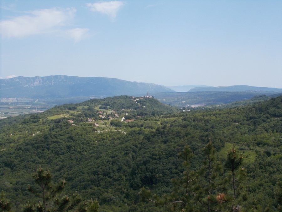
Pićan Municipality at a glance
- The municipality is located in central Istria, in the Labinština area, and covers 51 square kilometres.
- The historic town of Pićan is the municipal seat and lies on a limestone hill west of Čepićko polje.
- The protected landscape between Gračišće and Pićan covers 570 hectares.
- PetiVina takes place in Pićan on the first weekend of June.
What makes the historic town of Pićan distinctive?
Pićan sits on a striking limestone hill, with fields and vineyards shaping the surrounding municipality. In town, you will encounter buildings from different periods. The monumental town gate dates from the 14th century and was restored in 1613 for Bishop Antonio Zara. The bell tower, built of white limestone, was constructed in 1872 and is 48 metres tall. At its foot stands a historic stone measure once used to measure the dues paid by subjects.
The Parish Church of the Annunciation also tells a story of architectural changes: its present exterior dates back to a renovation in 1753, while its interior was remodelled in the Baroque style under Bishop Piccardia. The Church of St. Roch was founded during a major plague epidemic; Bishop Gašpar Bobek laid its cornerstone. At the entrance to Pićan, a statue of St. John of Nepomuk, erected in 1714, stands in the park.
Which cultural sites and viewpoints can you explore?
North of the centre, on a neighbouring hill, stands the single-nave Romanesque Church of St. Michael, dating from the 13th century. A natural viewpoint is located by the church, complemented by Nane Zavagna’s stone sculpture “The Family”, created in 1999. The Franz Ferdinand viewpoint offers a view of the hilly landscapes of central Istria. St. Helena lies at the other end of the historic settlement of Pićan; the viewpoint is named after a church that once stood there.
Opposite the parish church stands the birthplace of Matko Brajša Rašan. In 1912, he composed the present official Istrian anthem, “Krasna zemljo”, to lyrics by Ivan Cukon. Another cultural focus is CENKI, the Centre for the Intangible Culture of Istria, run by the Ethnographic Museum of Istria. It was established in Pićan in 2011 and is dedicated to researching, documenting, preserving and promoting this culture. This also includes studying how knowledge and practices endure in rural and urban settings.
Which landscapes and waterfalls shape the surroundings?
The protected landscape between Gračišće and Pićan covers 570 hectares and has unusual geological features. This is a different focus from the town’s architectural history: here, the emphasis is on landforms. Those interested in waterfalls will find two with distinct characteristics. The Benkovski Waterfall lies near Pićan, more precisely by Most Pićan, and is about 40 metres high. It flows mainly in autumn, winter and spring; in summer, it dries up.
The St. Roch Trail 702 begins in Pićan and leads through the forest to the spring of St. Nicephorus. The trail also leads to Sopot Waterfall: it is 24.5 metres high, with a turquoise lake at its foot. Sopot Waterfall can also be reached by car from Floričići. From the main road between Pazin and Labin, reach Floričići via Zajci, then follow the signs to Jakomići and Švići.
Which cultural events and town pages can help you compare?
On the first weekend of June, PetiVina brings winemakers and wine lovers together in Pićan with local products and homemade handicrafts. Alongside the historic buildings and natural attractions, this gives the municipality a culinary and artisanal dimension. If you are looking for a hotel in the Municipality of Pićan, you can first consider whether to focus your stay more on Pićan’s cultural history or on landscapes and waterfalls.
For more information about local places, visit the pages for PicanPicanPican, Sveta KatarinaSveta KatarinaSveta Katarina, ZajciZajciZajci, KrbuneKrbuneKrbune and GrobnikGrobnikGrobnik. To compare with other municipalities in the same higher-level area, you can also visit the pages for Municipality of GrožnjanMunicipality of GrožnjanMunicipality of Grožnjan, Municipality of GračišćeMunicipality of GračišćeMunicipality of Gračišće and Municipality of KarojbaMunicipality of KarojbaMunicipality of Karojba.
FAQ
Where is the Municipality of Pićan?
The municipality is located in central Istria, in the Labinština area. It covers 51 square kilometres and is surrounded by fields and vineyards.
What viewpoints are there in Pićan?
The Franz Ferdinand viewpoint offers a view of the hilly landscapes of central Istria. St. Helena lies at the other end of the historic settlement; by the Church of St. Michael, there is a natural viewpoint featuring the 1999 sculpture “The Family”.
How do the waterfalls in the area differ?
Sopot Waterfall is 24.5 metres high, with a turquoise lake at its foot. The Benkovski Waterfall near Most Pićan is about 40 metres high, flows mainly in autumn, winter and spring, and dries up in summer.
When does PetiVina take place?
PetiVina takes place in Pićan on the first weekend of June and brings together winemakers, wine lovers, local products and homemade handicrafts.
For the higher-level travel overview: Istria County.

