
Municipality of Gračišće
Accommodation in Municipality of Gračišće
For your travel planning, the Municipality of Gračišće offers two specific highlights: historic buildings in Gračišće and routes for hiking and cycling. If you would like to combine culture with outdoor activities, you can include the various buildings and routes in your plans.
Gračišće Municipality at a glance
- The protected landscape of Gračišće covers an area of 702.59 ha within the municipality.
- The Staza svetog Šimuna (701) loop trail starts and ends in Gračišće, is 8.9 km long, and is classified as moderate.
- The official 619 Pazin-Gračišće-Pazin cycling route is 29.7 km long; it has 550 m of elevation gain and a stated duration of 2:30 hours.
- The traditional Izložba vina Gračišće takes place on Easter Monday.
Which historic buildings can you discover in Gračišće?
The historic urban layout of Gračišće is divided into districts. Each district has its own square and church, and the urban layout is listed in the Register of Cultural Heritage. The artisans’ street, Pod Fumiju, has also retained its original appearance to this day. These features provide a tangible framework for the town’s history, without reducing Gračišće to a single building.
Next to the main gate stands Salamon Palace, a two-storey building made of carefully hewn local stone. Its architecture combines Gothic and Renaissance elements. The Romanesque town gate is preserved on the western side of the town. The loggia, accessible through the town gate, dates from 1549. The round Renaissance tower, dating from 1500, stands at the eastern corner. Sections of the medieval defensive walls have been preserved on the western, northern, and eastern sides.
The churches and their history also offer different points of interest for culture-minded travellers. The late Gothic Church of St. Mary na Placu was built in 1425 by Master Dento. The Church of St. Euphemia dates from 1383. The Church of St. Vitus, Modestus and Crescentia houses a 15th-century statue of St. Vitus holding a model of the town. In the southern part of Gračišće are the ruins of the Brotherhood Church of St. Pangrac, built in the 14th century. A famous 18th-century crucifix from Gračišće is kept in the Chapel of St. Anthony.
Which routes suit your travel plans?
For a hike, the Staza svetog Šimuna (701) loop trail is one clearly described option: it covers 8.9 km and is classified as moderate. The Trail of St. Simeon (701) leads to Sopot Waterfall by an old bridge. The trail also runs entirely through an area designated as a protected landscape in the 1970s. This provides both the loop’s length and difficulty rating, as well as a waterfall destination to help guide your planning.
If you prefer cycling, consider the official 619 Pazin-Gračišće-Pazin route. It is 29.7 km long, has 550 m of elevation gain, and is listed as taking 2:30 hours. These details can help you plan the cycling route as a separate activity. The hiking and cycling routes differ in distance, elevation gain, and stated duration, so choose according to the kind of activity you would like to include in your trip.
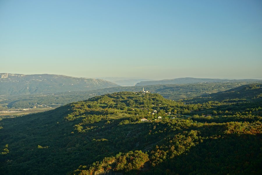
A viewpoint behind the Church of St. Vitus in Gračišće offers views across Istria. The protected landscape of Gračišće covers 702.59 ha within the municipality. For nature lovers, these details complement the historic sights with a landscape perspective; they also describe different aspects of a visit, from a single viewpoint to the extent of the protected landscape.
What culinary experiences are described?
At the traditional Izložba vina Gračišće on Easter Monday, visitors can sample the wines on display at local konobas. If wine is part of your travel plans, Easter Monday is the specific date given for this exhibition.
At the Festival istarskih maneštri, visitors can try different versions of Istrian maneštra. Cooking teams prepare the varieties. The festival therefore offers a different culinary focus from the wine exhibition: one centres on varieties of maneštra and their preparation by cooking teams, while the other features wines on display and tastings at local konobas.
For more information about places within the municipality, see the pages for Batlug, Bazgalji, Gračišće, and Mandalenčići. More municipal destinations in the travel guide: Municipality of Ližnjan, Municipality of Brtonigla, Municipality of Svetvinčenat, Municipality of Višnjan.
FAQ
How long is the Staza svetog Šimuna (701) loop trail?
The loop trail is 8.9 km long, starts and ends in Gračišće, and is classified as moderate.
What are the details of cycling route 619?
The official Pazin-Gračišće-Pazin cycling route is 29.7 km long. It has 550 m of elevation gain and a stated duration of 2:30 hours.
When does Izložba vina Gračišće take place?
The traditional wine exhibition takes place on Easter Monday. Visitors can sample the wines on display at local konobas.
How large is the protected landscape of Gračišće?
The protected landscape of Gračišće within the municipality covers 702.59 ha.
For the wider travel overview: Istria County.

