
Vlkančice: Hiking Trails, Cycling Routes and Historic Traces
Accommodation in Vlkančice
The blue hiking route No. 1 runs through Vlkančice and has existed there since at least 1956. It is 18.5 kilometres long and has a moderate difficulty level. Its route follows mainly surfaced forest paths as well as roads with little car traffic.
Hiking and Cycling
For your planning, you can distinguish the routes by mode of transport, length, difficulty level, surface and markings. These features describe different aspects of a route and do not need to be combined into a single rating.
Hiking route No. 2 combines blue-, yellow- and red-marked hiking trails. More than 90 percent of hiking route No. 2 can also be ridden by mountain bike. On this route, the markings and possible mode of transport place different emphasis than the route length alone. When comparing the routes, you can consider these features individually rather than combining different characteristics into a single classification.
For cycling, cycling tour No. 1 covers a range of 18.5 to 55 kilometres and has a moderate to higher difficulty level. Cycling tour No. 2 offers variants of 29 or 40 kilometres and has a moderate difficulty level. For personal day planning, distance, the chosen variant and difficulty level can stand side by side as separate comparison criteria.
When comparing a hotel in Vlkančice, you can compare the same travel dates, room category and cancellation conditions on the respective offer pages. Looking at these three fields consistently makes it easier to objectively compare different offers without treating room details and conditions as linguistically equivalent.
PID line 660 stops at the Vlkančice–Komorce, Vlkančice–U Zbořeného mlýna, Vlkančice, Vlkančice–U Králů and Vlkančice–Stará Hůra stops.
In addition to the place name, the stops also bear names such as Komorce, U Zbořeného mlýna, U Králů and Stará Hůra. This keeps the individual points on the line linguistically distinguishable, while Vlkančice itself appears as a separate stop name. The line number and the complete sequence of stops are therefore separate from the information about hiking and cycling routes.
Culture and History
For historic sites, you can distinguish between a dated construction and a general classification as a historic building.
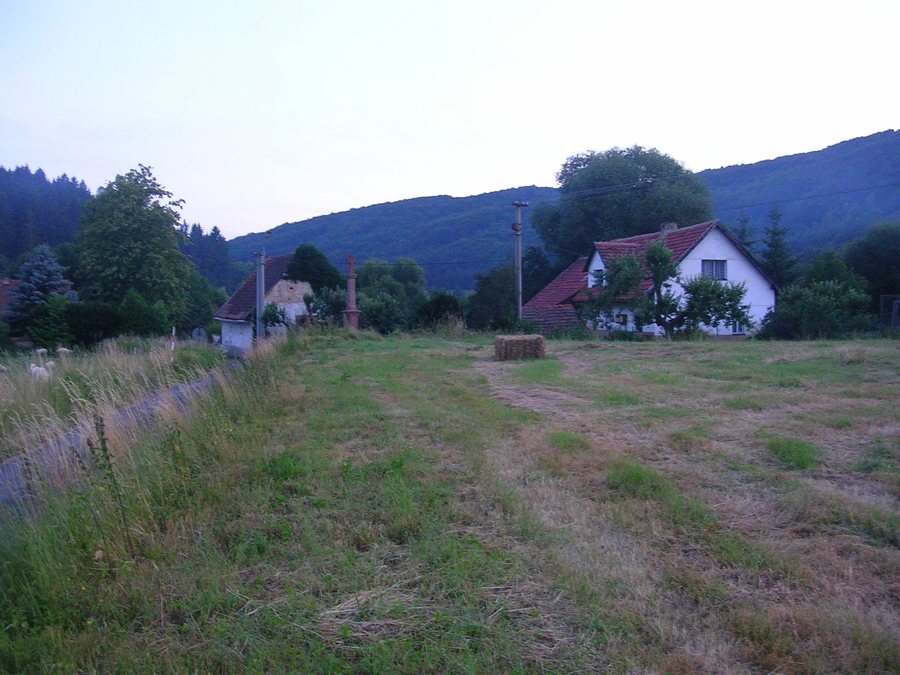
The cross by House No. 21 in Vlkančice was erected in 1810, possibly in connection with the Napoleonic Wars. The former granary by House No. 21 in Vlkančice is a historic building.
Other places: Lhota, Svémyslice, Brandýs nad Labem-Stará Boleslav, Dřevčice, Dubiny, Vodochody, Veliš, Březí U Říčan
For geographical classification, you can consider the landscape form, elevation, connection to bodies of water, settlement setting and type of access separately.
The Posázavské bučiny protected area extends along the elongated ridge of Mount Baba (439 m above sea level), above the right bank of the Nučický (Vlkančický) stream near the Pyskočely holiday settlement, and is accessible only via forest paths.
For the general travel overview: Okres Praha-Východ.

.jpg)