
Tahitótfalu: Nature, Churches and Routes
Accommodation in Tahitótfalu
Protected natural areas, church architecture and marked routes give you several ways to plan a trip to Tahitótfalu. When looking for accommodation, you can first consider whether you want to focus on nature, architecture, or routes to explore on foot or by bike.
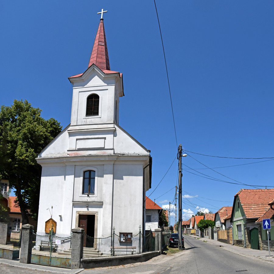 File:Tahitótfalu, római katolikus templom 2022 03.jpg
Photo: Pasztilla aka Attila Terbócs via Wikimedia Commons, CC BY-SA 4.0
Tahitótfalu at a glance
- Parts of Duna-Ipoly National Park lie within Tahitótfalu’s administrative boundaries.
- Pánkúti legelő and Kecske-sziget are a nature reserve.
- Listed architectural monuments include the remains of a castellum (burgus).
- Described hiking and cycling routes lead to springs and named destinations such as Dunabogdány and Pap-rét.
Which natural areas define the area?
The national park and the nature reserve are two distinct designations: parts of Duna-Ipoly National Park lie within Tahitótfalu’s administrative boundaries, while Pánkúti legelő and Kecske-sziget are identified as a nature reserve. This gives you a way to understand the area’s natural character through both a protected area and specific place names.
You can connect these topics with the described routes when planning your trip, without treating them as the same thing: the information about the natural areas describes their protection status, while the route descriptions specify their own destinations and paths. If you plan to travel on foot or by bike, check current trail markings and conditions before setting out.
What do the churches and architectural monuments tell us?
The Roman Catholic Church of St. Stephen is considered an Empire-style church. Its predecessor was built in 1778; the church has been remodeled several times since then. The year therefore refers to the predecessor building, while the repeated renovations indicate a longer architectural history.
The Reformed Church offers a different architectural point of comparison: it is a late Baroque building surrounded by a stone wall and was built between 1801 and 1805. Its tower was built in 1855. The construction period and the tower’s date therefore belong to different phases. Pollack Mihály’s Szüreti ház also has several construction phases: it was built at the beginning of the 19th century, expanded in the second half of that century, and has displayed Eclectic features ever since. The remains of a castellum (burgus) are also listed as architectural monuments. Together, these examples show the different forms and periods in Tahitótfalu’s architectural history.
Which hiking destinations are described?
A hiking route described from Tahitótfalu follows the Ugró Stream to the Leány-kút spring. The route description also mentions crossing the Villám Stream and the path to the Hétvályús-forrás spring. The described route also reaches Vörös-kő. From there, the route information describes a panorama of Szentendre Island and the Danube Valley.
This lets you distinguish the hiking destinations by their character: springs and a stream crossing on the one hand, and Vörös-kő, associated with a described panorama, on the other. The view should be understood as part of the route description. This information can help you decide in advance which of the named destinations interest you most; trail conditions may change.
How do the cycling routes differ?
The green-marked cycling route runs from Tahitótfalu through the Kalicsa Valley and reaches Dunabogdány after about 3 km. The blue-marked route heads south from Tahitótfalu along the main road to the neighboring municipality of Pócsmegyer, Pázsit-tó and the ferry between Pócsmegyer and Leányfalu. The routes therefore differ in their markings, direction and named destinations.
A red-marked cycling route reaches Pap-rét after about 4 km. A hiking trail marked as a national blue trail also runs along this section. The approximate distances of 3 km and 4 km refer to different routes and destinations. If you plan to take the blue route and use the ferry mentioned, check the current timetable in advance; ferry services and trail conditions may change.
Discover more destinations: Visegrád, Csobánka, Szentendre, Pócsmegyer, Dunabogdány, Kisoroszi, Leányfalu, Pomáz.
FAQ
Which cycling route leads to Dunabogdány?
The green-marked cycling route runs from Tahitótfalu through the Kalicsa Valley to Dunabogdány; the stated distance is about 3 km.
Which destinations does the hiking route mention?
The route mentions the Leány-kút spring on the Ugró Stream, the Villám Stream crossing, the Hétvályús-forrás spring and Vörös-kő. For Vörös-kő, the route information describes a panorama of Szentendre Island and the Danube Valley.
What is known about the Váci–Rév ferry in Tahitótfalu?
A 2021 timetable lists the Révállomás landing in Tahitótfalu for the Váci–Rév ferry. Check the current timetable before your trip.
Go to the main travel overview: Szentendrei.

