
Discover Bukhar-Zhyrau District
Accommodation in Bukhar-Zhyrau District
Lakes, river landscapes, a nature reserve, and historic sites offer different themes for planning a trip to Bukhar-Zhyrau District. If you are looking for hotels, you can start by considering whether you are particularly interested in nature or in history and culture.
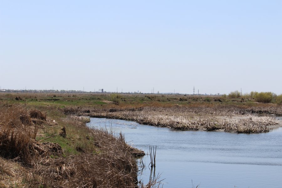 File:Bukhar-Zhyrau District, Kazakhstan - panoramio (2).jpg
Photo: Маргарита москалюк via Wikimedia Commons, CC BY 3.0
Bukhar-Zhyrau District at a glance
Belagash Nature Reserve is located in Bukhar-Zhyrau District. Lake Botakara covers 581 ha; the Intumak Reservoir covers 4,100 ha. The Nura River is listed as 110 km long within the district. The district’s cultural history is also tied to specific places: it has more than 60 archaeological monuments from the Stone and Bronze Ages. In Botakara, there is an Orthodox church building dating from 1909 and a local history museum with 3,788 exhibits.
Which bodies of water and natural areas define the district?
The figures help distinguish the district’s bodies of water: the Intumak Reservoir is much larger than Lake Botakara. The Nura River, with its listed length of 110 km within the district, represents another geographic feature. Together with Belagash Nature Reserve, they form a natural profile that includes a protected area, lake, reservoir, and river.
This distinction is useful when planning a themed trip: you can consider the bodies of water and the river as separate reference points rather than grouping them into a single landscape theme. The stated areas and lengths describe their respective sizes; they do not indicate specific visiting conditions or services.
Which historic sites and collections are of interest?
The archaeological monuments from the Stone and Bronze Ages span a broad period. Several specifically named mausoleums can also be distinguished by location. The Bukhar-Zhyrau Mausoleum lies about 25 km north of the village of Shalkar, at the foot of Mount Dalba; it was built at the burial site in 1993. The Alshynbay Mausoleum is northwest of the village of Umutker. The Aimagambet-Qazhy Mausoleum is in the village of Akzhar.
In Botakara, the local history museum, with its 3,788 exhibits, and the Orthodox church building dating from 1909 complement the archaeological and funerary monuments with the histories of collections and architecture. The district’s cultural heritage therefore extends from early periods to a dated building. The different location details make it easier to distinguish these themes when planning your own trip.
What other nature experiences does the Qaraghandy destination offer?
The wider Qaraghandy destination also has distinctive natural attractions that extend beyond Bukhar-Zhyrau District. Near Karkaraly is the Great Lake, a freshwater lake covering 2.5 km², with a maximum depth of about 4.6 m. The north or west shore is recommended for beach areas. Lake Basin in Karkaraly National Park is accessible only on foot via the “Stone Fairy Tales” route; check the route duration and seasonal conditions before your visit.
Another activity in the Qaraghandy destination is Mount Aksoran: the ascent from the Torkora tract to the summit is about 3.4 km long, with an elevation gain of approximately 560–600 m. These figures provide a concrete comparison with the district’s water and cultural attractions. Check route conditions and markings before setting out.
Discover more destinations: Qaraghandy, Ulytau District.
FAQ
Which bodies of water are mentioned in Bukhar-Zhyrau District?
Lake Botakara covers 581 ha, and the Intumak Reservoir covers 4,100 ha. The Nura River is listed as 110 km long within the district.
Where are the described mausoleums located?
The Bukhar-Zhyrau Mausoleum lies about 25 km north of Shalkar, at the foot of Mount Dalba. The Alshynbay Mausoleum is northwest of Umutker, and the Aimagambet-Qazhy Mausoleum is in the village of Akzhar.
Which natural attractions are described in the wider Qaraghandy destination?
These include the Great Lake near Karkaraly and Lake Basin in Karkaraly National Park. Basin is accessible only on foot via the “Stone Fairy Tales” route.
View the wider travel guide: Qaraghandy.

