
Discover Turek: Cycling Routes, Landscapes and Culture
Accommodation in Turek
In Turek, cycling routes through Turek County sit alongside distinctive landscapes and historic sites. When planning your trip, you can decide whether to include longer cycling routes, trails in a protected landscape area or cultural sites in your stay.
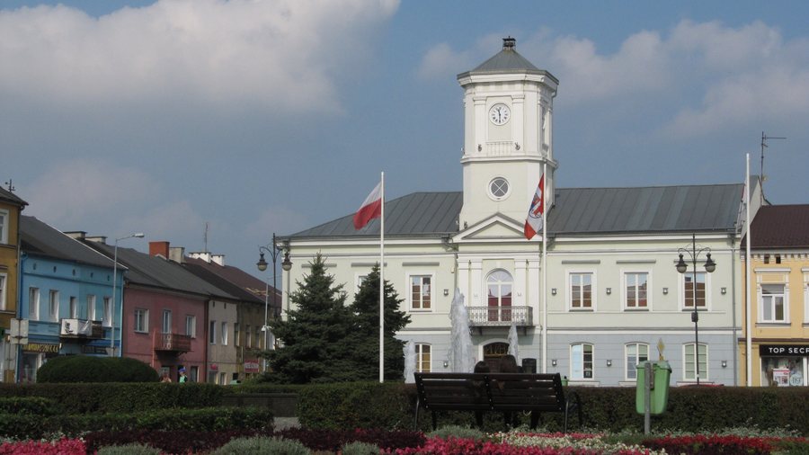 Old Town Hall in Turek, now the Józef-Mehoffer Museum
Photo: A.fiedler via Wikimedia Commons, CC BY-SA 3.0 pl
Old Town Hall in Turek, now the Józef-Mehoffer Museum
Photo: A.fiedler via Wikimedia Commons, CC BY-SA 3.0 pl
Turek at a glance
- The “Panorama” educational cycling route consists of six stages and reaches all the municipalities of Turek County.
- The “Zdrojki” routes are in the southeastern part of the Złotogórski Protected Landscape Area. The first cycling route starts at Turek Forest District and is 23.5 km long.
- All the “Bogdałów” routes start and end at the “Bogdałów” forest car park, beside a 10-hectare body of water formed in a former open-pit mine.
- In Wyszyna, the ruins of a Renaissance castle stand near the church, above the floodplains of the Topiec River.
Which cycling routes are right for your trip?
“Panorama” passes through the most interesting scenic, natural and cultural areas of Turek County. Its six stages give this educational cycling route a clear structure. It also reaches every municipality in the county. This makes its described extent different from the more specifically defined “Zdrojki” and “Bogdałów” routes.
For “Zdrojki,” its location within the Złotogórski Protected Landscape Area is an important consideration when choosing a route. The routes lie in the southeastern part of the area. The starting point and length of the first cycling route are also specified: it begins at Turek Forest District and is 23.5 km long. Take this distance into account when planning your day; the length alone does not indicate travel time or difficulty.
The “Bogdałów” routes pass through scenic and naturally interesting areas of Turek County. They all start and end at the “Bogdałów” forest car park. A 10-hectare body of water, formed in a former open-pit mine, is nearby. When planning your trip, you can therefore choose between a route with a specified length and starting point, and routes sharing a starting and ending point beside a body of water.
What landscape and cultural sites are there?
The reservoir near Przykona lies on an inner spoil heap at the Adamów open-pit mine. It is located along the former riverbed of the Middle Teleszyna. Its origin sets it apart from a naturally formed body of water. Together with the body of water near “Bogdałów,” it illustrates two different connections to the former mining landscape: at Przykona, its location on a spoil heap is described, while at “Bogdałów,” it was formed in a former open-pit mine.
The “Skarbiec” Hutsul horse stud in Młodzianów has been operating since 2003. In Słodków, the manor house and park complex is a protected historic site; its present-day appearance took shape around the middle of the 19th century. These offer a different focus from the cycling routes: a horse stud and a protected complex with an approximately dated design.
In Wyszyna, the ruins of a Renaissance castle stand near the church, above the floodplains of the Topiec. The castle was probably built around 1556 by the Grodziecki family, who bore the Dryja coat of arms. The sanctuary in Wyszyna is one of three such churches in Europe and the only wooden, sixteen-sided church in Poland. Those interested in regional architectural and cultural history will find several distinct subjects here: castle ruins, a sanctuary, and the manor house and park complex in Słodków.
To compare other town pages, you can also view Kawęczyn, Turek, Dzierżązna and Marcjanów. More pages to compare as destinations: Śrem, Nowy Tomyśl, Krotoszyn and Gostyń.
FAQ
How many stages does the “Panorama” cycling route have?
The “Panorama” cycling route consists of six stages and reaches all the municipalities of Turek County.
How long is the first cycling route in “Zdrojki”?
It is 23.5 km long and starts at Turek Forest District.
Where do the “Bogdałów” routes start and end?
They all start and end at the “Bogdałów” forest car park, beside a 10-hectare body of water formed in a former open-pit mine.
What is known about the castle in Wyszyna?
The Renaissance castle was probably built around 1556 by the Grodziecki family, who bore the Dryja coat of arms. Its ruins rise near the church above the floodplains of the Topiec.
For the broader travel overview: Greater Poland.

